The right (north) side offers the Dallas skyline at departure, a possible distant glimpse of northern New Mexico/Arizona highlands during cruise, and clear views of the southern Sierra Nevada during descent into Fresno, giving it more topographic variety than the flatter left side.
Flight Path
Flat plains of West Texas and eastern New Mexico giving way to the elevated Llano Estacado, followed by the desert basins of eastern Arizona before the terrain rises into the southern Sierra Nevada near the California border.
Great circle distance and headings ›.jpg?width=600)

.jpeg?width=600)


Phase by phase
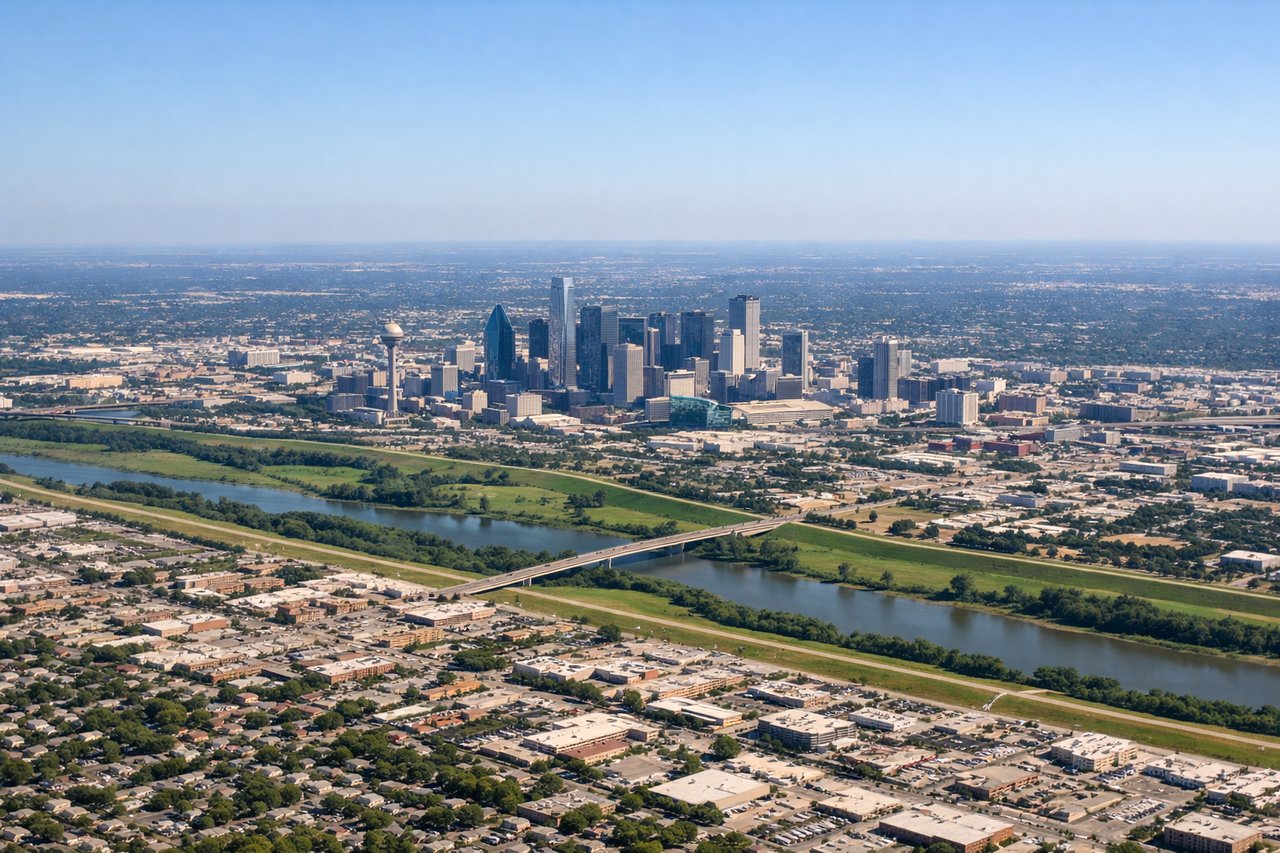
Takeoff from DAL
RIGHTClimbing out of Love Field to the northwest, the Dallas downtown skyline and the White Rock Lake area fall to the right side before the plane levels over flat North Texas farmland. The left side only shows featureless suburban sprawl and prairie.
Landing at FAT
RIGHTOn the descent into Fresno from the east, the southern Sierra Nevada high peaks near Kings Canyon and Sequoia rise clearly to the north side of the aircraft before the plane drops into the flat San Joaquin Valley farmland for landing. The left side mostly shows the featureless valley floor.
Landmarks on this routeAll landmarks →
Will your flight be in sunlight?
See exactly which side of the plane gets sun and shade at your departure time.
About This Route
Which side of the plane should I sit on flying from Dallas Love Fld (DAL) to Fresno Yosemite International (FAT)?
Sit on the Right side of the plane for the best views on flights from Dallas to Fresno. The right (north) side offers the Dallas skyline at departure, a possible distant glimpse of northern New Mexico/Arizona highlands during cruise, and clear views of the southern Sierra Nevada during descent into Fresno, giving it more topographic variety than the flatter left side.
What can I see during takeoff from Dallas Love Fld in Dallas?
During takeoff from Dallas Love Fld (DAL), sit on the Right side for the best views. Climbing out of Love Field to the northwest, the Dallas downtown skyline and the White Rock Lake area fall to the right side before the plane levels over flat North Texas farmland. The left side only shows featureless suburban sprawl and prairie. Notable sights include: Downtown Dallas skyline, White Rock Lake, Trinity River bends, North Texas farmland.
What can I see when landing at Fresno Yosemite International in Fresno?
When landing at Fresno Yosemite International (FAT), sit on the Right side for the best views. On the descent into Fresno from the east, the southern Sierra Nevada high peaks near Kings Canyon and Sequoia rise clearly to the north side of the aircraft before the plane drops into the flat San Joaquin Valley farmland for landing. The left side mostly shows the featureless valley floor. Notable sights include: Southern Sierra Nevada foothills, Kings Canyon high country, San Joaquin Valley farmland, Sierra National Forest ridgelines.
How long is the flight from Dallas to Fresno?
The flight from Dallas Love Fld (DAL) to Fresno Yosemite International (FAT) takes 2h 50m.
What does the Dallas to Fresno flight path pass over?
Flat plains of West Texas and eastern New Mexico giving way to the elevated Llano Estacado, followed by the desert basins of eastern Arizona before the terrain rises into the southern Sierra Nevada near the California border.