The takeoff from Dubrovnik on the right side offers more dramatic and distinctive scenery—the Adriatic islands and rocky coastline are visually striking. While the landing approach favors the left, the takeoff views are more memorable and geographically unique.
Flown DBV to CDG? Did we get it right?
Flight Path
Dubrovnik to Paris is 876 miles (1,410 km), a flight of about 2 hours 25 minutes.
The flight path crosses the Alps (visible around 1.5 hours into flight, typically at cruising altitude with Mont Blanc and the main Alpine ridge visible on the left side during northwesterly routing), then transitions over the Jura Mountains and into the Burgundy region. The Rhône Valley may be visible as a north-south corridor of lower terrain. As the aircraft approaches France, the landscape flattens into the Paris Basin with scattered forests and agricultural land.
Great circle distance and headings ›


Phase by phase
Takeoff from DBV
RIGHTRight-side seats offer immediate views of the Adriatic coastline and the Elaphiti Islands as the aircraft climbs northwestward from Dubrovnik. The left side faces inland toward less dramatic terrain.
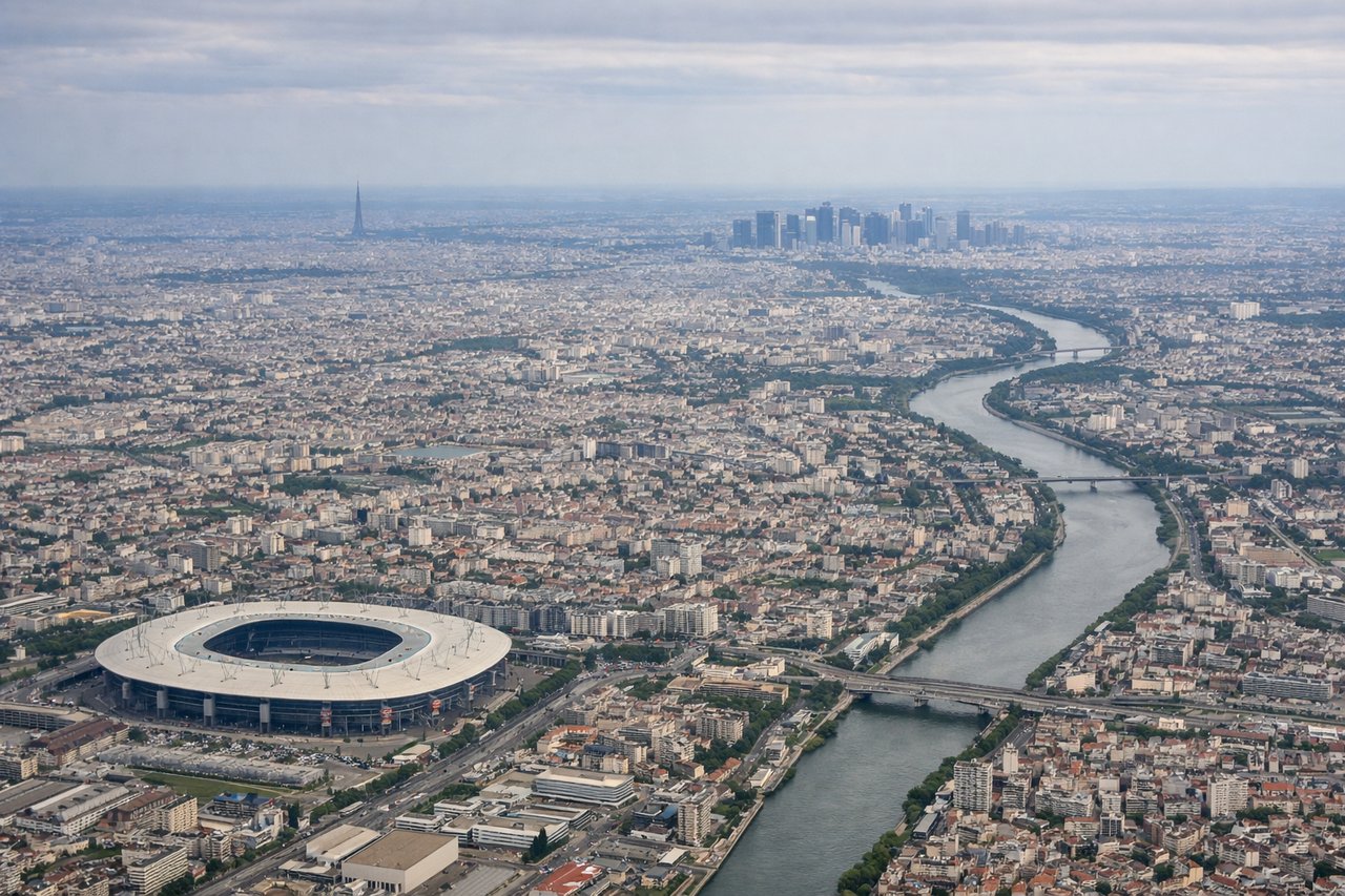
Landing at CDG
LEFTLeft-side seats provide excellent views during the descent approach into CDG, with clear sightlines of the Seine River, Paris city center, and the Île-de-France region's patchwork farmland and forests. Right-side views are obscured by the approach corridor.
Will your flight be in sunlight?
Pick a date and time in the Sun Map to watch the sun move across your whole flight.
About This Route
Which side of the plane should I sit on flying from Dubrovnik (DBV) to Charles De Gaulle (CDG)?
Sit on the Right side of the plane for the best views on flights from Dubrovnik to Paris. The takeoff from Dubrovnik on the right side offers more dramatic and distinctive scenery—the Adriatic islands and rocky coastline are visually striking. While the landing approach favors the left, the takeoff views are more memorable and geographically unique.
What can I see during takeoff from Dubrovnik in Dubrovnik?
During takeoff from Dubrovnik (DBV), sit on the Right side for the best views. Right-side seats offer immediate views of the Adriatic coastline and the Elaphiti Islands as the aircraft climbs northwestward from Dubrovnik. The left side faces inland toward less dramatic terrain. Notable sights include: Adriatic Sea, Elaphiti Islands (Koločep, Lopud, Šipan), Pelješac Peninsula, Dalmatian coastline.
What can I see when landing at Charles De Gaulle in Paris?
When landing at Charles De Gaulle (CDG), sit on the Left side for the best views. Left-side seats provide excellent views during the descent approach into CDG, with clear sightlines of the Seine River, Paris city center, and the Île-de-France region's patchwork farmland and forests. Right-side views are obscured by the approach corridor. Notable sights include: Seine River, Paris city center (Île de la Cité, Notre-Dame area), Île-de-France agricultural plains, Fontainebleau Forest (distant).
How long is the flight from Dubrovnik to Paris?
The flight from Dubrovnik (DBV) to Charles De Gaulle (CDG) takes about 2 hours 25 minutes. The shortest flight path between them is 876 miles (1,410 km); winds and air traffic control usually add a few percent.
What does the Dubrovnik to Paris flight path pass over?
The flight path crosses the Alps (visible around 1.5 hours into flight, typically at cruising altitude with Mont Blanc and the main Alpine ridge visible on the left side during northwesterly routing), then transitions over the Jura Mountains and into the Burgundy region. The Rhône Valley may be visible as a north-south corridor of lower terrain. As the aircraft approaches France, the landscape flattens into the Paris Basin with scattered forests and agricultural land.