While takeoff favors the left, the landing approach on the right—with views of the Pindus Mountains, Corinthian Gulf, and the dramatic transition into Greece—provides more visually distinctive scenery. The right side captures the geographic climax of the journey.
Flown DEL to ATH? Did we get it right?
Flight Path
Delhi to Athens is 3,097 miles (4,984 km), a flight of about 5 hours 45 minutes.
The flight path crosses the Zagros Mountains in western Iran (visible from both sides depending on altitude and exact routing), the Mesopotamian plains, and the Taurus Mountains in southern Turkey. The Persian Gulf and the eastern Mediterranean coastline of Turkey and Syria are potential midpoint features depending on the specific routing chosen by ATC.
Great circle distance and headings ›


Phase by phase
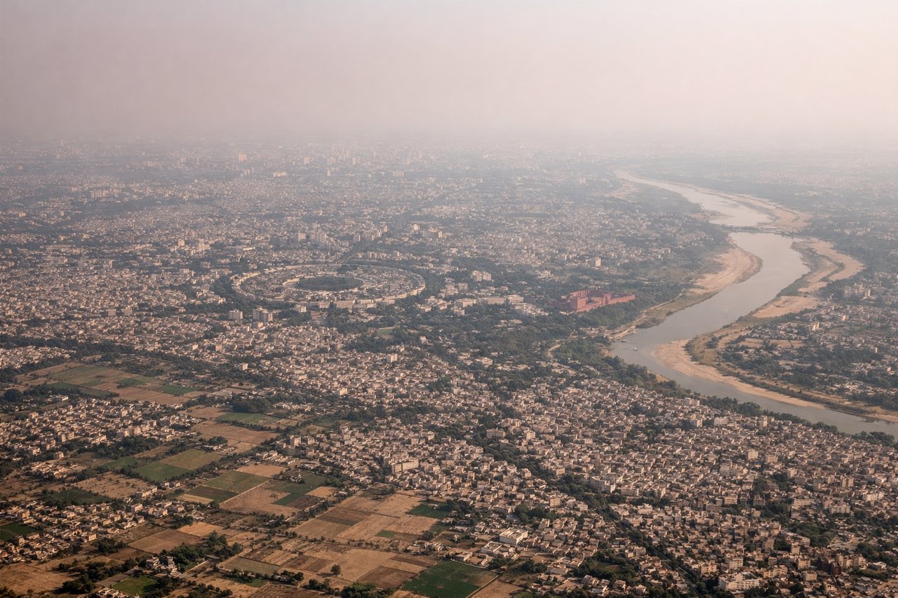
Takeoff from DEL
LEFTLeft side offers views of the Yamuna River winding through Delhi's urban sprawl and the Aravalli Hills to the southwest. Right side faces the flat Indo-Gangetic Plain with less distinctive topography.
Landing at ATH
RIGHTRight side provides views of the Pindus Mountains and the transition into Greece's mountainous terrain. The approach also offers glimpses of the Corinthian Gulf and the Attica Peninsula. Left side faces the Aegean Sea with less dramatic landforms.
Will your flight be in sunlight?
Pick a date and time in the Sun Map to watch the sun move across your whole flight.
About This Route
Which side of the plane should I sit on flying from Indira Gandhi International (DEL) to Athens International Eleftherios Venizelos (ATH)?
Sit on the Right side of the plane for the best views on flights from Delhi to Athens. While takeoff favors the left, the landing approach on the right—with views of the Pindus Mountains, Corinthian Gulf, and the dramatic transition into Greece—provides more visually distinctive scenery. The right side captures the geographic climax of the journey.
What can I see during takeoff from Indira Gandhi International in Delhi?
During takeoff from Indira Gandhi International (DEL), sit on the Left side for the best views. Left side offers views of the Yamuna River winding through Delhi's urban sprawl and the Aravalli Hills to the southwest. Right side faces the flat Indo-Gangetic Plain with less distinctive topography. Notable sights include: Yamuna River, Aravalli Hills, Delhi urban grid, Indus Valley plains extending eastward.
What can I see when landing at Athens International Eleftherios Venizelos in Athens?
When landing at Athens International Eleftherios Venizelos (ATH), sit on the Right side for the best views. Right side provides views of the Pindus Mountains and the transition into Greece's mountainous terrain. The approach also offers glimpses of the Corinthian Gulf and the Attica Peninsula. Left side faces the Aegean Sea with less dramatic landforms. Notable sights include: Pindus Mountains, Corinthian Gulf, Attica Peninsula, Athens urban sprawl.
How long is the flight from Delhi to Athens?
The flight from Indira Gandhi International (DEL) to Athens International Eleftherios Venizelos (ATH) takes about 5 hours 45 minutes. The shortest flight path between them is 3,097 miles (4,984 km); winds and air traffic control usually add a few percent.
What does the Delhi to Athens flight path pass over?
The flight path crosses the Zagros Mountains in western Iran (visible from both sides depending on altitude and exact routing), the Mesopotamian plains, and the Taurus Mountains in southern Turkey. The Persian Gulf and the eastern Mediterranean coastline of Turkey and Syria are potential midpoint features depending on the specific routing chosen by ATC.