While the right side offers Delhi's immediate departure scenery, the left side provides the more dramatic and sustained visual experience during descent into Bali, with the volcanic landscape and island geography being far more visually distinctive than the flat Indo-Gangetic Plain crossed during cruise.
Flown DEL to DPS? Did we get it right?
Flight Path
Delhi to Denpasar is 3,618 miles (5,822 km), a flight of about 7 hours 20 minutes.
The flight path crosses the Indo-Gangetic Plain (flat, haze-prone), then transitions over the Bay of Bengal. Notable midpoint geography includes the Ganges Delta region (visible as a vast braided river system if flying low enough), the eastern coast of India (Odisha and Andhra Pradesh coastlines), and the open waters of the Bay of Bengal and Andaman Sea. The Andaman Islands may be visible as small dark specks on the horizon during the southern crossing. As the aircraft approaches Bali, the Java Sea becomes visible, followed by the volcanic islands of Java and the Bali Strait.
Great circle distance and headings ›

Phase by phase
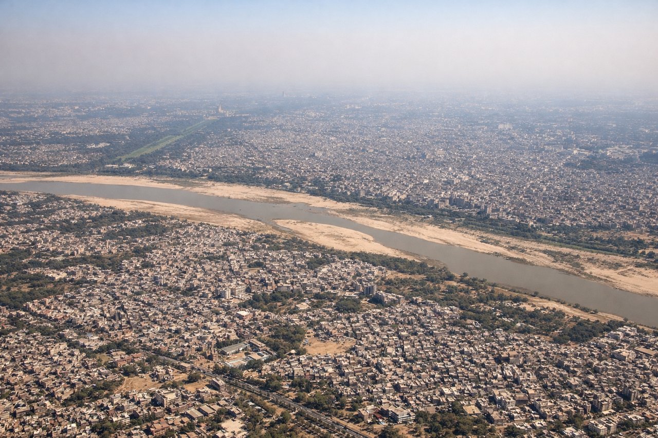
Takeoff from DEL
RIGHTRight-side seats capture the Yamuna River winding through Delhi's eastern districts and the Aravalli Hills rising to the southeast. The aircraft climbs southeastward from DEL, making the right side the optimal viewing side for these immediate post-departure features.
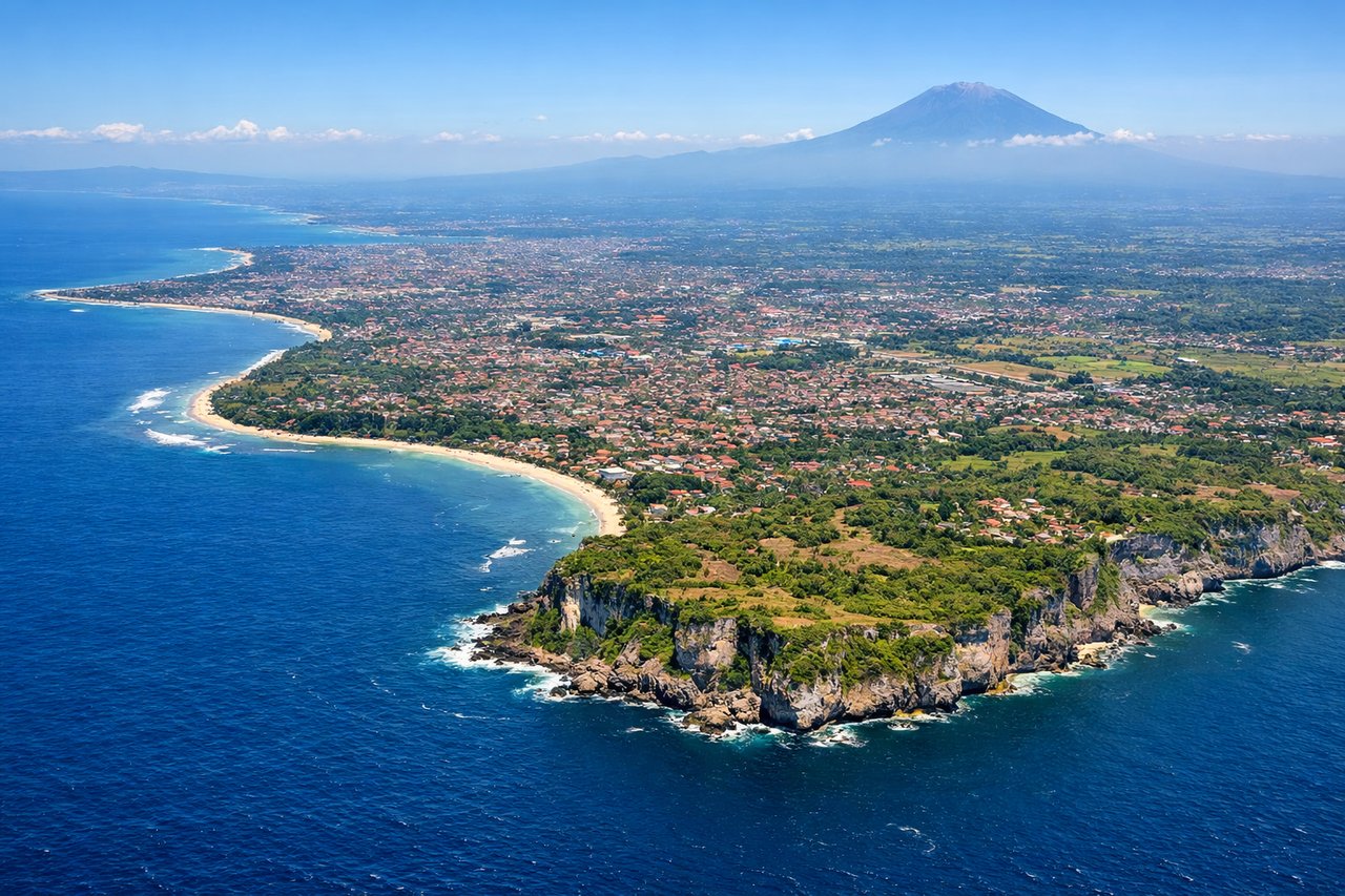
Landing at DPS
LEFTLeft-side seats offer views of Bali's volcanic spine and the island's northern coastline as the aircraft descends on approach from the northwest. The descent path brings Mount Agung and Mount Batur into view on the left, along with the Bali Strait separating Bali from Lombok.
Will your flight be in sunlight?
Pick a date and time in the Sun Map to watch the sun move across your whole flight.
About This Route
Which side of the plane should I sit on flying from Indira Gandhi International (DEL) to Denpasar I Gusti Ngurah Rai International Airport (DPS)?
Sit on the Left side of the plane for the best views on flights from Delhi to Denpasar. While the right side offers Delhi's immediate departure scenery, the left side provides the more dramatic and sustained visual experience during descent into Bali, with the volcanic landscape and island geography being far more visually distinctive than the flat Indo-Gangetic Plain crossed during cruise.
What can I see during takeoff from Indira Gandhi International in Delhi?
During takeoff from Indira Gandhi International (DEL), sit on the Right side for the best views. Right-side seats capture the Yamuna River winding through Delhi's eastern districts and the Aravalli Hills rising to the southeast. The aircraft climbs southeastward from DEL, making the right side the optimal viewing side for these immediate post-departure features. Notable sights include: Yamuna River (visible as a brown ribbon through urban sprawl), Aravalli Hills (low mountain range on the horizon), Delhi's urban grid (Noida and Ghaziabad districts), Indira Gandhi International Airport complex (receding below).
What can I see when landing at Denpasar I Gusti Ngurah Rai International Airport in Denpasar?
When landing at Denpasar I Gusti Ngurah Rai International Airport (DPS), sit on the Left side for the best views. Left-side seats offer views of Bali's volcanic spine and the island's northern coastline as the aircraft descends on approach from the northwest. The descent path brings Mount Agung and Mount Batur into view on the left, along with the Bali Strait separating Bali from Lombok. Notable sights include: Mount Agung (Bali's highest volcano, 10,308 ft, visible as a distinctive cone), Mount Batur (active volcano with caldera lake), Bali Strait (water body separating Bali from Lombok), Denpasar city and surrounding rice terraces (visible as geometric green and brown patterns).
How long is the flight from Delhi to Denpasar?
The flight from Indira Gandhi International (DEL) to Denpasar I Gusti Ngurah Rai International Airport (DPS) takes about 7 hours 20 minutes. The shortest flight path between them is 3,618 miles (5,822 km); winds and air traffic control usually add a few percent.
What does the Delhi to Denpasar flight path pass over?
The flight path crosses the Indo-Gangetic Plain (flat, haze-prone), then transitions over the Bay of Bengal. Notable midpoint geography includes the Ganges Delta region (visible as a vast braided river system if flying low enough), the eastern coast of India (Odisha and Andhra Pradesh coastlines), and the open waters of the Bay of Bengal and Andaman Sea. The Andaman Islands may be visible as small dark specks on the horizon during the southern crossing. As the aircraft approaches Bali, the Java Sea becomes visible, followed by the volcanic islands of Java and the Bali Strait.