Delhi to Allahabad is 358 miles (575 km), a flight of about 1 hour 10 minutes.
While takeoff offers good river views on the right, the landing approach on the left provides the more dramatic and geographically significant view—the Yamuna-Ganges confluence is a major landmark visible from altitude and culturally iconic. The left side captures this better during descent.
Flight Path
The flight path heads southeast from Delhi across the Indo-Gangetic Plain. You'll cross the Yamuna River multiple times as it meanders. The terrain remains predominantly flat agricultural land with scattered towns and villages. Around the midpoint, the landscape transitions from Delhi's hinterland to Uttar Pradesh's central plains. No major mountain ranges are visible on this route—the Aravalli Hills fade quickly after takeoff. The Ganges River system becomes increasingly prominent as you approach Allahabad from the northwest.
Great circle distance and headings ›Phase by phase
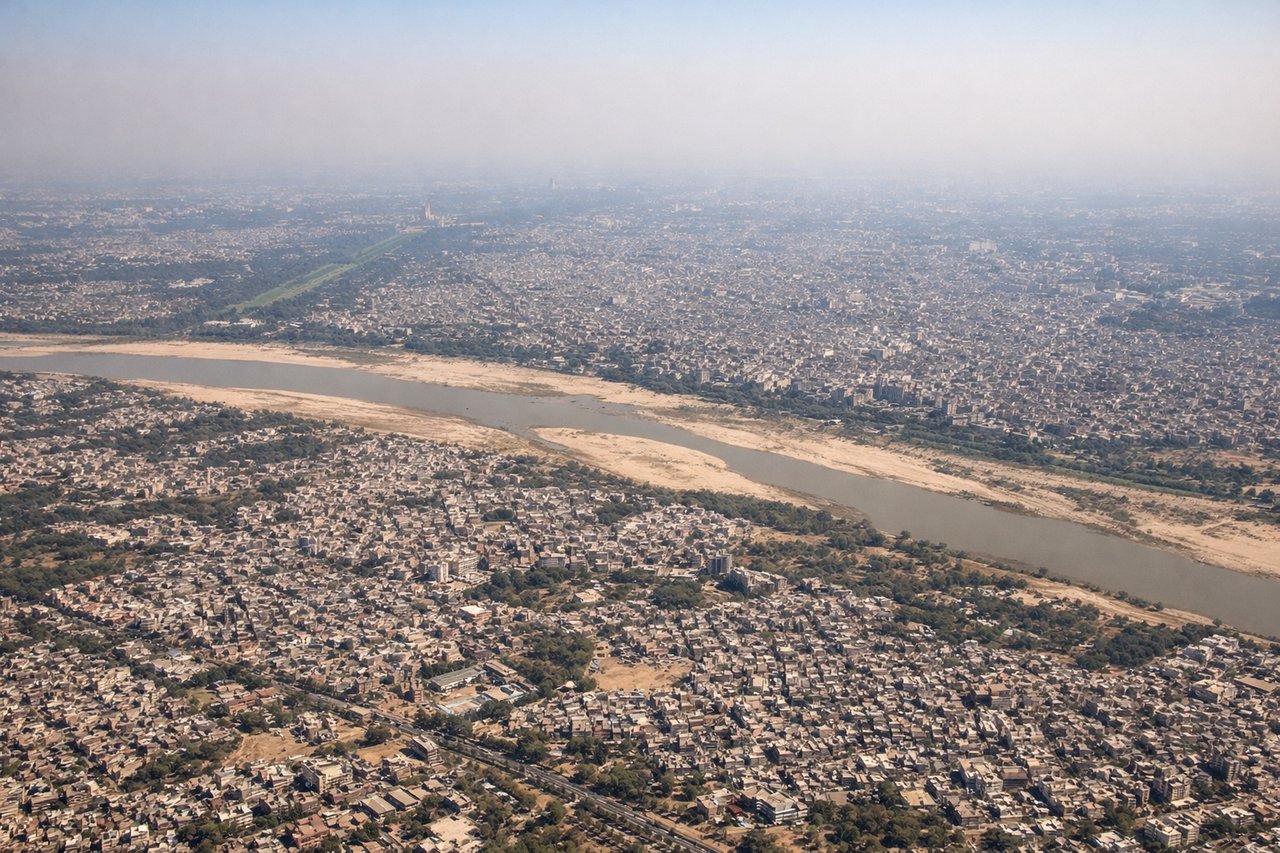
Takeoff from DEL
RIGHTRight-side seats capture the Yamuna River winding through Delhi's eastern suburbs during initial climb. You'll see the river's distinctive curves and the urban sprawl transitioning to agricultural land as you gain altitude heading southeast toward Allahabad.
Landing at IXD
LEFTLeft-side seats offer the best view of the Yamuna River as it approaches Allahabad, and you'll see the distinctive confluence area where the Yamuna meets the Ganges—one of India's most sacred and geographically prominent features. The river's wider channel and the city layout become visible during descent.
Landmarks on this routeAll landmarks →
Will your flight be in sunlight?
Pick a date and time in the Sun Map to watch the sun move across your whole flight.
About This Route
Which side of the plane should I sit on flying from Indira Gandhi International (DEL) to Prayagraj Airport (IXD)?
Sit on the Left side of the plane for the best views on flights from Delhi to Allahabad. While takeoff offers good river views on the right, the landing approach on the left provides the more dramatic and geographically significant view—the Yamuna-Ganges confluence is a major landmark visible from altitude and culturally iconic. The left side captures this better during descent.
What can I see during takeoff from Indira Gandhi International in Delhi?
During takeoff from Indira Gandhi International (DEL), sit on the Right side for the best views. Right-side seats capture the Yamuna River winding through Delhi's eastern suburbs during initial climb. You'll see the river's distinctive curves and the urban sprawl transitioning to agricultural land as you gain altitude heading southeast toward Allahabad. Notable sights include: Yamuna River (immediate right, snaking through Delhi), Delhi's urban grid (directly below transitioning to right), Aravalli Hills (distant left horizon), agricultural fields of Uttar Pradesh (right and ahead).
What can I see when landing at Prayagraj Airport in Allahabad?
When landing at Prayagraj Airport (IXD), sit on the Left side for the best views. Left-side seats offer the best view of the Yamuna River as it approaches Allahabad, and you'll see the distinctive confluence area where the Yamuna meets the Ganges—one of India's most sacred and geographically prominent features. The river's wider channel and the city layout become visible during descent. Notable sights include: Yamuna River (left side, widening toward confluence), Ganges River (left, converging with Yamuna), Allahabad city grid (center-left), agricultural plains of central Uttar Pradesh (right and ahead).
How long is the flight from Delhi to Allahabad?
The flight from Indira Gandhi International (DEL) to Prayagraj Airport (IXD) takes about 1 hour 10 minutes. The shortest flight path between them is 358 miles (575 km); winds and air traffic control usually add a few percent.
What does the Delhi to Allahabad flight path pass over?
The flight path heads southeast from Delhi across the Indo-Gangetic Plain. You'll cross the Yamuna River multiple times as it meanders. The terrain remains predominantly flat agricultural land with scattered towns and villages. Around the midpoint, the landscape transitions from Delhi's hinterland to Uttar Pradesh's central plains. No major mountain ranges are visible on this route—the Aravalli Hills fade quickly after takeoff. The Ganges River system becomes increasingly prominent as you approach Allahabad from the northwest.