The takeoff view from the right side (Yamuna River and Aravalli Hills) is more geographically distinctive than the landing view. While the landing left-side view of the Cooum River and estuary is good, the takeoff right-side experience offers clearer visual landmarks and better geographic context for the start of the journey.
Flown DEL to MAA? Did we get it right?
Flight Path
Delhi to Madras is 1,094 miles (1,760 km), a flight of about 2 hours 30 minutes.
The flight path crosses the Deccan Plateau, passing over Madhya Pradesh and northern Andhra Pradesh. Notable features include the Vindhya Range (visible as a subtle ridge system in the north-central portion of the route), scattered reservoirs and lakes of the Deccan (Hyderabad region), and the gradual transition from the Indo-Gangetic Plain to the drier plateau terrain. The Godavari River basin is crossed in the southern portion of the route. Visibility of these features depends on atmospheric conditions and altitude; the plateau terrain is generally less dramatic than mountain ranges but provides clear geographic definition.
Great circle distance and headings ›Phase by phase
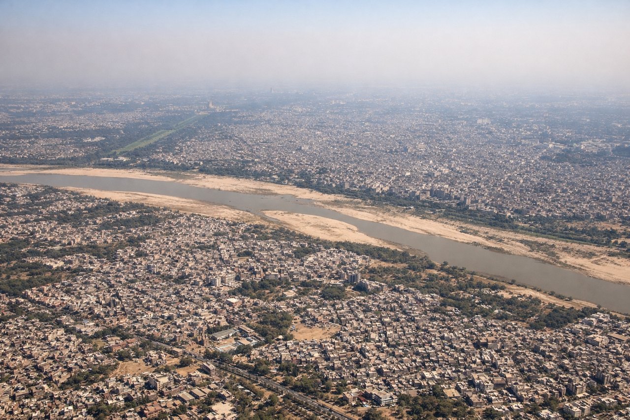
Takeoff from DEL
RIGHTRight-side seats capture the Yamuna River winding through Delhi's eastern suburbs during initial climb, with the Aravalli Hills visible as a distant ridge to the south. Left side faces the congested urban sprawl of west Delhi with minimal geographic interest.

Landing at MAA
LEFTLeft-side seats offer views of the Cooum River and the Adyar Estuary as the aircraft descends toward Chennai's runways. The water bodies and surrounding wetlands provide clear geographic reference points. Right side faces the industrial and urban sprawl of northern Chennai with less distinctive visual landmarks.
Will your flight be in sunlight?
Pick a date and time in the Sun Map to watch the sun move across your whole flight.
About This Route
Which side of the plane should I sit on flying from Indira Gandhi International (DEL) to Chennai International (MAA)?
Sit on the Right side of the plane for the best views on flights from Delhi to Madras. The takeoff view from the right side (Yamuna River and Aravalli Hills) is more geographically distinctive than the landing view. While the landing left-side view of the Cooum River and estuary is good, the takeoff right-side experience offers clearer visual landmarks and better geographic context for the start of the journey.
What can I see during takeoff from Indira Gandhi International in Delhi?
During takeoff from Indira Gandhi International (DEL), sit on the Right side for the best views. Right-side seats capture the Yamuna River winding through Delhi's eastern suburbs during initial climb, with the Aravalli Hills visible as a distant ridge to the south. Left side faces the congested urban sprawl of west Delhi with minimal geographic interest. Notable sights include: Yamuna River (immediate right, snaking through the airport vicinity), Aravalli Hills (southern horizon as a low ridge), Delhi's urban grid (spreading left and ahead), Indus-Gangetic Plain (extending northeast).
What can I see when landing at Chennai International in Madras?
When landing at Chennai International (MAA), sit on the Left side for the best views. Left-side seats offer views of the Cooum River and the Adyar Estuary as the aircraft descends toward Chennai's runways. The water bodies and surrounding wetlands provide clear geographic reference points. Right side faces the industrial and urban sprawl of northern Chennai with less distinctive visual landmarks. Notable sights include: Cooum River (visible as a dark linear feature approaching the airport), Adyar Estuary (confluence zone with the Bay of Bengal visible as water bodies), Bay of Bengal coastline (eastern horizon), Chennai's urban grid (spreading inland to the west).
How long is the flight from Delhi to Madras?
The flight from Indira Gandhi International (DEL) to Chennai International (MAA) takes about 2 hours 30 minutes. The shortest flight path between them is 1,094 miles (1,760 km); winds and air traffic control usually add a few percent.
What does the Delhi to Madras flight path pass over?
The flight path crosses the Deccan Plateau, passing over Madhya Pradesh and northern Andhra Pradesh. Notable features include the Vindhya Range (visible as a subtle ridge system in the north-central portion of the route), scattered reservoirs and lakes of the Deccan (Hyderabad region), and the gradual transition from the Indo-Gangetic Plain to the drier plateau terrain. The Godavari River basin is crossed in the southern portion of the route. Visibility of these features depends on atmospheric conditions and altitude; the plateau terrain is generally less dramatic than mountain ranges but provides clear geographic definition.