While the right side offers excellent Delhi departure views, the left side dominates the landing experience with unobstructed views of Ho Chi Minh City's river and urban landscape during the critical final approach phase. The left side also captures the Mekong Delta's distinctive canal network during descent.
Flown DEL to SGN? Did we get it right?
Flight Path
Delhi to Ho Chi Minh City is 2,269 miles (3,652 km), a flight of about 4 hours 15 minutes.
The flight path crosses the Indo-Gangetic Plain eastward, then transitions over the Ganges Delta (visible as a vast network of waterways and islands around 2 hours into flight), continues across the Bay of Bengal with scattered islands and shipping traffic, then approaches the Mekong Delta with its dense canal network and agricultural grid pattern. The Ganges Delta's braided river channels and the contrast between the Bay of Bengal's open water and the Mekong Delta's intricate waterway system are the most distinctive midpoint features.
Great circle distance and headings ›


Phase by phase
Takeoff from DEL
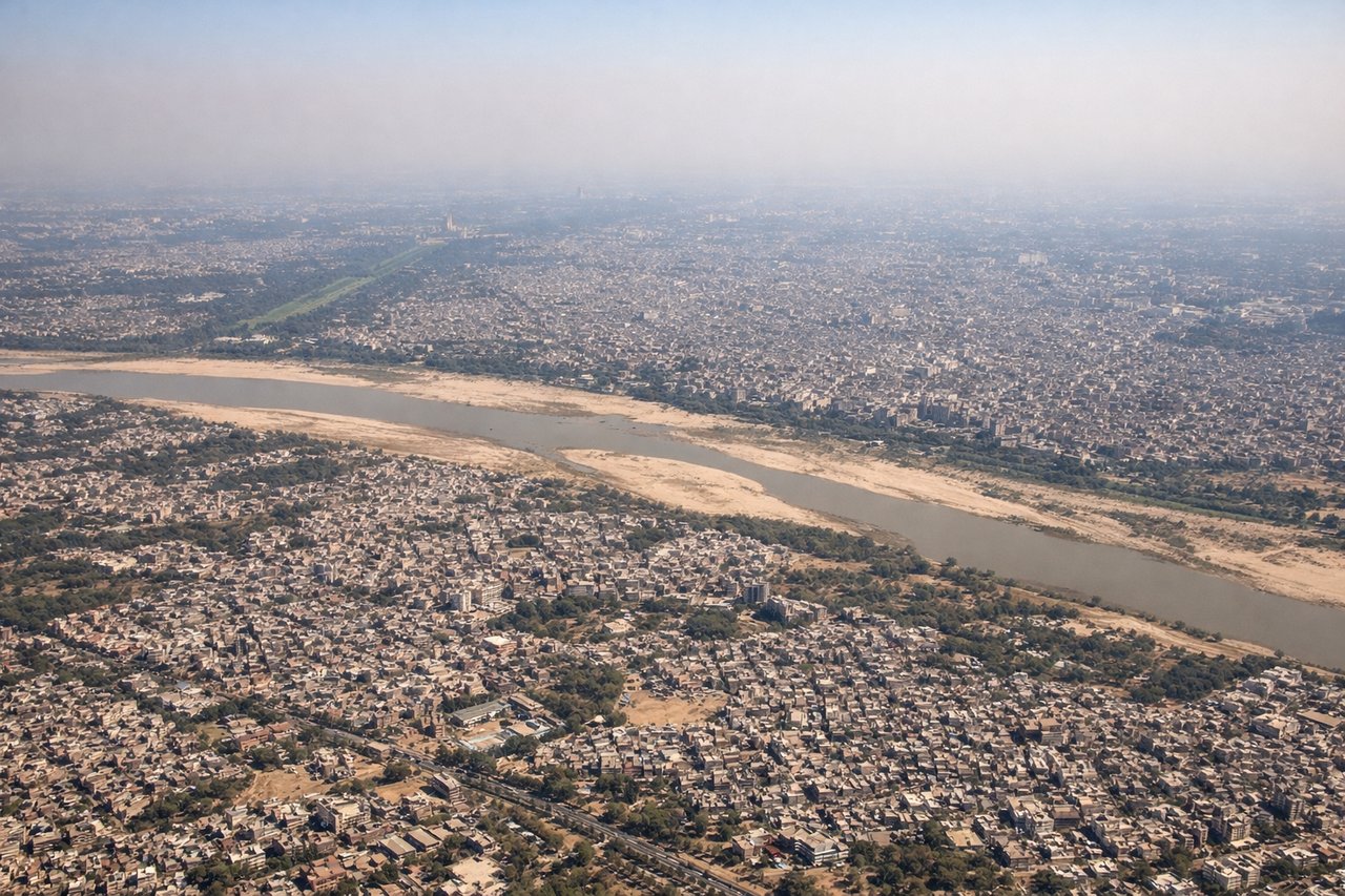
RIGHTRight-side seats capture the Yamuna River winding through Delhi's eastern districts during the initial climb. DEL typically departs runway 09L/27R; a northeasterly departure on 09L gives right-seaters a clear view of the river's curves and the city sprawl below before turning southeast toward Vietnam.
Landing at SGN
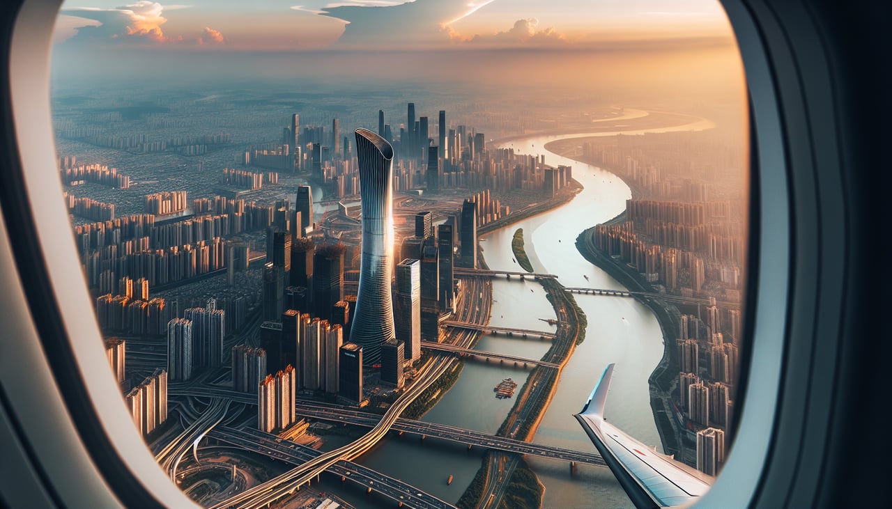
LEFTLeft-side seats offer the best view of the Saigon River and Ho Chi Minh City's dense urban core during final approach. SGN typically lands on runway 25L/07R; a westerly approach on 25L positions left-seaters directly over the river delta and the city's central districts, with the Mekong River visible in the distance.
Will your flight be in sunlight?
Pick a date and time in the Sun Map to watch the sun move across your whole flight.
About This Route
Which side of the plane should I sit on flying from Indira Gandhi International (DEL) to Tansonnhat International (SGN)?
Sit on the Left side of the plane for the best views on flights from Delhi to Ho Chi Minh City. While the right side offers excellent Delhi departure views, the left side dominates the landing experience with unobstructed views of Ho Chi Minh City's river and urban landscape during the critical final approach phase. The left side also captures the Mekong Delta's distinctive canal network during descent.
What can I see during takeoff from Indira Gandhi International in Delhi?
During takeoff from Indira Gandhi International (DEL), sit on the Right side for the best views. Right-side seats capture the Yamuna River winding through Delhi's eastern districts during the initial climb. DEL typically departs runway 09L/27R; a northeasterly departure on 09L gives right-seaters a clear view of the river's curves and the city sprawl below before turning southeast toward Vietnam. Notable sights include: Yamuna River (meandering through central Delhi), Delhi Ridge (forested hills to the south), Indus Valley plains extending eastward, Aravalli Range foothills (distant southern horizon).
What can I see when landing at Tansonnhat International in Ho Chi Minh City?
When landing at Tansonnhat International (SGN), sit on the Left side for the best views. Left-side seats offer the best view of the Saigon River and Ho Chi Minh City's dense urban core during final approach. SGN typically lands on runway 25L/07R; a westerly approach on 25L positions left-seaters directly over the river delta and the city's central districts, with the Mekong River visible in the distance. Notable sights include: Saigon River (prominent brown waterway through city center), Mekong River Delta (flat, grid-patterned agricultural land with canals), Ho Chi Minh City urban sprawl (dense high-rise and mid-rise development), Tan Son Nhat Airport runways (visible in final descent).
How long is the flight from Delhi to Ho Chi Minh City?
The flight from Indira Gandhi International (DEL) to Tansonnhat International (SGN) takes about 4 hours 15 minutes. The shortest flight path between them is 2,269 miles (3,652 km); winds and air traffic control usually add a few percent.
What does the Delhi to Ho Chi Minh City flight path pass over?
The flight path crosses the Indo-Gangetic Plain eastward, then transitions over the Ganges Delta (visible as a vast network of waterways and islands around 2 hours into flight), continues across the Bay of Bengal with scattered islands and shipping traffic, then approaches the Mekong Delta with its dense canal network and agricultural grid pattern. The Ganges Delta's braided river channels and the contrast between the Bay of Bengal's open water and the Mekong Delta's intricate waterway system are the most distinctive midpoint features.