While right seats offer the better DEL departure view, left seats provide the superior landing experience at TSA with clear views of Taipei's iconic landmarks and basin geography. The landing view is more visually rewarding and geographically distinctive.
Flown DEL to TSA? Did we get it right?
Flight Path
Delhi to Taipei is 2,737 miles (4,404 km), a flight of about 5 hours 45 minutes.
The flight path crosses the Indo-Gangetic Plain (agricultural and urban patches), then transitions over the Ganges River valley. Around the midpoint near the India-Bangladesh border region, you'll see the vast alluvial plains of the Ganges Delta (if visible through haze). Entering Myanmar/Thailand airspace, the terrain becomes more mountainous with the Shan Plateau visible as elevated, forested terrain. The final approach into Taiwan crosses the Taiwan Strait, with the Chinese coast (Fujian Province) visible to the west on clear days before descending into the Taipei Basin.
Great circle distance and headings ›


Phase by phase
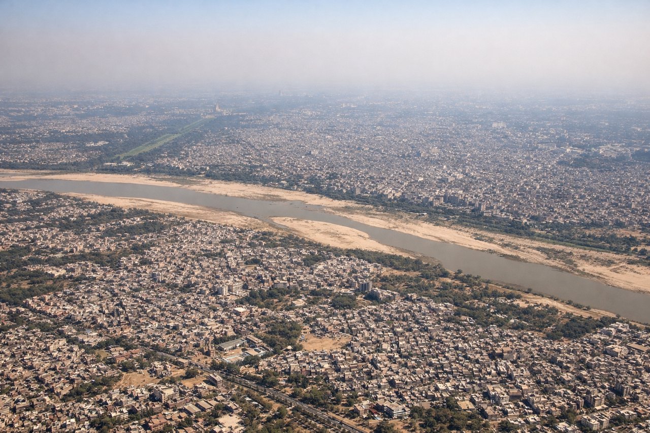
Takeoff from DEL
RIGHTDEL typically departs eastbound (Runway 09L/R or 27L/R depending on wind). Right-side seats offer views of the Yamuna River floodplain and the sprawling Delhi metropolitan area receding southeastward. Left seats face the western suburbs and industrial zones with less dramatic geography.
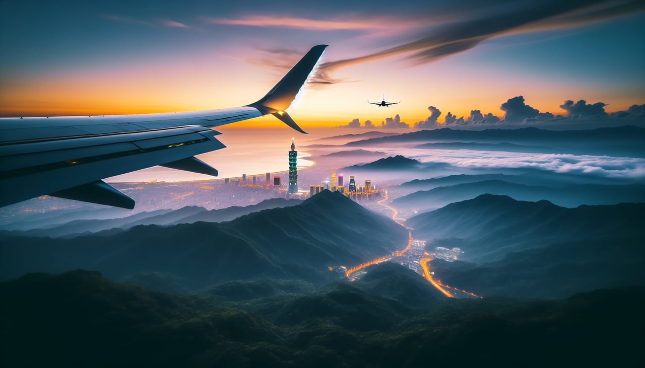
Landing at TSA
LEFTTSA (Sungshan) is located in central Taipei and typically uses runways aligned roughly north-south (09/27). Left-side seats during approach offer views of the Taipei Basin, Keelung River, and the city's distinctive geography. Right seats face the eastern suburbs and mountains with less urban detail.
Will your flight be in sunlight?
Pick a date and time in the Sun Map to watch the sun move across your whole flight.
About This Route
Which side of the plane should I sit on flying from Indira Gandhi International (DEL) to Sungshan (TSA)?
Sit on the Left side of the plane for the best views on flights from Delhi to Taipei. While right seats offer the better DEL departure view, left seats provide the superior landing experience at TSA with clear views of Taipei's iconic landmarks and basin geography. The landing view is more visually rewarding and geographically distinctive.
What can I see during takeoff from Indira Gandhi International in Delhi?
During takeoff from Indira Gandhi International (DEL), sit on the Right side for the best views. DEL typically departs eastbound (Runway 09L/R or 27L/R depending on wind). Right-side seats offer views of the Yamuna River floodplain and the sprawling Delhi metropolitan area receding southeastward. Left seats face the western suburbs and industrial zones with less dramatic geography. Notable sights include: Yamuna River (visible as a meandering ribbon below), Delhi Ridge (Aravalli foothills to the southwest, appearing as low, hazy ridges), Noida urban sprawl (grid pattern expanding southeast), Taj Mahal region (distant, ~200 km south—not clearly visible but in the flight path direction).
What can I see when landing at Sungshan in Taipei?
When landing at Sungshan (TSA), sit on the Left side for the best views. TSA (Sungshan) is located in central Taipei and typically uses runways aligned roughly north-south (09/27). Left-side seats during approach offer views of the Taipei Basin, Keelung River, and the city's distinctive geography. Right seats face the eastern suburbs and mountains with less urban detail. Notable sights include: Taipei 101 (iconic supertall building in Xinyi District, visible as a needle-like structure), Keelung River (winding through the city center), Yangmingshan volcanic plateau (northern rim of the basin, appearing as elevated terrain), Taipei Basin floor (dense urban grid).
How long is the flight from Delhi to Taipei?
The flight from Indira Gandhi International (DEL) to Sungshan (TSA) takes about 5 hours 45 minutes. The shortest flight path between them is 2,737 miles (4,404 km); winds and air traffic control usually add a few percent.
What does the Delhi to Taipei flight path pass over?
The flight path crosses the Indo-Gangetic Plain (agricultural and urban patches), then transitions over the Ganges River valley. Around the midpoint near the India-Bangladesh border region, you'll see the vast alluvial plains of the Ganges Delta (if visible through haze). Entering Myanmar/Thailand airspace, the terrain becomes more mountainous with the Shan Plateau visible as elevated, forested terrain. The final approach into Taiwan crosses the Taiwan Strait, with the Chinese coast (Fujian Province) visible to the west on clear days before descending into the Taipei Basin.