Left side captures the Yamuna and Delhi's urban geography on departure, then provides superior views during the long southern crossing of India and East Africa. The flight path crosses the Deccan Plateau, the Western Ghats (visible on left during midpoint), and approaches Kenya from the east—all features better positioned for left-side viewing. Landing views of Nairobi National Park are also left-side dominant.
Flight Path
The flight crosses central India's Deccan Plateau (relatively featureless from altitude), then the Western Ghats mountain range (visible as a north-south trending ridge with darker green vegetation on the left/west side around 3-4 hours into flight). The Arabian Sea lies to the west. Crossing into the Indian Ocean, the flight passes east of the Maldives. Over East Africa, the flight crosses Kenya's highlands and the Great Rift Valley (visible as a linear depression with lakes) before descending into Nairobi. The Rift Valley's escarpments and crater lakes are the most visually distinctive midpoint features, best seen from the left side.
Great circle distance and headings ›

Phase by phase
Takeoff from DEL
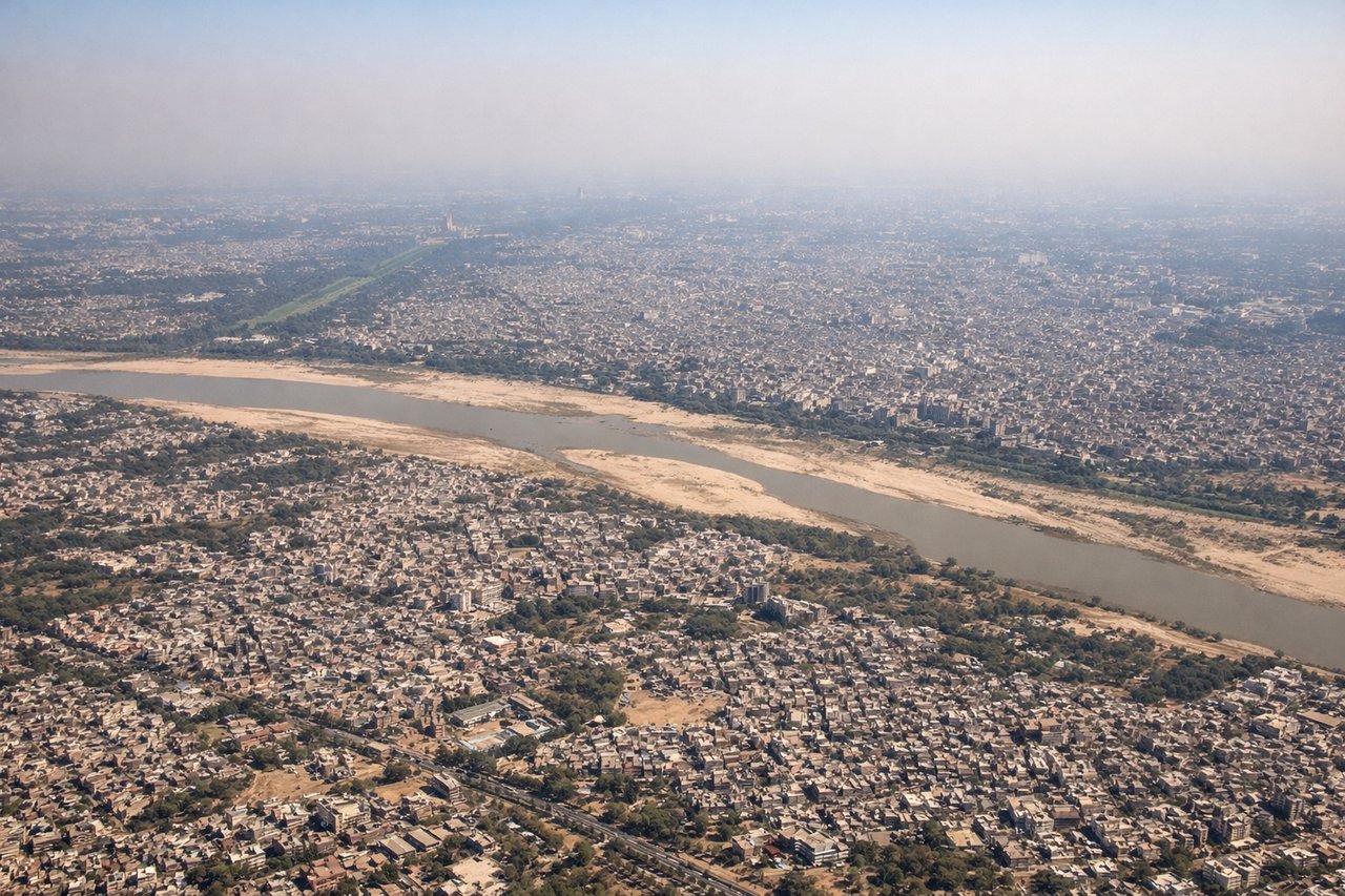
RIGHTDEL typically departs runway 09L/27R or 09R/27L depending on wind. Westbound departures use runway 27, climbing northwest. Right-side seats capture the Yamuna River floodplain immediately below, then the Delhi urban sprawl transitioning to agricultural fields of Haryana. The Western Ghats remain too distant on this northwesterly track.
Landing at WIL
LEFTNairobi Wilson (ICAO: HKWI) is a small airfield on Nairobi's outskirts. Approach typically comes from the east or northeast. Left-side seats on descent provide views of the Nairobi National Park's open grasslands and acacia woodland, the city's southern suburbs, and the Athi River valley. Right-side views would show industrial areas and less distinctive terrain.
Landmarks on this routeAll landmarks →
Will your flight be in sunlight?
See exactly which side of the plane gets sun and shade at your departure time.
About This Route
Which side of the plane should I sit on flying from Indira Gandhi International (DEL) to Nairobi Wilson (WIL)?
Sit on the Left side of the plane for the best views on flights from Delhi to Nairobi. Left side captures the Yamuna and Delhi's urban geography on departure, then provides superior views during the long southern crossing of India and East Africa. The flight path crosses the Deccan Plateau, the Western Ghats (visible on left during midpoint), and approaches Kenya from the east—all features better positioned for left-side viewing. Landing views of Nairobi National Park are also left-side dominant.
What can I see during takeoff from Indira Gandhi International in Delhi?
During takeoff from Indira Gandhi International (DEL), sit on the Right side for the best views. DEL typically departs runway 09L/27R or 09R/27L depending on wind. Westbound departures use runway 27, climbing northwest. Right-side seats capture the Yamuna River floodplain immediately below, then the Delhi urban sprawl transitioning to agricultural fields of Haryana. The Western Ghats remain too distant on this northwesterly track. Notable sights include: Yamuna River (visible as a brown ribbon threading through Delhi), Delhi city grid with its distinctive radial road pattern, Haryana agricultural plains extending northwest to the horizon.
What can I see when landing at Nairobi Wilson in Nairobi?
When landing at Nairobi Wilson (WIL), sit on the Left side for the best views. Nairobi Wilson (ICAO: HKWI) is a small airfield on Nairobi's outskirts. Approach typically comes from the east or northeast. Left-side seats on descent provide views of the Nairobi National Park's open grasslands and acacia woodland, the city's southern suburbs, and the Athi River valley. Right-side views would show industrial areas and less distinctive terrain. Notable sights include: Nairobi National Park (visible as open grassland with scattered trees), Nairobi city skyline to the north, Athi River valley to the south, suburban sprawl of Nairobi's southern districts.
How long is the flight from Delhi to Nairobi?
The flight from Indira Gandhi International (DEL) to Nairobi Wilson (WIL) takes Approximately 5 hours 45 minutes to 6 hours 15 minutes.
What does the Delhi to Nairobi flight path pass over?
The flight crosses central India's Deccan Plateau (relatively featureless from altitude), then the Western Ghats mountain range (visible as a north-south trending ridge with darker green vegetation on the left/west side around 3-4 hours into flight). The Arabian Sea lies to the west. Crossing into the Indian Ocean, the flight passes east of the Maldives. Over East Africa, the flight crosses Kenya's highlands and the Great Rift Valley (visible as a linear depression with lakes) before descending into Nairobi. The Rift Valley's escarpments and crater lakes are the most visually distinctive midpoint features, best seen from the left side.