The left side delivers the dramatic Rocky Mountain Front Range panorama on departure — the single most visually spectacular moment of the flight. The landing view on the right is excellent, but the Rockies at takeoff are hard to beat. Over the Atlantic and Mediterranean the views are broadly similar on both sides.
Flown DEN to ALG? Did we get it right?
Flight Path
Denver to Algier is 5,446 miles (8,764 km), a flight of about 11 hours.
The flight path crosses the US Great Plains, then the northeastern US or Canadian Maritime coast, then the North Atlantic Ocean. Over Europe it tracks across the Iberian Peninsula or France depending on routing — the Pyrenees may be visible as a snow-capped east-west ridge. The Strait of Gibraltar and the Spanish and Moroccan coastlines appear before the final Mediterranean leg into Algiers.
Great circle distance and headings ›Phase by phase
Takeoff from DEN
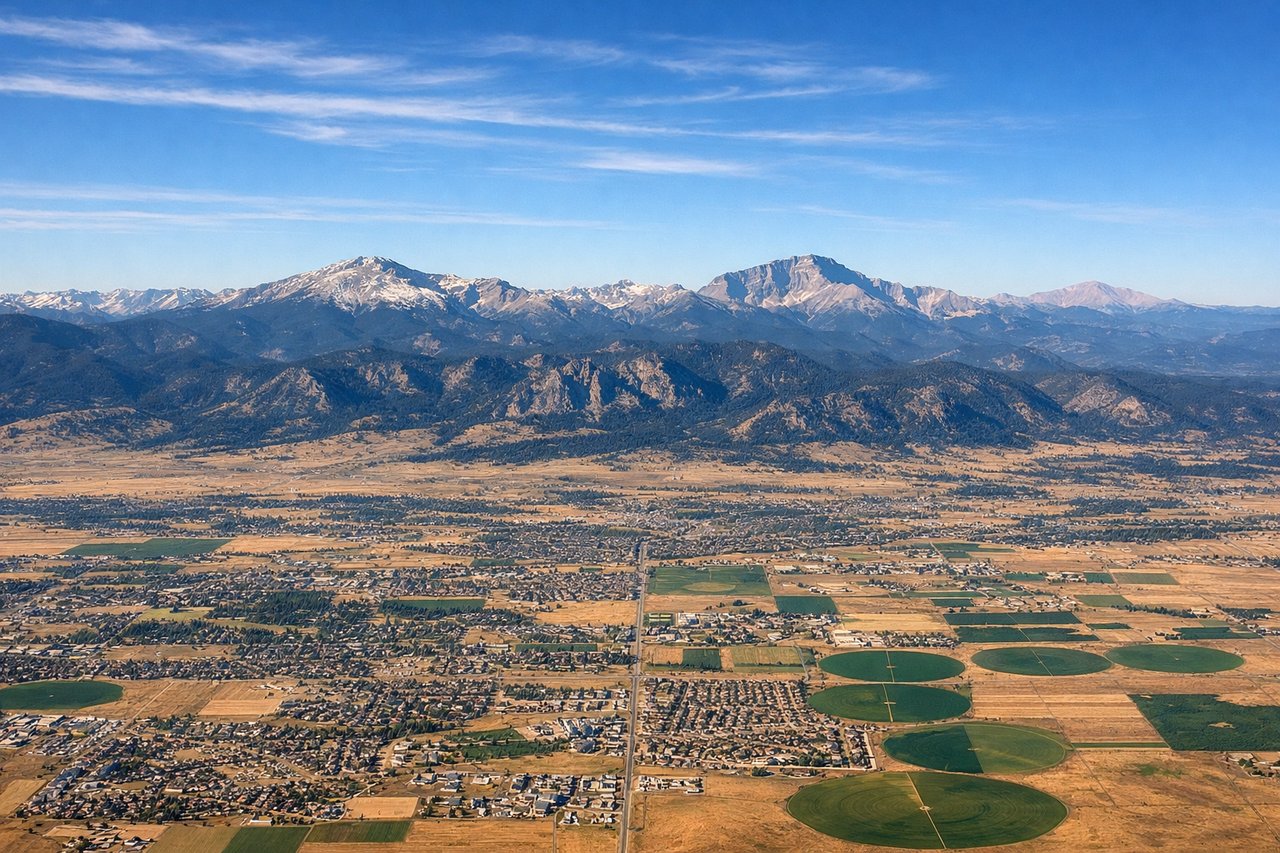
LEFTDEN typically departs westbound on runway 16L/34R or eastbound on 8/26. For a transatlantic routing heading northeast, aircraft often climb out heading east then turn north-northeast. The left side gives you the Rocky Mountain Front Range — a continuous wall of peaks running north-south — including Longs Peak, Mount Evans, and Pikes Peak visible to the south. The right side faces the flat eastern plains with little of interest.
Landing at ALG
RIGHTHouari Boumediene Airport sits just east of Algiers on the Mediterranean coast. Aircraft typically approach from the north or northwest over the sea, landing on runway 05/23. On a right-side seat, you get the Bay of Algiers, the white hillside city of Algiers (the Casbah district visible as a dense urban mass on the slope), and the Mediterranean coastline curving westward. The left side faces inland toward the Tell Atlas mountains.
Will your flight be in sunlight?
Pick a date and time in the Sun Map to watch the sun move across your whole flight.
About This Route
Which side of the plane should I sit on flying from Denver International (DEN) to Houari Boumediene (ALG)?
Sit on the Left side of the plane for the best views on flights from Denver to Algier. The left side delivers the dramatic Rocky Mountain Front Range panorama on departure — the single most visually spectacular moment of the flight. The landing view on the right is excellent, but the Rockies at takeoff are hard to beat. Over the Atlantic and Mediterranean the views are broadly similar on both sides.
What can I see during takeoff from Denver International in Denver?
During takeoff from Denver International (DEN), sit on the Left side for the best views. DEN typically departs westbound on runway 16L/34R or eastbound on 8/26. For a transatlantic routing heading northeast, aircraft often climb out heading east then turn north-northeast. The left side gives you the Rocky Mountain Front Range — a continuous wall of peaks running north-south — including Longs Peak, Mount Evans, and Pikes Peak visible to the south. The right side faces the flat eastern plains with little of interest. Notable sights include: Rocky Mountain Front Range, Longs Peak (14,259 ft), Mount Evans (14,265 ft), Denver metro grid below.
What can I see when landing at Houari Boumediene in Algier?
When landing at Houari Boumediene (ALG), sit on the Right side for the best views. Houari Boumediene Airport sits just east of Algiers on the Mediterranean coast. Aircraft typically approach from the north or northwest over the sea, landing on runway 05/23. On a right-side seat, you get the Bay of Algiers, the white hillside city of Algiers (the Casbah district visible as a dense urban mass on the slope), and the Mediterranean coastline curving westward. The left side faces inland toward the Tell Atlas mountains. Notable sights include: Bay of Algiers, Algiers city and Casbah hillside, Mediterranean coastline, Tell Atlas foothills to the south.
How long is the flight from Denver to Algier?
The flight from Denver International (DEN) to Houari Boumediene (ALG) takes about 11 hours. The shortest flight path between them is 5,446 miles (8,764 km); winds and air traffic control usually add a few percent.
What does the Denver to Algier flight path pass over?
The flight path crosses the US Great Plains, then the northeastern US or Canadian Maritime coast, then the North Atlantic Ocean. Over Europe it tracks across the Iberian Peninsula or France depending on routing — the Pyrenees may be visible as a snow-capped east-west ridge. The Strait of Gibraltar and the Spanish and Moroccan coastlines appear before the final Mediterranean leg into Algiers.