Denver to Burlington is 716 miles (1,152 km), a flight of about 2 hours 5 minutes.
Both sides score equally low because this is a short 1-hour flight over predominantly flat Midwestern terrain with minimal dramatic features. The left side (westbound departure) edges ahead slightly due to Denver's mountain-adjacent location providing brief foothills views during climb-out, whereas the landing approach offers only modest river valley variation. Neither side qualifies as scenic by any standard; this route crosses the Great Plains with no mountains, coastlines, or major urban centers visible for most of the flight.
Flight Path
The flight path crosses central Nebraska and northern Missouri, passing over the Platte River drainage system in Nebraska and the rolling prairie of northern Missouri. No major mountain ranges, canyons, or distinctive landmarks are visible during cruise altitude. The terrain remains predominantly flat to gently rolling agricultural land with scattered small towns and river valleys. The Republican River and its tributaries may be visible as thin lines in the landscape during the Nebraska portion of the flight.
Great circle distance and headings ›Phase by phase
Takeoff from DEN
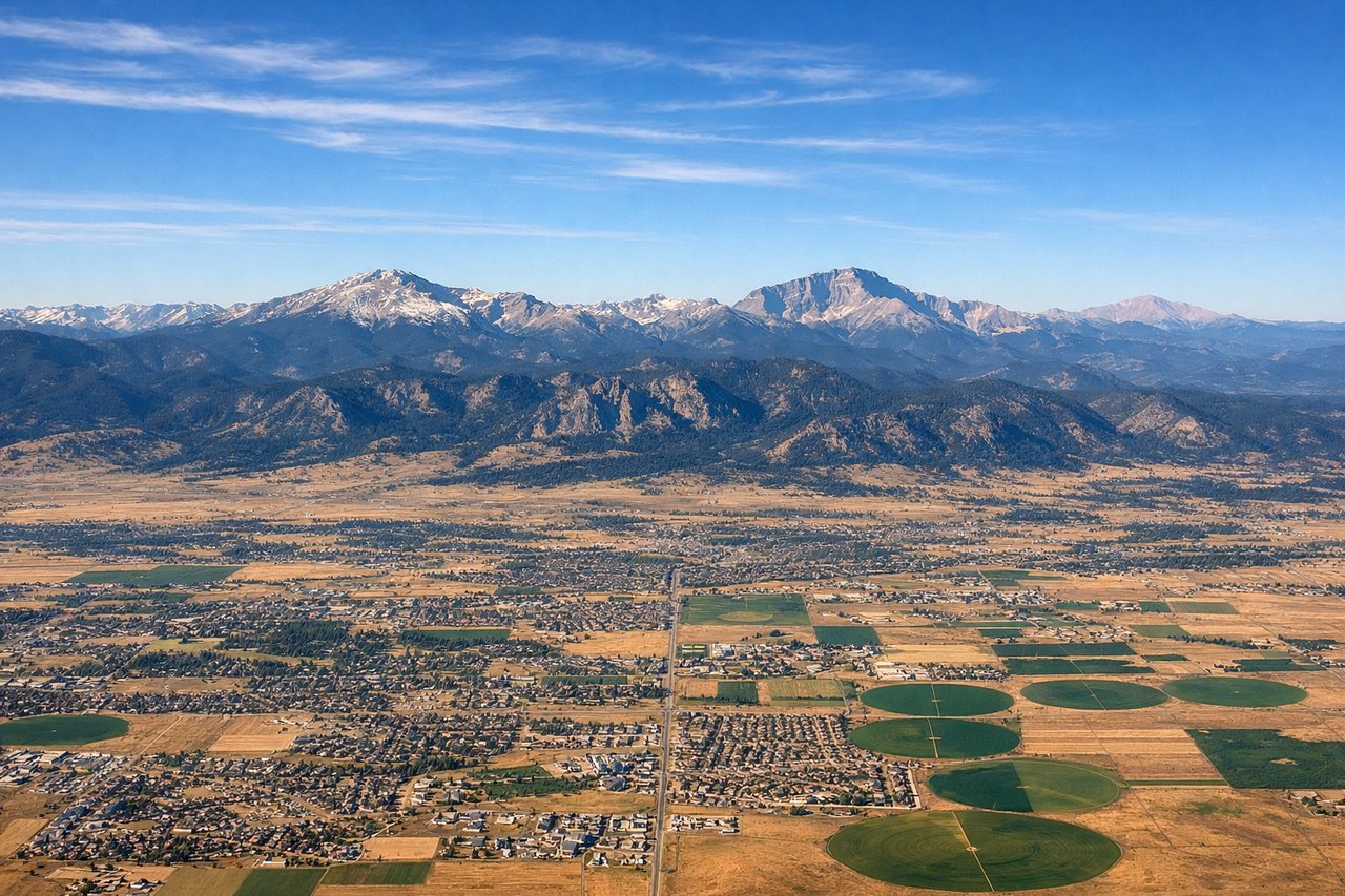
LEFTDenver's high-altitude departure offers brief views of the Front Range foothills and the South Platte River valley as you climb out, providing slightly more visual interest than the flat approach to Burlington.
Landing at BRL
RIGHTThe approach to Burlington from the west provides views of the Des Moines River valley and the transition from Iowa farmland to the river bluffs, offering marginally more terrain variation than the departure side.
Landmarks on this routeAll landmarks →
Will your flight be in sunlight?
Pick a date and time in the Sun Map to watch the sun move across your whole flight.
About This Route
Which side of the plane should I sit on flying from Denver International (DEN) to Southeast Iowa Regional Airport (BRL)?
Sit on the Left side of the plane for the best views on flights from Denver to Burlington. Both sides score equally low because this is a short 1-hour flight over predominantly flat Midwestern terrain with minimal dramatic features. The left side (westbound departure) edges ahead slightly due to Denver's mountain-adjacent location providing brief foothills views during climb-out, whereas the landing approach offers only modest river valley variation. Neither side qualifies as scenic by any standard; this route crosses the Great Plains with no mountains, coastlines, or major urban centers visible for most of the flight.
What can I see during takeoff from Denver International in Denver?
During takeoff from Denver International (DEN), sit on the Left side for the best views. Denver's high-altitude departure offers brief views of the Front Range foothills and the South Platte River valley as you climb out, providing slightly more visual interest than the flat approach to Burlington. Notable sights include: Front Range foothills, South Platte River, Denver metropolitan sprawl, Rocky Mountain foothills receding westward.
What can I see when landing at Southeast Iowa Regional Airport in Burlington?
When landing at Southeast Iowa Regional Airport (BRL), sit on the Right side for the best views. The approach to Burlington from the west provides views of the Des Moines River valley and the transition from Iowa farmland to the river bluffs, offering marginally more terrain variation than the departure side. Notable sights include: Des Moines River valley, Iowa agricultural grid, river bluffs near Burlington, Mississippi River drainage system.
How long is the flight from Denver to Burlington?
The flight from Denver International (DEN) to Southeast Iowa Regional Airport (BRL) takes about 2 hours 5 minutes. The shortest flight path between them is 716 miles (1,152 km); winds and air traffic control usually add a few percent.
What does the Denver to Burlington flight path pass over?
The flight path crosses central Nebraska and northern Missouri, passing over the Platte River drainage system in Nebraska and the rolling prairie of northern Missouri. No major mountain ranges, canyons, or distinctive landmarks are visible during cruise altitude. The terrain remains predominantly flat to gently rolling agricultural land with scattered small towns and river valleys. The Republican River and its tributaries may be visible as thin lines in the landscape during the Nebraska portion of the flight.