The takeoff views of the Rocky Mountain Front Range are more visually dramatic and distinctive than the landing approach. While Doha's coastal approach is interesting, the mountains of Colorado offer sharper relief, greater elevation contrast, and more memorable scenery from a passenger perspective.
Flown DEN to DOH? Did we get it right?
Flight Path
Denver to Doha is 7,684 miles (12,367 km), a flight of about 15 hours 30 minutes.
The flight path crosses the Great Plains (eastern Colorado, Kansas, Oklahoma panhandle), then transitions over the Mississippi River valley and Appalachian foothills. Over the Atlantic, the Mid-Atlantic Ridge lies far below but invisible. Crossing the Mediterranean, Sicily and southern Italy may be visible on clear days. The flight then crosses the Levant (Syria, Lebanon coast), with the Anti-Lebanon Mountains visible on clear conditions, before descending into the Persian Gulf region. The Zagros Mountains of Iran run parallel to the flight path's southern leg but typically remain beyond the horizon or visible only as a distant ridge on exceptionally clear days.
Great circle distance and headings ›


Phase by phase
Takeoff from DEN
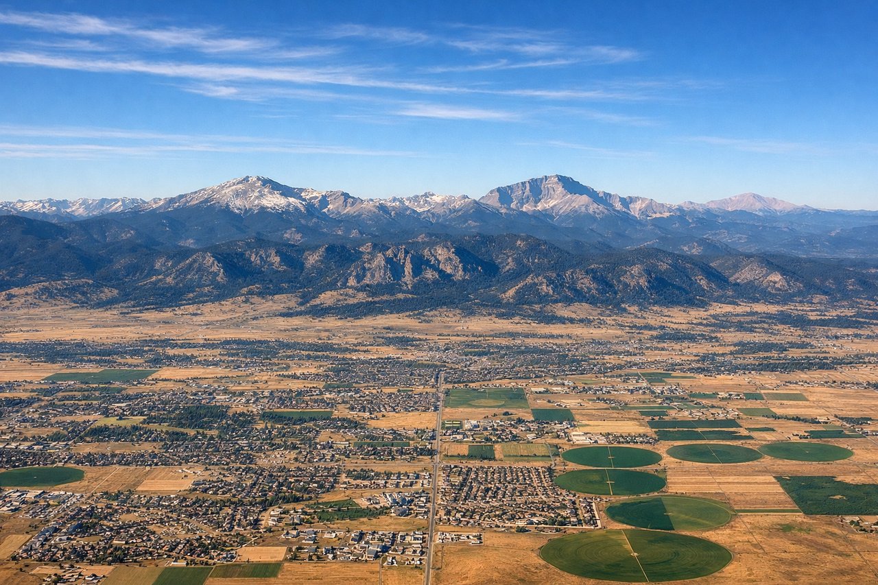
LEFTLeft seats offer immediate views of the Rocky Mountain Front as the aircraft climbs northwest from Denver. The Front Range peaks, including Mount Evans and the Indian Peaks, rise dramatically to the west and northwest of the airport, visible within the first 15–20 minutes of climb-out.
Landing at DOH
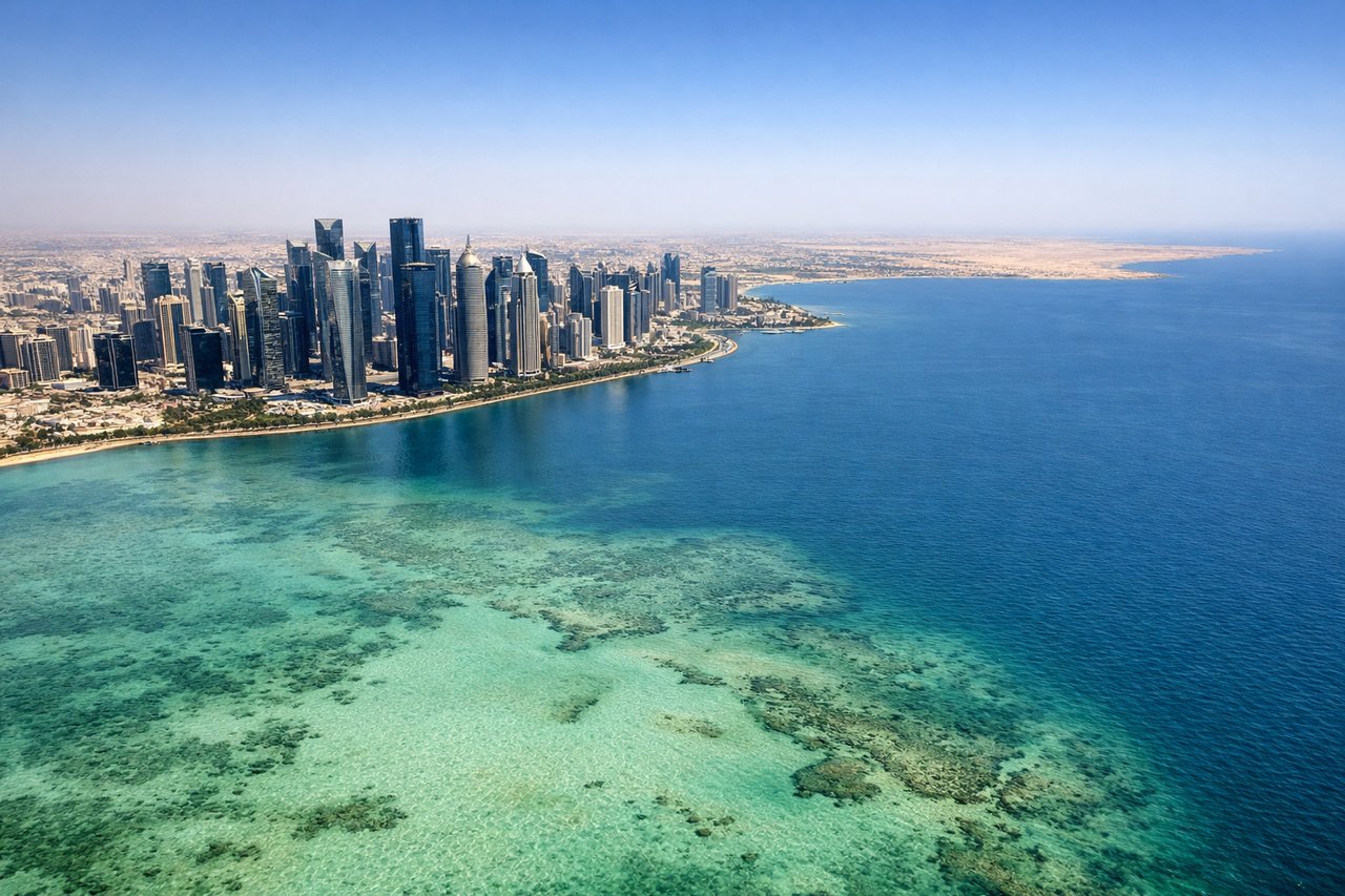
RIGHTRight seats provide the best views during the final approach into Doha. Aircraft typically descend from the northwest over the Persian Gulf, and right-side windows capture the coastline transition, the shallow turquoise waters of the Gulf, and the sprawling development of Doha's waterfront and the Corniche as the aircraft banks toward the runway.
Will your flight be in sunlight?
Pick a date and time in the Sun Map to watch the sun move across your whole flight.
About This Route
Which side of the plane should I sit on flying from Denver International (DEN) to Hamad International Airport (DOH)?
Sit on the Left side of the plane for the best views on flights from Denver to Doha. The takeoff views of the Rocky Mountain Front Range are more visually dramatic and distinctive than the landing approach. While Doha's coastal approach is interesting, the mountains of Colorado offer sharper relief, greater elevation contrast, and more memorable scenery from a passenger perspective.
What can I see during takeoff from Denver International in Denver?
During takeoff from Denver International (DEN), sit on the Left side for the best views. Left seats offer immediate views of the Rocky Mountain Front as the aircraft climbs northwest from Denver. The Front Range peaks, including Mount Evans and the Indian Peaks, rise dramatically to the west and northwest of the airport, visible within the first 15–20 minutes of climb-out. Notable sights include: Rocky Mountain Front Range (Mount Evans, Indian Peaks), South Platte River valley, Denver metropolitan area sprawl to the southeast.
What can I see when landing at Hamad International Airport in Doha?
When landing at Hamad International Airport (DOH), sit on the Right side for the best views. Right seats provide the best views during the final approach into Doha. Aircraft typically descend from the northwest over the Persian Gulf, and right-side windows capture the coastline transition, the shallow turquoise waters of the Gulf, and the sprawling development of Doha's waterfront and the Corniche as the aircraft banks toward the runway. Notable sights include: Persian Gulf coastline, Doha Corniche and harbor, Qatar's flat desert interior, artificial islands and port facilities.
How long is the flight from Denver to Doha?
The flight from Denver International (DEN) to Hamad International Airport (DOH) takes about 15 hours 30 minutes. The shortest flight path between them is 7,684 miles (12,367 km); winds and air traffic control usually add a few percent.
What does the Denver to Doha flight path pass over?
The flight path crosses the Great Plains (eastern Colorado, Kansas, Oklahoma panhandle), then transitions over the Mississippi River valley and Appalachian foothills. Over the Atlantic, the Mid-Atlantic Ridge lies far below but invisible. Crossing the Mediterranean, Sicily and southern Italy may be visible on clear days. The flight then crosses the Levant (Syria, Lebanon coast), with the Anti-Lebanon Mountains visible on clear conditions, before descending into the Persian Gulf region. The Zagros Mountains of Iran run parallel to the flight path's southern leg but typically remain beyond the horizon or visible only as a distant ridge on exceptionally clear days.