The left side delivers continuous mountain scenery from Denver's Front Range at takeoff, along the Rocky Mountain Front through Montana, to the Mission Mountains and Glacier National Park peaks on final approach — a far richer visual sequence than the plains and prairie views on the right.
Flown DEN to FCA? Did we get it right?
Flight Path
Denver to Kalispell is 752 miles (1,210 km), a flight of about 2 hours 15 minutes.
Wind River Range and the Absaroka Mountains of Wyoming, followed by the Rocky Mountain Front and Bob Marshall Wilderness in Montana
Great circle distance and headings ›

Phase by phase
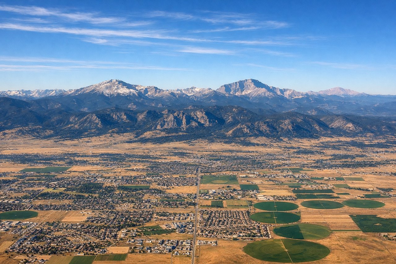
Takeoff from DEN
LEFTDeparting DEN northbound, the Front Range of the Rockies rises immediately to the west, giving left-side passengers a dramatic wall of peaks including the Indian Peaks Wilderness as the plane climbs out over the plains.
Landing at FCA
LEFTOn approach to FCA from the south, the plane tracks up the Flathead Valley with the Mission Mountains and Swan Range visible to the west, and the jagged peaks of Glacier National Park emerging ahead near touchdown.
Will your flight be in sunlight?
Pick a date and time in the Sun Map to watch the sun move across your whole flight.
About This Route
Which side of the plane should I sit on flying from Denver International (DEN) to Glacier Park International Airport (FCA)?
Sit on the Left side of the plane for the best views on flights from Denver to Kalispell. The left side delivers continuous mountain scenery from Denver's Front Range at takeoff, along the Rocky Mountain Front through Montana, to the Mission Mountains and Glacier National Park peaks on final approach — a far richer visual sequence than the plains and prairie views on the right.
What can I see during takeoff from Denver International in Denver?
During takeoff from Denver International (DEN), sit on the Left side for the best views. Departing DEN northbound, the Front Range of the Rockies rises immediately to the west, giving left-side passengers a dramatic wall of peaks including the Indian Peaks Wilderness as the plane climbs out over the plains. Notable sights include: Front Range foothills, Longs Peak, Indian Peaks Wilderness, Denver skyline receding below.
What can I see when landing at Glacier Park International Airport in Kalispell?
When landing at Glacier Park International Airport (FCA), sit on the Left side for the best views. On approach to FCA from the south, the plane tracks up the Flathead Valley with the Mission Mountains and Swan Range visible to the west, and the jagged peaks of Glacier National Park emerging ahead near touchdown. Notable sights include: Flathead Lake, Mission Mountains, Swan Range, Glacier National Park peaks.
How long is the flight from Denver to Kalispell?
The flight from Denver International (DEN) to Glacier Park International Airport (FCA) takes about 2 hours 15 minutes. The shortest flight path between them is 752 miles (1,210 km); winds and air traffic control usually add a few percent.
What does the Denver to Kalispell flight path pass over?
Wind River Range and the Absaroka Mountains of Wyoming, followed by the Rocky Mountain Front and Bob Marshall Wilderness in Montana