Denver to Greenwood is 918 miles (1,478 km), a flight of about 2 hours 30 minutes.
While the takeoff offers dramatic mountain scenery on the left, the landing provides more sustained visual interest with the Mississippi River's complex meanders and the distinctive delta landscape. The right side captures the most geographically significant feature of this route's destination region.
Flight Path
The flight path crosses the Great Plains, passing over eastern Colorado and western Kansas with sparse settlement and agricultural land. As the aircraft continues southeast, it crosses into Oklahoma and northern Texas, then into Arkansas and Mississippi. Notable features include the Canadian River valley in the Oklahoma Panhandle, the Arkansas River system in central Arkansas, and the transition from rolling terrain to the flat Mississippi alluvial plain. The Ozark plateau region appears briefly in northern Arkansas as low, forested hills before the landscape flattens completely into the Delta.
Great circle distance and headings ›Phase by phase
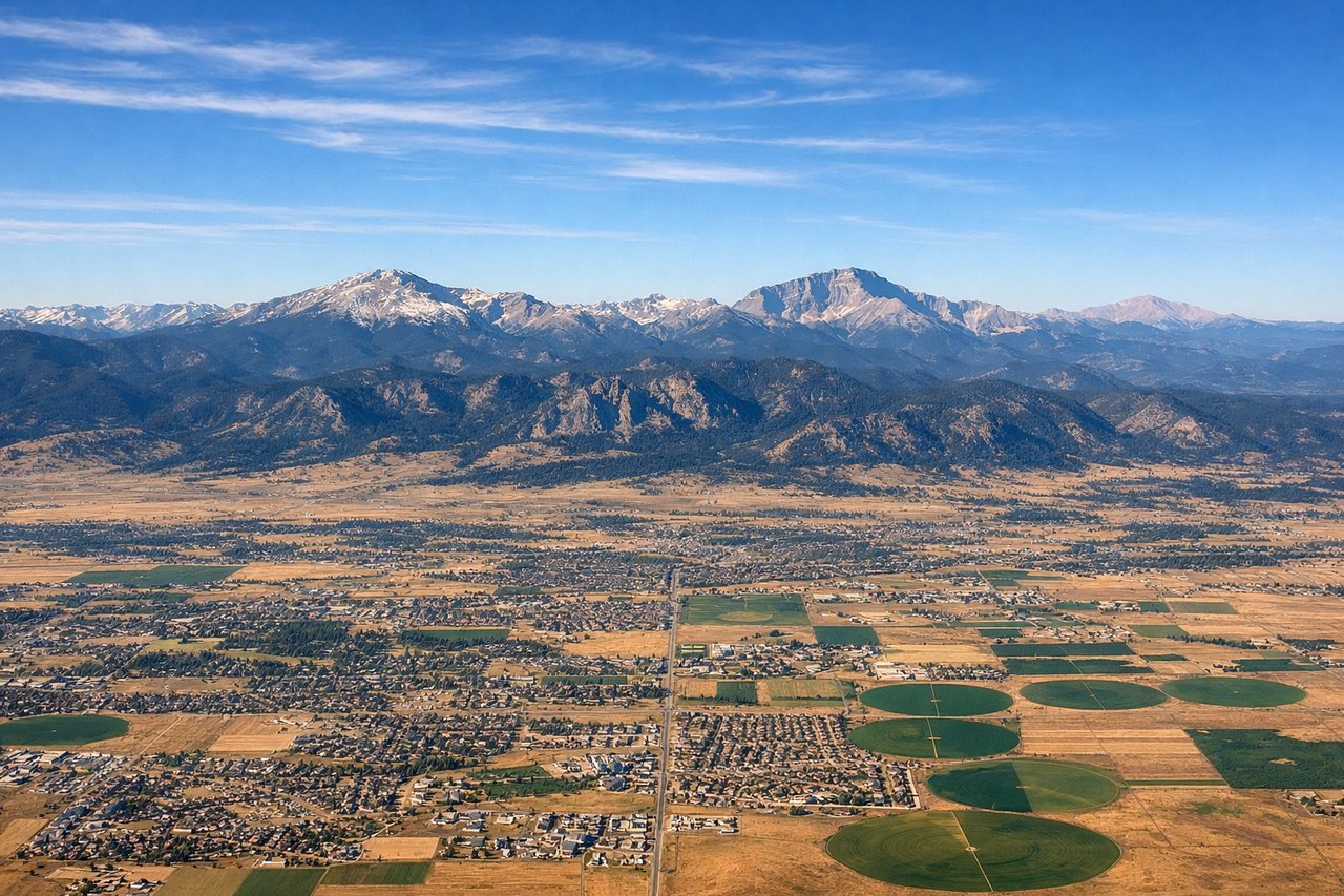
Takeoff from DEN
LEFTLeft side offers immediate views of the Front Range of the Rocky Mountains as the aircraft climbs eastbound out of Denver. The peaks are dramatic and clearly visible during the initial climb phase.
Landing at GWO
RIGHTRight side provides views of the Mississippi River delta region and the flat Mississippi alluvial plain as the aircraft descends into Greenwood. The river's oxbow bends and agricultural landscape are distinctive from altitude.
Landmarks on this routeAll landmarks →
Will your flight be in sunlight?
Pick a date and time in the Sun Map to watch the sun move across your whole flight.
About This Route
Which side of the plane should I sit on flying from Denver International (DEN) to Greenwood Leflore (GWO)?
Sit on the Right side of the plane for the best views on flights from Denver to Greenwood. While the takeoff offers dramatic mountain scenery on the left, the landing provides more sustained visual interest with the Mississippi River's complex meanders and the distinctive delta landscape. The right side captures the most geographically significant feature of this route's destination region.
What can I see during takeoff from Denver International in Denver?
During takeoff from Denver International (DEN), sit on the Left side for the best views. Left side offers immediate views of the Front Range of the Rocky Mountains as the aircraft climbs eastbound out of Denver. The peaks are dramatic and clearly visible during the initial climb phase. Notable sights include: Front Range (Rocky Mountains), South Platte River valley, Denver metropolitan area sprawl to the east, Pikes Peak region in the distance to the south.
What can I see when landing at Greenwood Leflore in Greenwood?
When landing at Greenwood Leflore (GWO), sit on the Right side for the best views. Right side provides views of the Mississippi River delta region and the flat Mississippi alluvial plain as the aircraft descends into Greenwood. The river's oxbow bends and agricultural landscape are distinctive from altitude. Notable sights include: Mississippi River and its oxbow meanders, Mississippi Delta agricultural plains, Yazoo River confluence area, flat terrain characteristic of the alluvial floodplain.
How long is the flight from Denver to Greenwood?
The flight from Denver International (DEN) to Greenwood Leflore (GWO) takes about 2 hours 30 minutes. The shortest flight path between them is 918 miles (1,478 km); winds and air traffic control usually add a few percent.
What does the Denver to Greenwood flight path pass over?
The flight path crosses the Great Plains, passing over eastern Colorado and western Kansas with sparse settlement and agricultural land. As the aircraft continues southeast, it crosses into Oklahoma and northern Texas, then into Arkansas and Mississippi. Notable features include the Canadian River valley in the Oklahoma Panhandle, the Arkansas River system in central Arkansas, and the transition from rolling terrain to the flat Mississippi alluvial plain. The Ozark plateau region appears briefly in northern Arkansas as low, forested hills before the landscape flattens completely into the Delta.