The left side wins on both ends of the flight: dramatic Rocky Mountain and Denver skyline views during departure, and volcanic Big Island terrain during the descent into Kona, while the right side offers flat plains and then hours of empty ocean with no coastal detail on arrival.
Flight Path
The route crosses the Great Basin and the eastern Sierra Nevada shortly after departure, then transitions to several hours over open Pacific Ocean with no land visible until the Hawaiian Islands appear near the end of the flight.
Great circle distance and headings ›.jpg?width=600)

Phase by phase
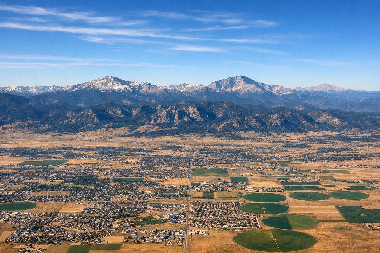
Takeoff from DEN
LEFTDeparting DEN, flights bound for Hawaii typically climb out and swing onto a westerly heading, putting the Front Range of the Rockies and the Denver skyline on the left side of the aircraft. The right side mostly shows flat eastern Colorado plains fading into the horizon.
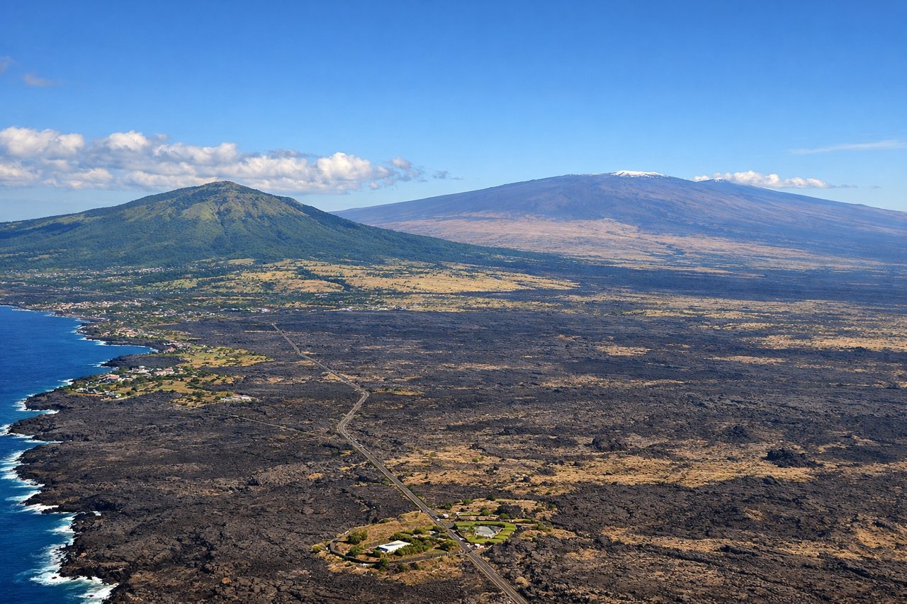
Landing at KOA
LEFTOn the typical trade-wind approach to KOA, the aircraft descends southward along the Kona coast, putting the volcanic slopes of Hualalai and the vast lava fields on the left side, while the right side faces only open Pacific Ocean. The volcanic terrain, black lava rock, and green coastal pockets make the left side far more visually striking.
Landmarks on this routeAll landmarks →
Will your flight be in sunlight?
See exactly which side of the plane gets sun and shade at your departure time.
About This Route
Which side of the plane should I sit on flying from Denver International (DEN) to Kona International At Keahole (KOA)?
Sit on the Left side of the plane for the best views on flights from Denver to Kona. The left side wins on both ends of the flight: dramatic Rocky Mountain and Denver skyline views during departure, and volcanic Big Island terrain during the descent into Kona, while the right side offers flat plains and then hours of empty ocean with no coastal detail on arrival.
What can I see during takeoff from Denver International in Denver?
During takeoff from Denver International (DEN), sit on the Left side for the best views. Departing DEN, flights bound for Hawaii typically climb out and swing onto a westerly heading, putting the Front Range of the Rockies and the Denver skyline on the left side of the aircraft. The right side mostly shows flat eastern Colorado plains fading into the horizon. Notable sights include: Front Range foothills, Pikes Peak, downtown Denver skyline, South Platte River valley.
What can I see when landing at Kona International At Keahole in Kona?
When landing at Kona International At Keahole (KOA), sit on the Left side for the best views. On the typical trade-wind approach to KOA, the aircraft descends southward along the Kona coast, putting the volcanic slopes of Hualalai and the vast lava fields on the left side, while the right side faces only open Pacific Ocean. The volcanic terrain, black lava rock, and green coastal pockets make the left side far more visually striking. Notable sights include: Hualalai volcano, Kona lava fields, Kailua-Kona coastline, Mauna Loa's distant slopes.
How long is the flight from Denver to Kona?
The flight from Denver International (DEN) to Kona International At Keahole (KOA) takes 7h 05m.
What does the Denver to Kona flight path pass over?
The route crosses the Great Basin and the eastern Sierra Nevada shortly after departure, then transitions to several hours over open Pacific Ocean with no land visible until the Hawaiian Islands appear near the end of the flight.