The left side delivers the standout moment of the flight: the sweeping panorama of the Rocky Mountain Front Range during departure from Denver, which is genuinely spectacular and unique. The landing views at MKL on the right are pleasant but relatively modest — forested Tennessee countryside. The Rocky Mountain departure view on the left is the defining visual experience of this route.
Flown DEN to MKL? Did we get it right?
Flight Path
Denver to Jackson is 909 miles (1,462 km), a flight of about 2 hours 25 minutes.
The flight crosses the high plains of eastern Colorado and Kansas, transitioning from flat shortgrass prairie to the more agricultural patchwork of central Kansas and Missouri. The Arkansas River is visible crossing Kansas. The Ozark Plateau appears as a low forested upland in southern Missouri and northern Arkansas before descending into the Mississippi Embayment lowlands of western Tennessee. No major mountain ranges after the Rockies — the terrain is predominantly flat to gently rolling throughout.
Great circle distance and headings ›Phase by phase
Takeoff from DEN
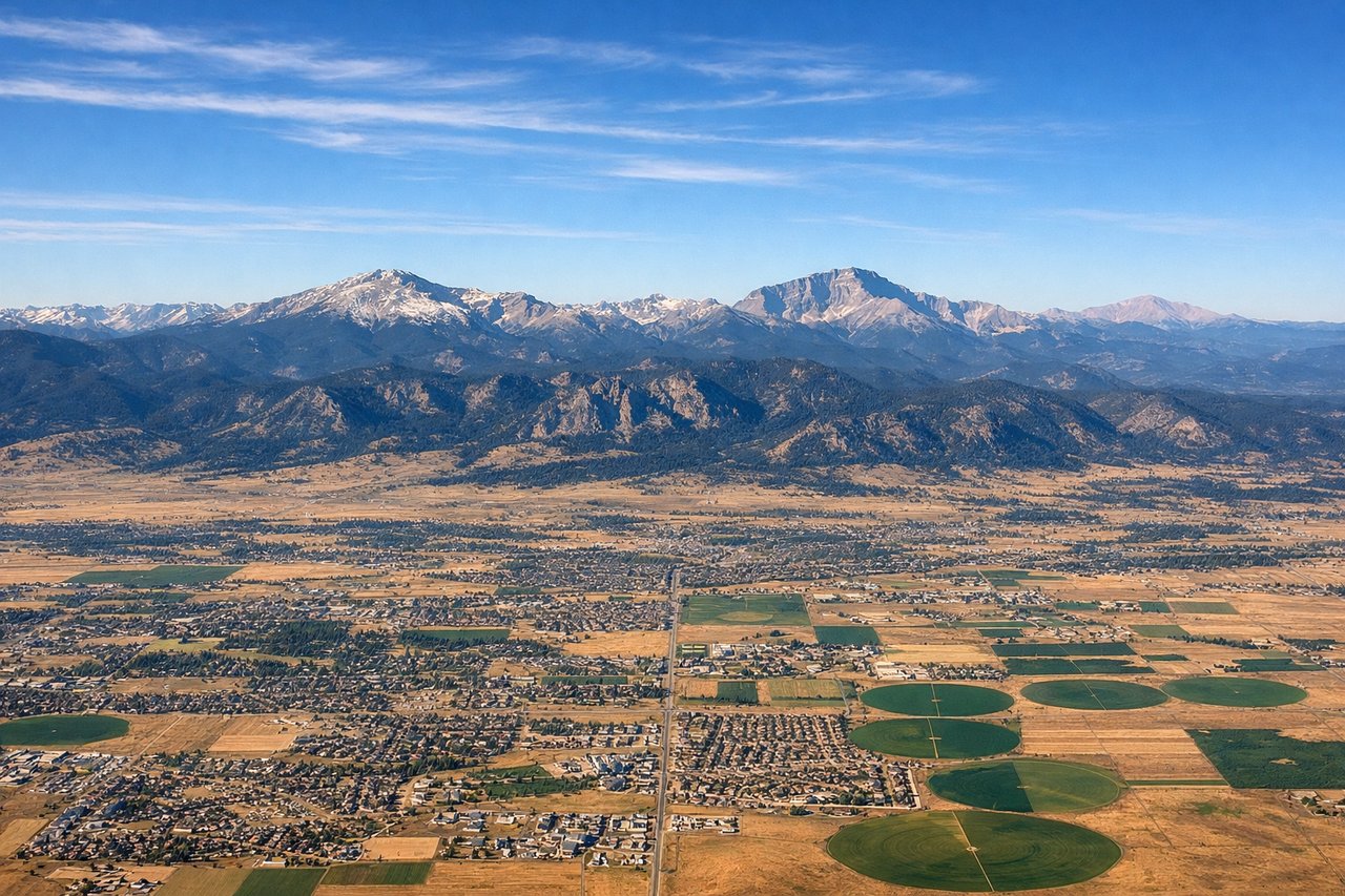
LEFTDEN typically departs east or southeast on runways 16/17, then turns east toward the route. The left side faces north and northwest, giving you a clear view back toward the Front Range and the Rocky Mountains as you climb out. You'll see the Denver metro spread out below with the mountains as a dramatic backdrop.
Landing at MKL
RIGHTMKL sits just west of Jackson, Tennessee, and aircraft typically approach from the west or southwest on runway 02 or 20. On approach from the southwest, the right side faces north and east, giving views over the Tennessee River valley and the rolling hardwood forests of western Tennessee. The left side looks south into flat Mississippi delta farmland with less visual interest.
Will your flight be in sunlight?
Pick a date and time in the Sun Map to watch the sun move across your whole flight.
About This Route
Which side of the plane should I sit on flying from Denver International (DEN) to Mc Kellar Sipes Rgnl (MKL)?
Sit on the Left side of the plane for the best views on flights from Denver to Jackson. The left side delivers the standout moment of the flight: the sweeping panorama of the Rocky Mountain Front Range during departure from Denver, which is genuinely spectacular and unique. The landing views at MKL on the right are pleasant but relatively modest — forested Tennessee countryside. The Rocky Mountain departure view on the left is the defining visual experience of this route.
What can I see during takeoff from Denver International in Denver?
During takeoff from Denver International (DEN), sit on the Left side for the best views. DEN typically departs east or southeast on runways 16/17, then turns east toward the route. The left side faces north and northwest, giving you a clear view back toward the Front Range and the Rocky Mountains as you climb out. You'll see the Denver metro spread out below with the mountains as a dramatic backdrop. Notable sights include: Front Range of the Rockies (including Longs Peak and Pikes Peak visible to north and south), Denver metro grid, Denver International's distinctive white tent roof structure briefly visible below, Cherry Creek Reservoir.
What can I see when landing at Mc Kellar Sipes Rgnl in Jackson?
When landing at Mc Kellar Sipes Rgnl (MKL), sit on the Right side for the best views. MKL sits just west of Jackson, Tennessee, and aircraft typically approach from the west or southwest on runway 02 or 20. On approach from the southwest, the right side faces north and east, giving views over the Tennessee River valley and the rolling hardwood forests of western Tennessee. The left side looks south into flat Mississippi delta farmland with less visual interest. Notable sights include: Tennessee River valley to the northeast, Beech Lake near Jackson, flat patchwork agricultural fields of western Tennessee, Jackson city grid.
How long is the flight from Denver to Jackson?
The flight from Denver International (DEN) to Mc Kellar Sipes Rgnl (MKL) takes about 2 hours 25 minutes. The shortest flight path between them is 909 miles (1,462 km); winds and air traffic control usually add a few percent.
What does the Denver to Jackson flight path pass over?
The flight crosses the high plains of eastern Colorado and Kansas, transitioning from flat shortgrass prairie to the more agricultural patchwork of central Kansas and Missouri. The Arkansas River is visible crossing Kansas. The Ozark Plateau appears as a low forested upland in southern Missouri and northern Arkansas before descending into the Mississippi Embayment lowlands of western Tennessee. No major mountain ranges after the Rockies — the terrain is predominantly flat to gently rolling throughout.