Left side delivers superior scenery across the entire flight. Takeoff showcases the dramatic Front Range climb-out; cruise crosses the high desert and Great Basin with distant mountain views; landing features the Pacific coastline, Estero Bay, and Santa Lucia Range. Right side offers only flat plains on departure and inland agricultural valleys on arrival, with minimal terrain variety or landmark density.
Flown DEN to SBP? Did we get it right?
Flight Path
Denver to San Luis Obispo is 930 miles (1,496 km), a flight of about 2 hours 15 minutes.
Great Basin high desert terrain, Sierra Nevada range (distant southern horizon), Kern County oil fields and agricultural valleys, Cuesta Grade approach to San Luis Obispo County
Great circle distance and headings ›


Phase by phase
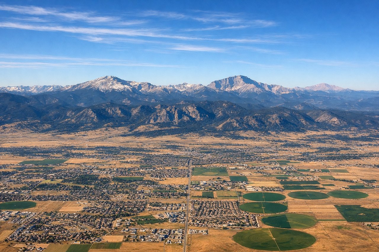
Takeoff from DEN
LEFTLeft side captures the Front Range of the Rocky Mountains immediately after departure. DEN typically departs southbound on runways 16L/16R/16C, climbing over the foothills and peaks that form Denver's dramatic western backdrop. Right side faces the flat High Plains extending eastward toward Kansas.
Landing at SBP
LEFTLeft side offers superior approach scenery into SBP. The descent path typically brings aircraft over the Santa Lucia Range and coastal valleys, with views of the Pacific coastline, Estero Bay, and the San Luis Obispo wine country. Right side faces inland agricultural valleys and lacks coastal drama.
Will your flight be in sunlight?
Pick a date and time in the Sun Map to watch the sun move across your whole flight.
About This Route
Which side of the plane should I sit on flying from Denver International (DEN) to San Luis County Regional Airport (SBP)?
Sit on the Left side of the plane for the best views on flights from Denver to San Luis Obispo. Left side delivers superior scenery across the entire flight. Takeoff showcases the dramatic Front Range climb-out; cruise crosses the high desert and Great Basin with distant mountain views; landing features the Pacific coastline, Estero Bay, and Santa Lucia Range. Right side offers only flat plains on departure and inland agricultural valleys on arrival, with minimal terrain variety or landmark density.
What can I see during takeoff from Denver International in Denver?
During takeoff from Denver International (DEN), sit on the Left side for the best views. Left side captures the Front Range of the Rocky Mountains immediately after departure. DEN typically departs southbound on runways 16L/16R/16C, climbing over the foothills and peaks that form Denver's dramatic western backdrop. Right side faces the flat High Plains extending eastward toward Kansas. Notable sights include: Front Range peaks (Mount Evans, Mount Bierstadt visible on clear days), South Platte River valley, Denver metropolitan sprawl transitioning to foothills.
What can I see when landing at San Luis County Regional Airport in San Luis Obispo?
When landing at San Luis County Regional Airport (SBP), sit on the Left side for the best views. Left side offers superior approach scenery into SBP. The descent path typically brings aircraft over the Santa Lucia Range and coastal valleys, with views of the Pacific coastline, Estero Bay, and the San Luis Obispo wine country. Right side faces inland agricultural valleys and lacks coastal drama. Notable sights include: Santa Lucia Range peaks, Estero Bay and Morro Bay (with Morro Rock), Pacific coastline, San Luis Obispo Valley vineyards and rolling terrain.
How long is the flight from Denver to San Luis Obispo?
The flight from Denver International (DEN) to San Luis County Regional Airport (SBP) takes about 2 hours 15 minutes. The shortest flight path between them is 930 miles (1,496 km); winds and air traffic control usually add a few percent.
What does the Denver to San Luis Obispo flight path pass over?
Great Basin high desert terrain, Sierra Nevada range (distant southern horizon), Kern County oil fields and agricultural valleys, Cuesta Grade approach to San Luis Obispo County