While both sides score equally at 1.5 due to the inherently flat terrain and limited scenic variety on this Great Plains route, the left side provides superior takeoff scenery with the Dallas-Fort Worth metropolitan area visible during departure. The landing experience is equally unremarkable on both sides, but the urban interest during climb-out gives left a marginal advantage for the overall flight experience.
Flown DFW to FSD? Did we get it right?
Flight Path
Dallas-Fort Worth to Sioux Falls is 739 miles (1,189 km), a flight of about 2 hours 15 minutes.
The flight path crosses central Oklahoma and southern Kansas, passing over the Red River valley near the Texas-Oklahoma border, then continues north across the gently rolling prairie of central Oklahoma and the flat grasslands of southern Kansas. No significant mountains, canyons, or water features are visible along the cruise portion. The terrain remains uniformly flat to gently rolling throughout, with scattered lakes and river valleys (Canadian River, Arkansas River) visible but not dramatic. Small towns and agricultural grid patterns dominate the landscape. No major geographic landmarks interrupt the monotonous prairie scenery during the 2-hour cruise segment.
Great circle distance and headings ›Phase by phase
Takeoff from DFW
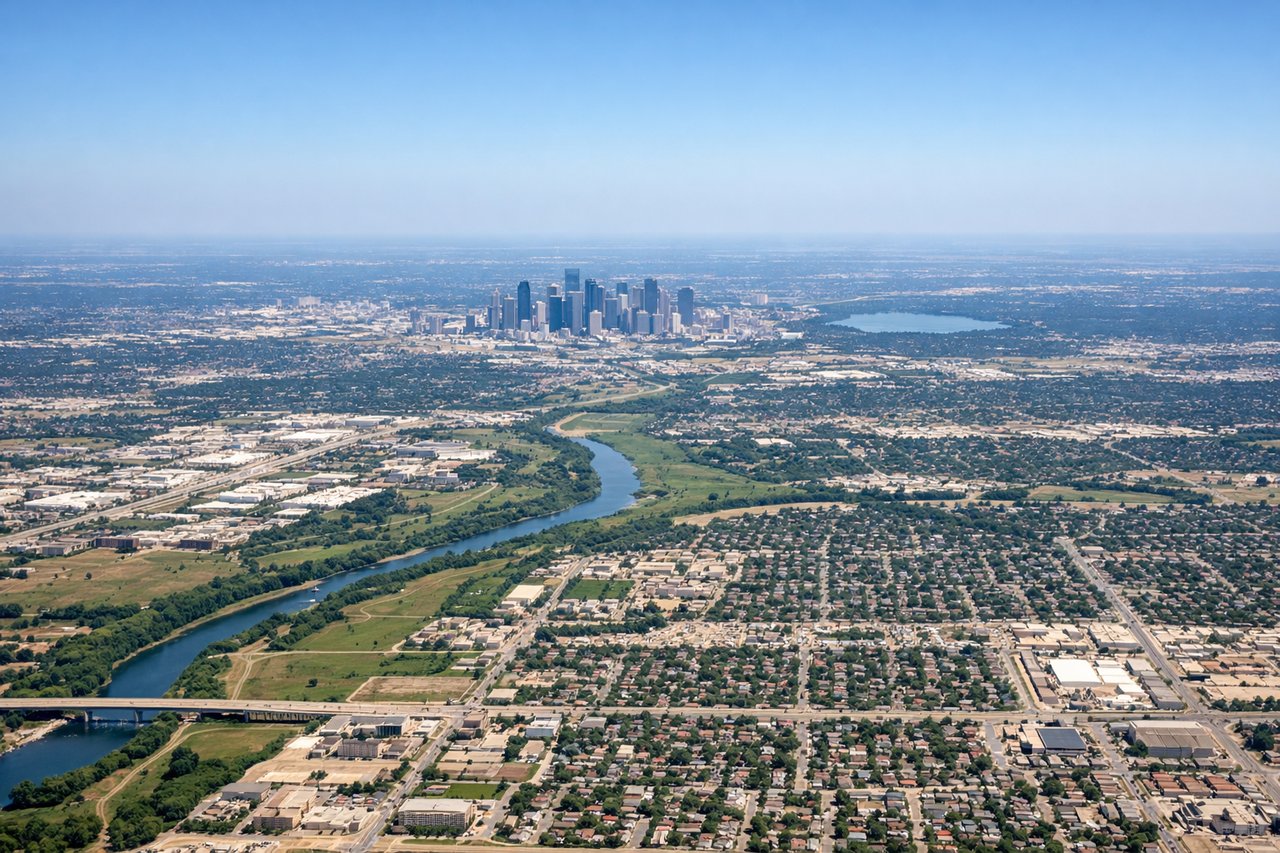
LEFTLeft side captures the DFW metroplex during departure, including downtown Dallas and Fort Worth skylines. Right side shows only flat suburban sprawl and open prairie with no distinctive urban features.
Landing at FSD
RIGHTRight side offers a clearer approach to Sioux Falls with views of the Big Sioux River valley and the city's position within the surrounding prairie. Left side shows only featureless Great Plains with no distinctive landmarks during descent.
Will your flight be in sunlight?
Pick a date and time in the Sun Map to watch the sun move across your whole flight.
About This Route
Which side of the plane should I sit on flying from Dallas Fort Worth International (DFW) to Sioux Falls Regional Airport (FSD)?
Sit on the Left side of the plane for the best views on flights from Dallas-Fort Worth to Sioux Falls. While both sides score equally at 1.5 due to the inherently flat terrain and limited scenic variety on this Great Plains route, the left side provides superior takeoff scenery with the Dallas-Fort Worth metropolitan area visible during departure. The landing experience is equally unremarkable on both sides, but the urban interest during climb-out gives left a marginal advantage for the overall flight experience.
What can I see during takeoff from Dallas Fort Worth International in Dallas-Fort Worth?
During takeoff from Dallas Fort Worth International (DFW), sit on the Left side for the best views. Left side captures the DFW metroplex during departure, including downtown Dallas and Fort Worth skylines. Right side shows only flat suburban sprawl and open prairie with no distinctive urban features. Notable sights include: Dallas downtown skyline, Fort Worth skyline, Trinity River corridor, suburban grid pattern extending north.
What can I see when landing at Sioux Falls Regional Airport in Sioux Falls?
When landing at Sioux Falls Regional Airport (FSD), sit on the Right side for the best views. Right side offers a clearer approach to Sioux Falls with views of the Big Sioux River valley and the city's position within the surrounding prairie. Left side shows only featureless Great Plains with no distinctive landmarks during descent. Notable sights include: Big Sioux River valley, Sioux Falls city grid, surrounding prairie grasslands, airport runways.
How long is the flight from Dallas-Fort Worth to Sioux Falls?
The flight from Dallas Fort Worth International (DFW) to Sioux Falls Regional Airport (FSD) takes about 2 hours 15 minutes. The shortest flight path between them is 739 miles (1,189 km); winds and air traffic control usually add a few percent.
What does the Dallas-Fort Worth to Sioux Falls flight path pass over?
The flight path crosses central Oklahoma and southern Kansas, passing over the Red River valley near the Texas-Oklahoma border, then continues north across the gently rolling prairie of central Oklahoma and the flat grasslands of southern Kansas. No significant mountains, canyons, or water features are visible along the cruise portion. The terrain remains uniformly flat to gently rolling throughout, with scattered lakes and river valleys (Canadian River, Arkansas River) visible but not dramatic. Small towns and agricultural grid patterns dominate the landscape. No major geographic landmarks interrupt the monotonous prairie scenery during the 2-hour cruise segment.