Both sides score equally at 2.0 due to the flight's geography: the route crosses flat Great Plains with minimal terrain drama. However, the right side edges ahead for landing quality. DFW's approach provides genuine urban scenery and airport infrastructure interest that Sioux Falls' modest river valley departure cannot match. The Trinity River and metropolitan sprawl offer more visual variety during descent than the featureless prairie during climb-out.
Flown FSD to DFW? Did we get it right?
Flight Path
Sioux Falls to Dallas-Fort Worth is 739 miles (1,189 km), a flight of about 2 hours 15 minutes.
Missouri River valley near Kansas-Missouri border, Flint Hills of Kansas (subtle rolling terrain), Red River valley approaching Texas, scattered lakes and reservoirs across Oklahoma panhandle and north Texas
Great circle distance and headings ›Phase by phase
Takeoff from FSD
LEFTSioux Falls sits on the Big Sioux River valley with modest rolling terrain to the west and northwest. Left-side departure typically climbs over the river valley and surrounding prairie, offering slightly more topographic variation than the flat eastern approach corridor.
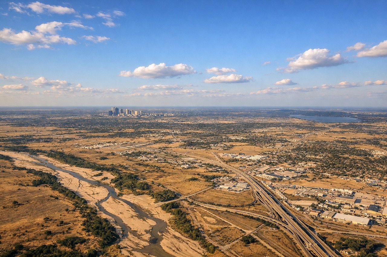
Landing at DFW
RIGHTDFW approach from the north brings views of the Dallas-Fort Worth urban sprawl, the Trinity River system, and the distinctive airport infrastructure. Right-side descent offers better sightlines of the city's northern suburbs, highway networks, and the airport's multiple runways and taxiways.
Will your flight be in sunlight?
Pick a date and time in the Sun Map to watch the sun move across your whole flight.
About This Route
Which side of the plane should I sit on flying from Sioux Falls Regional Airport (FSD) to Dallas Fort Worth International (DFW)?
Sit on the Right side of the plane for the best views on flights from Sioux Falls to Dallas-Fort Worth. Both sides score equally at 2.0 due to the flight's geography: the route crosses flat Great Plains with minimal terrain drama. However, the right side edges ahead for landing quality. DFW's approach provides genuine urban scenery and airport infrastructure interest that Sioux Falls' modest river valley departure cannot match. The Trinity River and metropolitan sprawl offer more visual variety during descent than the featureless prairie during climb-out.
What can I see during takeoff from Sioux Falls Regional Airport in Sioux Falls?
During takeoff from Sioux Falls Regional Airport (FSD), sit on the Left side for the best views. Sioux Falls sits on the Big Sioux River valley with modest rolling terrain to the west and northwest. Left-side departure typically climbs over the river valley and surrounding prairie, offering slightly more topographic variation than the flat eastern approach corridor. Notable sights include: Big Sioux River valley, rolling prairie terrain of eastern South Dakota, scattered farmland grid pattern.
What can I see when landing at Dallas Fort Worth International in Dallas-Fort Worth?
When landing at Dallas Fort Worth International (DFW), sit on the Right side for the best views. DFW approach from the north brings views of the Dallas-Fort Worth urban sprawl, the Trinity River system, and the distinctive airport infrastructure. Right-side descent offers better sightlines of the city's northern suburbs, highway networks, and the airport's multiple runways and taxiways. Notable sights include: Dallas-Fort Worth metropolitan area sprawl, Trinity River, DFW International Airport runways and terminals, northern Dallas suburbs.
How long is the flight from Sioux Falls to Dallas-Fort Worth?
The flight from Sioux Falls Regional Airport (FSD) to Dallas Fort Worth International (DFW) takes about 2 hours 15 minutes. The shortest flight path between them is 739 miles (1,189 km); winds and air traffic control usually add a few percent.
What does the Sioux Falls to Dallas-Fort Worth flight path pass over?
Missouri River valley near Kansas-Missouri border, Flint Hills of Kansas (subtle rolling terrain), Red River valley approaching Texas, scattered lakes and reservoirs across Oklahoma panhandle and north Texas