The right side strings together the most identifiable terrain the whole route: the Dallas skyline at takeoff, the Sandia Mountains and San Francisco Peaks near Albuquerque and Flagstaff, the Sierra Nevada crest, and finally San Francisco Bay on approach into SJC. The left side stays mostly over flat plains and desert with only minor relief.
Flight Path
Route crosses the Texas Panhandle, the Rio Grande valley near Albuquerque, the Colorado Plateau with the San Francisco Peaks and Painted Desert near Flagstaff, and the Mojave Desert before reaching the Sierra Nevada
Great circle distance and headings ›.jpg?width=600)

.jpeg?width=600)


Phase by phase
Takeoff from DFW
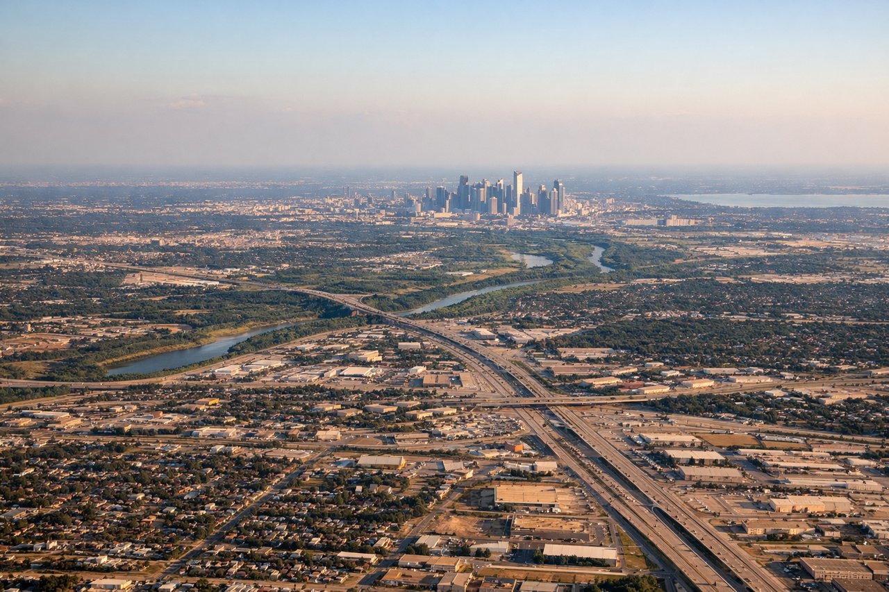
RIGHTWith DFW's common southerly-wind configuration, departures roll south on the 17-series runways before banking west toward California. That right-hand turn swings the downtown Dallas skyline and the Trinity River into view on the right side, while the left side only sees flat Tarrant County suburbs.
Landing at SJC
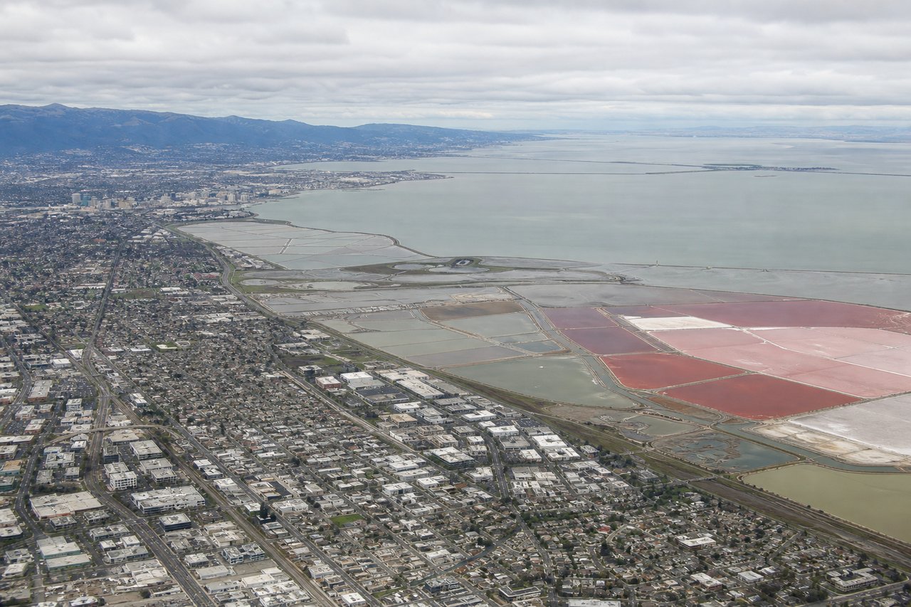
RIGHTArriving at SJC from the east, the aircraft crosses the Diablo Range and descends toward runway 30, putting the southern arm of San Francisco Bay and the Santa Clara Valley sprawl on the right side. The left side instead faces the lower, less distinctive Santa Cruz Mountain foothills.
Landmarks on this routeAll landmarks →
Will your flight be in sunlight?
See exactly which side of the plane gets sun and shade at your departure time.
About This Route
Which side of the plane should I sit on flying from Dallas Fort Worth International (DFW) to Norman Y Mineta San Jose International (SJC)?
Sit on the Right side of the plane for the best views on flights from Dallas-Fort Worth to San Jose. The right side strings together the most identifiable terrain the whole route: the Dallas skyline at takeoff, the Sandia Mountains and San Francisco Peaks near Albuquerque and Flagstaff, the Sierra Nevada crest, and finally San Francisco Bay on approach into SJC. The left side stays mostly over flat plains and desert with only minor relief.
What can I see during takeoff from Dallas Fort Worth International in Dallas-Fort Worth?
During takeoff from Dallas Fort Worth International (DFW), sit on the Right side for the best views. With DFW's common southerly-wind configuration, departures roll south on the 17-series runways before banking west toward California. That right-hand turn swings the downtown Dallas skyline and the Trinity River into view on the right side, while the left side only sees flat Tarrant County suburbs. Notable sights include: Downtown Dallas skyline, Trinity River, DFW's parallel runway complex, Las Colinas towers.
What can I see when landing at Norman Y Mineta San Jose International in San Jose?
When landing at Norman Y Mineta San Jose International (SJC), sit on the Right side for the best views. Arriving at SJC from the east, the aircraft crosses the Diablo Range and descends toward runway 30, putting the southern arm of San Francisco Bay and the Santa Clara Valley sprawl on the right side. The left side instead faces the lower, less distinctive Santa Cruz Mountain foothills. Notable sights include: San Francisco Bay, Diablo Range foothills, Santa Clara Valley, San Jose downtown skyline.
How long is the flight from Dallas-Fort Worth to San Jose?
The flight from Dallas Fort Worth International (DFW) to Norman Y Mineta San Jose International (SJC) takes 3h 30m.
What does the Dallas-Fort Worth to San Jose flight path pass over?
Route crosses the Texas Panhandle, the Rio Grande valley near Albuquerque, the Colorado Plateau with the San Francisco Peaks and Painted Desert near Flagstaff, and the Mojave Desert before reaching the Sierra Nevada