Tucson to San Francisco is 752 miles (1,210 km), a flight of about 2 hours 10 minutes.
While takeoff offers good mountain views on the right, the landing approach into SFO on the left provides more dramatic and iconic scenery—the Golden Gate Strait, bay, and coastal geography are visually superior to the inland climb-out.
Flight Path
The flight path northwestward crosses the Sierra Nevada foothills and the Central Valley. Notable features include the Diablo Range to the east of the Bay Area, the Sacramento Valley floor (agricultural patchwork visible from altitude), and the transition from desert/mountain terrain to coastal California geography. The Salton Sea may be visible far to the southeast early in the flight depending on exact routing.
Great circle distance and headings ›Phase by phase
Takeoff from DMA
RIGHTRight-side seats offer views of the Santa Catalina Mountains immediately north of Tucson during climb-out, plus the broader Sonoran Desert landscape stretching eastward. Left side faces the city and lower terrain.
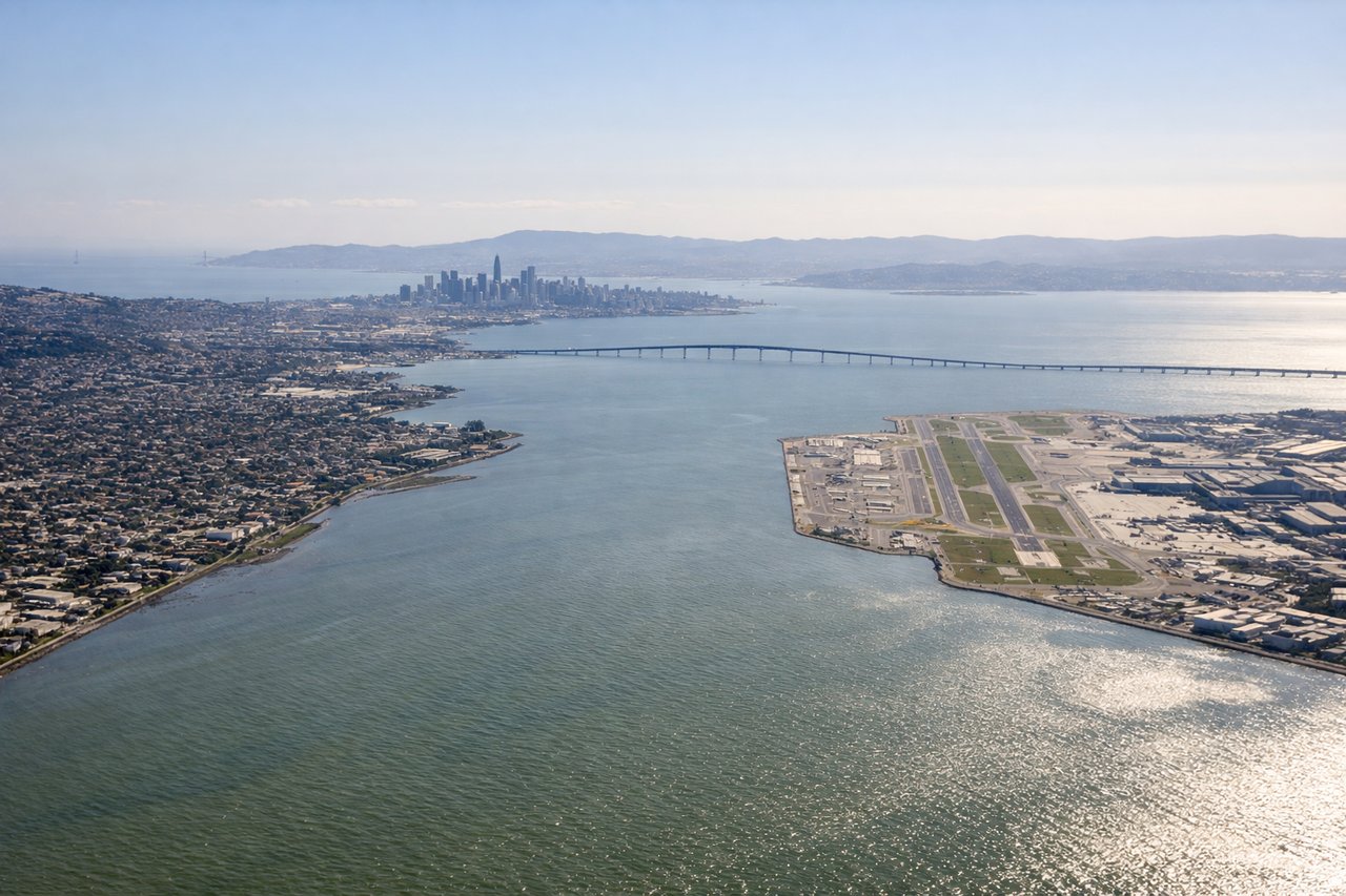
Landing at SFO
LEFTLeft-side seats during descent into SFO provide excellent views of the San Francisco Bay, the Golden Gate Strait, and Marin Headlands. Right side faces inland terrain with less distinctive scenery.
Landmarks on this routeAll landmarks →
Will your flight be in sunlight?
Pick a date and time in the Sun Map to watch the sun move across your whole flight.
About This Route
Which side of the plane should I sit on flying from Davis Monthan Afb (DMA) to San Francisco International (SFO)?
Sit on the Left side of the plane for the best views on flights from Tucson to San Francisco. While takeoff offers good mountain views on the right, the landing approach into SFO on the left provides more dramatic and iconic scenery—the Golden Gate Strait, bay, and coastal geography are visually superior to the inland climb-out.
What can I see during takeoff from Davis Monthan Afb in Tucson?
During takeoff from Davis Monthan Afb (DMA), sit on the Right side for the best views. Right-side seats offer views of the Santa Catalina Mountains immediately north of Tucson during climb-out, plus the broader Sonoran Desert landscape stretching eastward. Left side faces the city and lower terrain. Notable sights include: Santa Catalina Mountains, Sonoran Desert basin, Tucson urban area, Rincon Mountains to the southeast.
What can I see when landing at San Francisco International in San Francisco?
When landing at San Francisco International (SFO), sit on the Left side for the best views. Left-side seats during descent into SFO provide excellent views of the San Francisco Bay, the Golden Gate Strait, and Marin Headlands. Right side faces inland terrain with less distinctive scenery. Notable sights include: San Francisco Bay, Golden Gate Strait, Marin Headlands, San Francisco Peninsula.
How long is the flight from Tucson to San Francisco?
The flight from Davis Monthan Afb (DMA) to San Francisco International (SFO) takes about 2 hours 10 minutes. The shortest flight path between them is 752 miles (1,210 km); winds and air traffic control usually add a few percent.
What does the Tucson to San Francisco flight path pass over?
The flight path northwestward crosses the Sierra Nevada foothills and the Central Valley. Notable features include the Diablo Range to the east of the Bay Area, the Sacramento Valley floor (agricultural patchwork visible from altitude), and the transition from desert/mountain terrain to coastal California geography. The Salton Sea may be visible far to the southeast early in the flight depending on exact routing.