While Dunhuang's desert and mountain departure offers some visual interest, Shenzhen's landing over the Pearl River Delta—one of Asia's most dramatic urban and geographic transformations—provides significantly more scenic variety and landmark density. The delta's complex waterways, massive urban development, and estuary geography create a far more compelling full-flight experience than the relatively monotonous Gobi Desert crossing that dominates the cruise phase.
Flown DNH to SZX? Did we get it right?
Flight Path
Dunhuang to Shenzhen is 1,642 miles (2,642 km), a flight of about 4 hours 15 minutes.
Hexi Corridor (narrow strip between Qilian Mountains and Mazong Mountains), Lanzhou area along Yellow River, Taihang Mountains eastern edge, North China Plain transition zone, Yangtze River tributaries in central China
Great circle distance and headings ›


Phase by phase
Takeoff from DNH
LEFTDunhuang sits at the edge of the Gobi Desert with the Qilian Mountains visible to the south. Left-side departure climbs over desert terrain with distant mountain ridges, offering more visual interest than a right-side departure over flat desert plains.
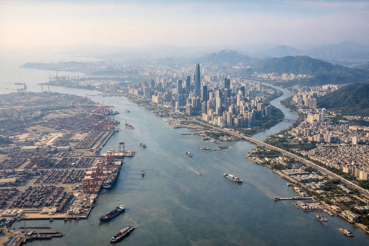
Landing at SZX
RIGHTApproach to Shenzhen from the northwest descends over the Pearl River Delta, one of China's most densely developed regions. Right-side descent offers views of Shenzhen's urban sprawl, the Pearl River estuary, and Hong Kong's New Territories—far more visually dramatic than left-side approach over open water or less developed areas.
Will your flight be in sunlight?
Pick a date and time in the Sun Map to watch the sun move across your whole flight.
About This Route
Which side of the plane should I sit on flying from Dunhuang Mogao International Airport (DNH) to Baoan (SZX)?
Sit on the Right side of the plane for the best views on flights from Dunhuang to Shenzhen. While Dunhuang's desert and mountain departure offers some visual interest, Shenzhen's landing over the Pearl River Delta—one of Asia's most dramatic urban and geographic transformations—provides significantly more scenic variety and landmark density. The delta's complex waterways, massive urban development, and estuary geography create a far more compelling full-flight experience than the relatively monotonous Gobi Desert crossing that dominates the cruise phase.
What can I see during takeoff from Dunhuang Mogao International Airport in Dunhuang?
During takeoff from Dunhuang Mogao International Airport (DNH), sit on the Left side for the best views. Dunhuang sits at the edge of the Gobi Desert with the Qilian Mountains visible to the south. Left-side departure climbs over desert terrain with distant mountain ridges, offering more visual interest than a right-side departure over flat desert plains. Notable sights include: Qilian Mountains (south), Dunhuang oasis settlement, Gobi Desert expanse, Ming Dynasty Great Wall remnants (visible as faint linear features in desert).
What can I see when landing at Baoan in Shenzhen?
When landing at Baoan (SZX), sit on the Right side for the best views. Approach to Shenzhen from the northwest descends over the Pearl River Delta, one of China's most densely developed regions. Right-side descent offers views of Shenzhen's urban sprawl, the Pearl River estuary, and Hong Kong's New Territories—far more visually dramatic than left-side approach over open water or less developed areas. Notable sights include: Pearl River estuary and delta waterways, Shenzhen skyline and urban grid, Hong Kong New Territories (north), Victoria Harbour area (distant).
How long is the flight from Dunhuang to Shenzhen?
The flight from Dunhuang Mogao International Airport (DNH) to Baoan (SZX) takes about 4 hours 15 minutes. The shortest flight path between them is 1,642 miles (2,642 km); winds and air traffic control usually add a few percent.
What does the Dunhuang to Shenzhen flight path pass over?
Hexi Corridor (narrow strip between Qilian Mountains and Mazong Mountains), Lanzhou area along Yellow River, Taihang Mountains eastern edge, North China Plain transition zone, Yangtze River tributaries in central China