Left side scores higher due to superior takeoff scenery from Shenzhen's harbor and Pearl River Delta urban landscape, which outweighs the landing advantage of the right side's Dunhuang oasis and dunes. The takeoff experience over one of China's most dynamic coastal regions provides more consistent visual interest across the full flight profile.
Flown SZX to DNH? Did we get it right?
Flight Path
Shenzhen to Dunhuang is 1,642 miles (2,642 km), a flight of about 4 hours 15 minutes.
Henan plains, Yellow River crossings, Shaanxi loess plateau, transition into Gansu's increasingly arid terrain with sparse settlements, gradual elevation gain toward the Qilian Mountains foothills
Great circle distance and headings ›

Phase by phase
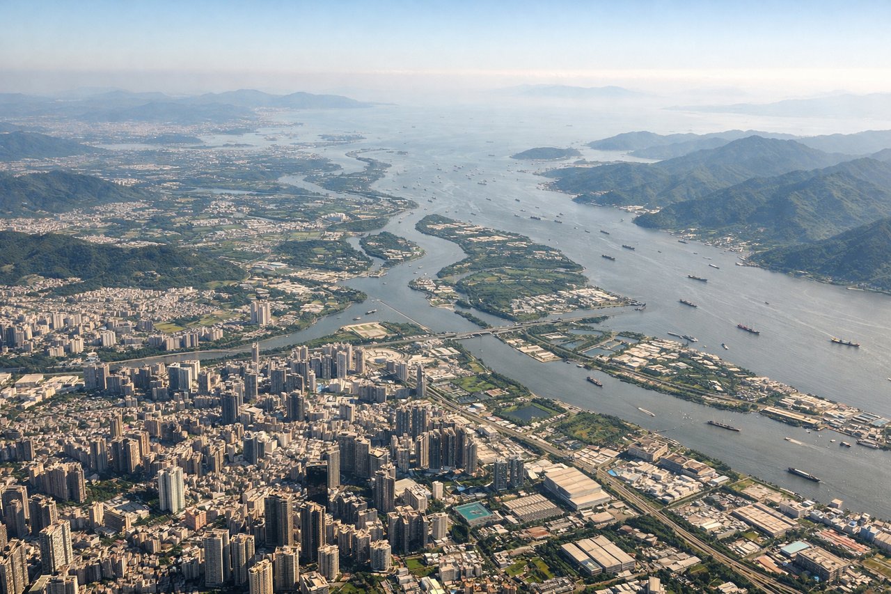
Takeoff from SZX
LEFTLeft side captures Shenzhen's harbor, Victoria Harbour views toward Hong Kong, and the Pearl River Delta's dense urban sprawl during climb-out. Right side faces inland toward Guangdong's flat plains with minimal visual interest during departure.
Landing at DNH
RIGHTRight side offers dramatic approach over the Qilian Mountains and Dunhuang's oasis landscape, with the Mingsha Sand Dunes and Crescent Lake visible during descent. Left side faces open desert plateau with minimal variation.
Will your flight be in sunlight?
Pick a date and time in the Sun Map to watch the sun move across your whole flight.
About This Route
Which side of the plane should I sit on flying from Baoan (SZX) to Dunhuang Mogao International Airport (DNH)?
Sit on the Left side of the plane for the best views on flights from Shenzhen to Dunhuang. Left side scores higher due to superior takeoff scenery from Shenzhen's harbor and Pearl River Delta urban landscape, which outweighs the landing advantage of the right side's Dunhuang oasis and dunes. The takeoff experience over one of China's most dynamic coastal regions provides more consistent visual interest across the full flight profile.
What can I see during takeoff from Baoan in Shenzhen?
During takeoff from Baoan (SZX), sit on the Left side for the best views. Left side captures Shenzhen's harbor, Victoria Harbour views toward Hong Kong, and the Pearl River Delta's dense urban sprawl during climb-out. Right side faces inland toward Guangdong's flat plains with minimal visual interest during departure. Notable sights include: Shenzhen Bay, Victoria Harbour (Hong Kong), Pearl River Delta urban grid, Lantau Island.
What can I see when landing at Dunhuang Mogao International Airport in Dunhuang?
When landing at Dunhuang Mogao International Airport (DNH), sit on the Right side for the best views. Right side offers dramatic approach over the Qilian Mountains and Dunhuang's oasis landscape, with the Mingsha Sand Dunes and Crescent Lake visible during descent. Left side faces open desert plateau with minimal variation. Notable sights include: Qilian Mountains, Dunhuang oasis, Mingsha Sand Dunes, Crescent Lake.
How long is the flight from Shenzhen to Dunhuang?
The flight from Baoan (SZX) to Dunhuang Mogao International Airport (DNH) takes about 4 hours 15 minutes. The shortest flight path between them is 1,642 miles (2,642 km); winds and air traffic control usually add a few percent.
What does the Shenzhen to Dunhuang flight path pass over?
Henan plains, Yellow River crossings, Shaanxi loess plateau, transition into Gansu's increasingly arid terrain with sparse settlements, gradual elevation gain toward the Qilian Mountains foothills