Left side delivers the best views at both ends of the flight — the Gulf coastline on departure and the spectacular river confluence geography of Chongqing on arrival. The mid-flight section over the Tibetan Plateau's eastern edge also favors the left with views toward high terrain.
Flown DOH to CKG? Did we get it right?
Flight Path
Doha to Chongqing is 3,356 miles (5,402 km), a flight of about 7 hours.
The route crosses southern Iran and the Zagros Mountains, then transits Pakistan and northern India before crossing into western China over the Tibetan Plateau's eastern margins near Sichuan. The Hindu Kush and Karakoram ranges may be visible in the distance depending on exact routing. The descent into Chongqing crosses the Qinling-Daba mountain system before dropping into the Sichuan Basin.
Great circle distance and headings ›


Phase by phase
Takeoff from DOH
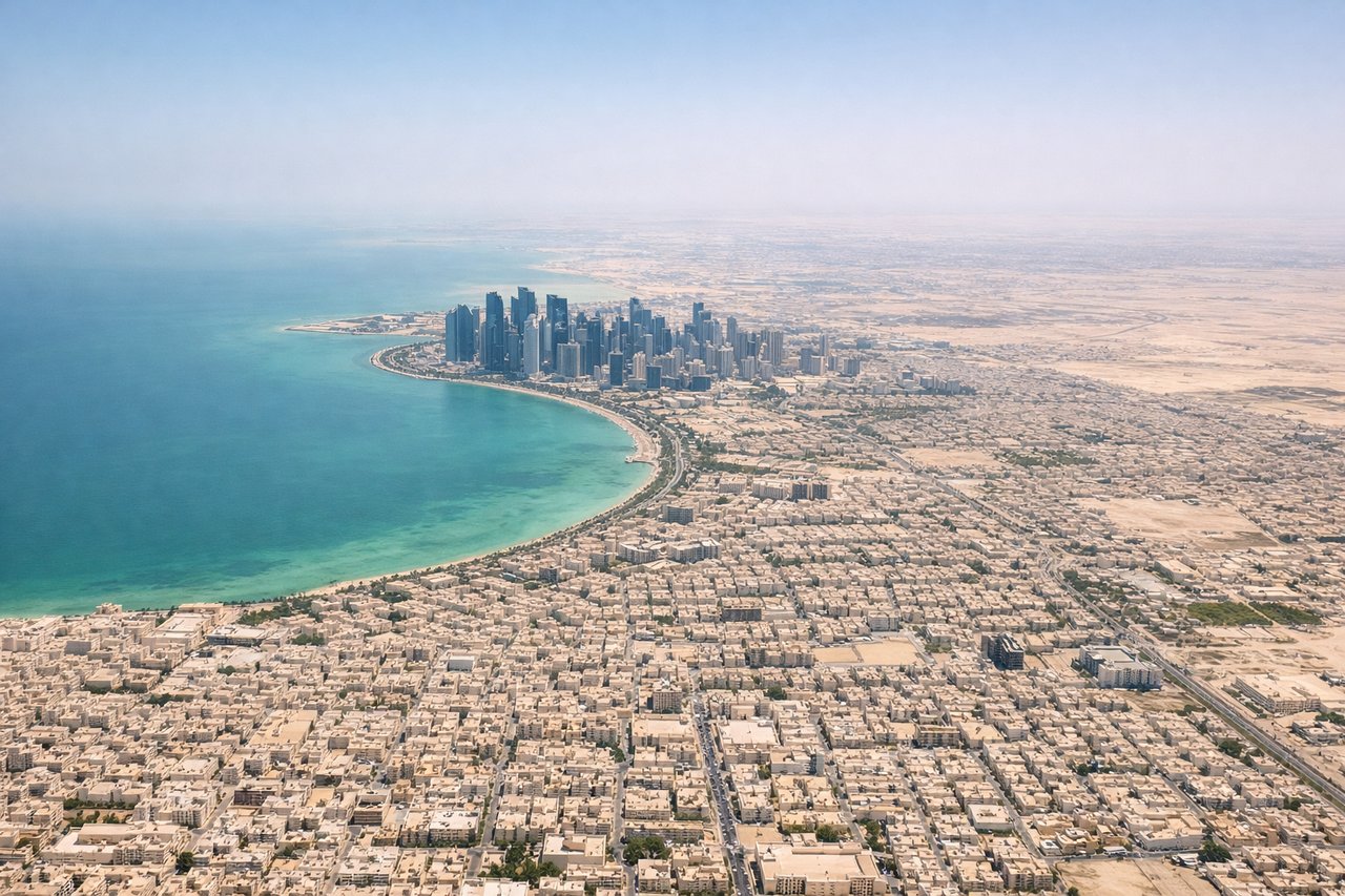
LEFTDoha's main runways (16/34 orientation) mean a northbound departure takes you over the Qatar peninsula with the city skyline and West Bay district visible to the left. The shallow turquoise waters of the Persian Gulf spread out on the left side as you climb out heading northeast.
Landing at CKG
LEFTJiangbei Airport sits north of central Chongqing, and approaches from the west or northwest on runway 02/20 bring the dramatic confluence of the Yangtze and Jialing rivers into view on the left side. The densely built Yuzhong Peninsula, where the two rivers meet, is one of the most visually striking urban geography features in China.
Will your flight be in sunlight?
Pick a date and time in the Sun Map to watch the sun move across your whole flight.
About This Route
Which side of the plane should I sit on flying from Hamad International Airport (DOH) to Jiangbei (CKG)?
Sit on the Left side of the plane for the best views on flights from Doha to Chongqing. Left side delivers the best views at both ends of the flight — the Gulf coastline on departure and the spectacular river confluence geography of Chongqing on arrival. The mid-flight section over the Tibetan Plateau's eastern edge also favors the left with views toward high terrain.
What can I see during takeoff from Hamad International Airport in Doha?
During takeoff from Hamad International Airport (DOH), sit on the Left side for the best views. Doha's main runways (16/34 orientation) mean a northbound departure takes you over the Qatar peninsula with the city skyline and West Bay district visible to the left. The shallow turquoise waters of the Persian Gulf spread out on the left side as you climb out heading northeast. Notable sights include: Doha West Bay skyline, Qatar peninsula coastline, Persian Gulf shallow turquoise shallows, Palm Tree Island area.
What can I see when landing at Jiangbei in Chongqing?
When landing at Jiangbei (CKG), sit on the Left side for the best views. Jiangbei Airport sits north of central Chongqing, and approaches from the west or northwest on runway 02/20 bring the dramatic confluence of the Yangtze and Jialing rivers into view on the left side. The densely built Yuzhong Peninsula, where the two rivers meet, is one of the most visually striking urban geography features in China. Notable sights include: Yangtze and Jialing River confluence, Yuzhong Peninsula, Chongqing's terraced hillside urban density, Jialing River gorge approach.
How long is the flight from Doha to Chongqing?
The flight from Hamad International Airport (DOH) to Jiangbei (CKG) takes about 7 hours. The shortest flight path between them is 3,356 miles (5,402 km); winds and air traffic control usually add a few percent.
What does the Doha to Chongqing flight path pass over?
The route crosses southern Iran and the Zagros Mountains, then transits Pakistan and northern India before crossing into western China over the Tibetan Plateau's eastern margins near Sichuan. The Hindu Kush and Karakoram ranges may be visible in the distance depending on exact routing. The descent into Chongqing crosses the Qinling-Daba mountain system before dropping into the Sichuan Basin.