While the Doha departure offers coastal interest, the Sapporo approach scores higher due to Hokkaido's dramatic transition from forested mountains to agricultural plains and the visible Chitose River valley. The landing sequence provides more terrain variety and recognizable landmarks than the relatively flat Persian Gulf departure. The overall flight crosses monotonous open ocean for most of the cruise, limiting both sides, but the right side's approach scenery is notably more compelling.
Flown DOH to CTS? Did we get it right?
Flight Path
Doha to Sapporo is 5,058 miles (8,140 km), a flight of about 9 hours 55 minutes.
The flight path crosses the Persian Gulf, then over Iran's Alborz Mountains (visible as a distant ridge from cruise altitude), continues across the Caspian Sea region, over the Caucasus Mountains, across southern Russia and Kazakhstan's steppes, then over the Altai Mountains and Mongolia's high plateaus before descending into Hokkaido. Most of the cruise occurs over open water and featureless steppe with minimal scenic variation on either side.
Great circle distance and headings ›


Phase by phase
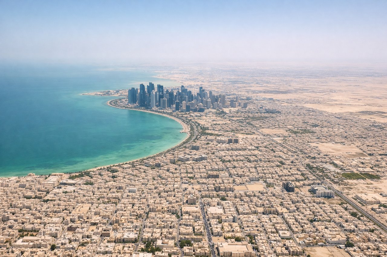
Takeoff from DOH
LEFTDoha's coastal departure offers views of the Persian Gulf shoreline and Qatar's urban sprawl. The left side captures the shallow turquoise waters and industrial port facilities along the coast before climbing over open water.
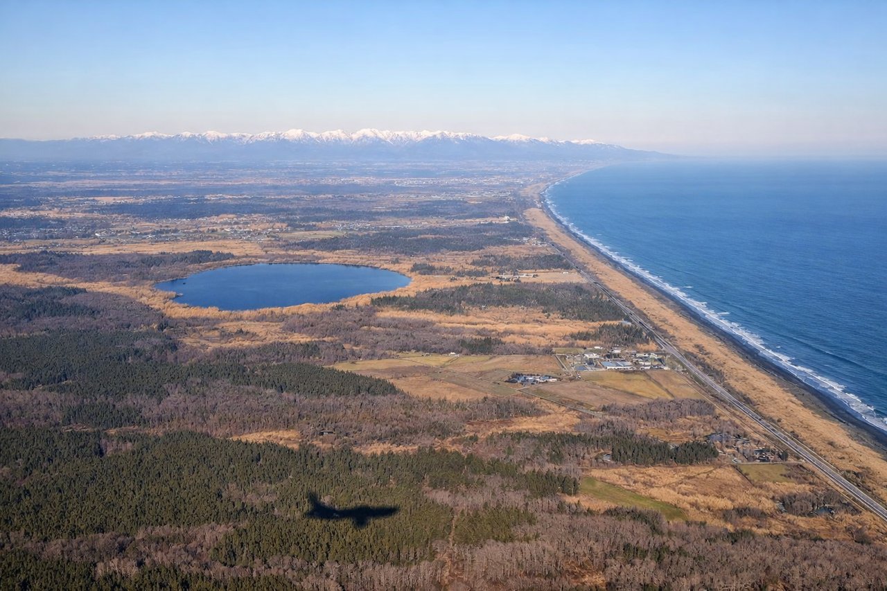
Landing at CTS
RIGHTThe approach to Sapporo from the southwest crosses Hokkaido's mountainous terrain and forested landscape. The right side captures the Ishikari Plain's agricultural patchwork and the transition from mountains to the coastal lowlands where Chitose Airport sits.
Will your flight be in sunlight?
Pick a date and time in the Sun Map to watch the sun move across your whole flight.
About This Route
Which side of the plane should I sit on flying from Hamad International Airport (DOH) to Chitose International Airport (CTS)?
Sit on the Right side of the plane for the best views on flights from Doha to Sapporo. While the Doha departure offers coastal interest, the Sapporo approach scores higher due to Hokkaido's dramatic transition from forested mountains to agricultural plains and the visible Chitose River valley. The landing sequence provides more terrain variety and recognizable landmarks than the relatively flat Persian Gulf departure. The overall flight crosses monotonous open ocean for most of the cruise, limiting both sides, but the right side's approach scenery is notably more compelling.
What can I see during takeoff from Hamad International Airport in Doha?
During takeoff from Hamad International Airport (DOH), sit on the Left side for the best views. Doha's coastal departure offers views of the Persian Gulf shoreline and Qatar's urban sprawl. The left side captures the shallow turquoise waters and industrial port facilities along the coast before climbing over open water. Notable sights include: Persian Gulf coastline, Doha harbor and port infrastructure, Qatar's flat desert interior, industrial zones south of the airport.
What can I see when landing at Chitose International Airport in Sapporo?
When landing at Chitose International Airport (CTS), sit on the Right side for the best views. The approach to Sapporo from the southwest crosses Hokkaido's mountainous terrain and forested landscape. The right side captures the Ishikari Plain's agricultural patchwork and the transition from mountains to the coastal lowlands where Chitose Airport sits. Notable sights include: Ishikari Plain agricultural fields, forested foothills of central Hokkaido, Chitose River valley, Sapporo urban area in the distance.
How long is the flight from Doha to Sapporo?
The flight from Hamad International Airport (DOH) to Chitose International Airport (CTS) takes about 9 hours 55 minutes. The shortest flight path between them is 5,058 miles (8,140 km); winds and air traffic control usually add a few percent.
What does the Doha to Sapporo flight path pass over?
The flight path crosses the Persian Gulf, then over Iran's Alborz Mountains (visible as a distant ridge from cruise altitude), continues across the Caspian Sea region, over the Caucasus Mountains, across southern Russia and Kazakhstan's steppes, then over the Altai Mountains and Mongolia's high plateaus before descending into Hokkaido. Most of the cruise occurs over open water and featureless steppe with minimal scenic variation on either side.