Doha to Dhaka is 2,431 miles (3,913 km), a flight of about 4 hours 15 minutes.
Left wins at takeoff for Doha's skyline and gulf views, but right side delivers the more sustained and visually interesting experience: over the Indian subcontinent the right side tracks the southern edge of the flight path, offering views of the Indus plains, and then the spectacular Ganges-Brahmaputra delta approach into Dhaka is best from the right. The delta landing view alone is worth it.
Flight Path
The route crosses the Arabian Sea coast near Karachi, then tracks over the flat Indus River plains of Sindh and Punjab in Pakistan, crossing into India over Rajasthan's arid terrain. The flight then passes over the Gangetic Plain — one of the most densely populated and agriculturally intense landscapes on Earth — before descending into the Ganges-Brahmaputra delta of Bangladesh, a vast flat floodplain laced with river channels and standing water visible from altitude.
Great circle distance and headings ›
_and_the_Dubai_skyline_(25781049892).jpg?width=600)


Phase by phase
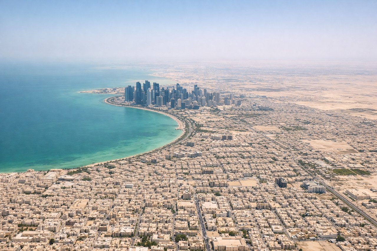
Takeoff from DOH
LEFTDoha's main departure runway 34L sends aircraft northward over the city and then out over the Persian Gulf. The left side faces west toward central Doha's skyline, the West Bay skyscraper district, and the shallow turquoise waters of the inner gulf. Right side gets open water with little of interest.
Landing at DAC
RIGHTZia International's primary approach is from the west on runway 14, meaning aircraft track southeast over the Buriganga and Turag rivers and the dense urban fabric of Dhaka. The right side faces southwest toward the river systems, Old Dhaka, and the broad flat floodplain of the Ganges-Brahmaputra delta. Left side faces northeast over less distinctive suburban sprawl.
Landmarks on this routeAll landmarks →
Will your flight be in sunlight?
Pick a date and time in the Sun Map to watch the sun move across your whole flight.
About This Route
Which side of the plane should I sit on flying from Hamad International Airport (DOH) to Hazrat Shahjalal International Airport (DAC)?
Sit on the Right side of the plane for the best views on flights from Doha to Dhaka. Left wins at takeoff for Doha's skyline and gulf views, but right side delivers the more sustained and visually interesting experience: over the Indian subcontinent the right side tracks the southern edge of the flight path, offering views of the Indus plains, and then the spectacular Ganges-Brahmaputra delta approach into Dhaka is best from the right. The delta landing view alone is worth it.
What can I see during takeoff from Hamad International Airport in Doha?
During takeoff from Hamad International Airport (DOH), sit on the Left side for the best views. Doha's main departure runway 34L sends aircraft northward over the city and then out over the Persian Gulf. The left side faces west toward central Doha's skyline, the West Bay skyscraper district, and the shallow turquoise waters of the inner gulf. Right side gets open water with little of interest. Notable sights include: West Bay skyscraper cluster, Doha Corniche waterfront arc, Pearl-Qatar artificial island, shallow turquoise Persian Gulf shallows.
What can I see when landing at Hazrat Shahjalal International Airport in Dhaka?
When landing at Hazrat Shahjalal International Airport (DAC), sit on the Right side for the best views. Zia International's primary approach is from the west on runway 14, meaning aircraft track southeast over the Buriganga and Turag rivers and the dense urban fabric of Dhaka. The right side faces southwest toward the river systems, Old Dhaka, and the broad flat floodplain of the Ganges-Brahmaputra delta. Left side faces northeast over less distinctive suburban sprawl. Notable sights include: Buriganga River snaking through Old Dhaka, Turag River confluence, Dhaka's dense urban grid, Ganges-Brahmaputra delta floodplain patchwork.
How long is the flight from Doha to Dhaka?
The flight from Hamad International Airport (DOH) to Hazrat Shahjalal International Airport (DAC) takes about 4 hours 15 minutes. The shortest flight path between them is 2,431 miles (3,913 km); winds and air traffic control usually add a few percent.
What does the Doha to Dhaka flight path pass over?
The route crosses the Arabian Sea coast near Karachi, then tracks over the flat Indus River plains of Sindh and Punjab in Pakistan, crossing into India over Rajasthan's arid terrain. The flight then passes over the Gangetic Plain — one of the most densely populated and agriculturally intense landscapes on Earth — before descending into the Ganges-Brahmaputra delta of Bangladesh, a vast flat floodplain laced with river channels and standing water visible from altitude.