The right side captures the spectacular San Diego Bay arrival sequence with the Coronado Bridge and downtown skyline, which is one of the more visually rewarding urban approaches in the US. The takeoff left-side advantage in Doha is real but shorter-lived, and the long overwater Pacific crossing offers little differentiation between sides.
Flown DOH to NZY? Did we get it right?
Flight Path
Doha to San Diego is 8,364 miles (13,461 km), a flight of about 15 hours 55 minutes.
Departure over the Arabian Gulf and Persian Gulf shallow waters, crossing the Gulf of Oman and the Arabian Sea, long transit over the Indian subcontinent or routing north of it depending on winds, crossing the Bay of Bengal, Southeast Asian coastlines, then the vast North Pacific Ocean with the Aleutian Island chain visible as distant specks on northern routing, before the California coast appears near Point Conception or Monterey
Great circle distance and headings ›


Phase by phase
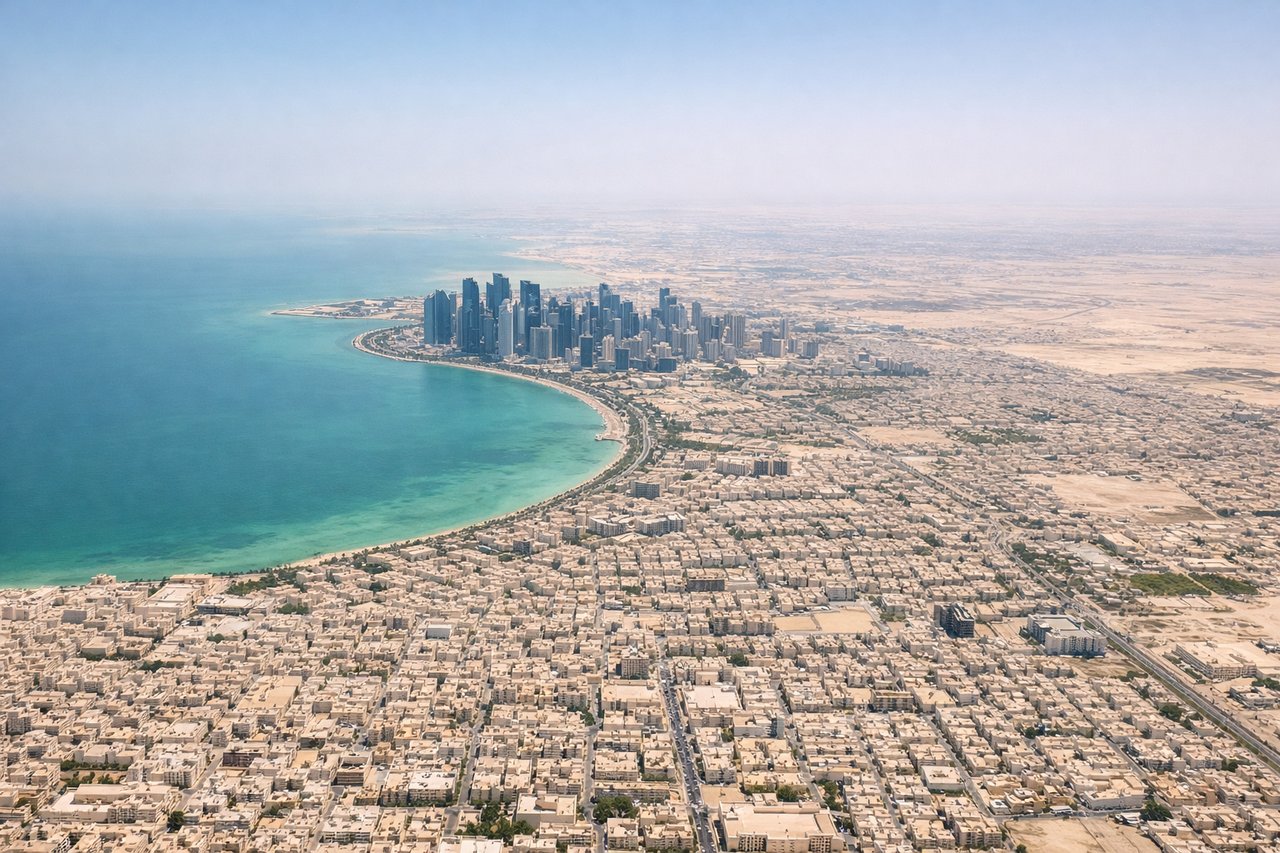
Takeoff from DOH
LEFTDoha's main runways (16/34 orientation) mean a northbound departure swings left over the city center and the West Bay skyline, with the dense cluster of towers clearly visible. A southbound departure on runway 34 gives the left side views over the older city districts and the southern Doha waterfront along the Arabian Gulf.
Landing at NZY
RIGHTNZY is on North Island in San Diego Bay, and approaches typically come in from the northwest or west over the Pacific. A right-side seat gives you the view over San Diego Bay, downtown San Diego, and the Coronado Bridge on final approach. The left side faces inland toward the suburban sprawl of Mission Valley.
Will your flight be in sunlight?
Pick a date and time in the Sun Map to watch the sun move across your whole flight.
About This Route
Which side of the plane should I sit on flying from Hamad International Airport (DOH) to North Island Nas (NZY)?
Sit on the Right side of the plane for the best views on flights from Doha to San Diego. The right side captures the spectacular San Diego Bay arrival sequence with the Coronado Bridge and downtown skyline, which is one of the more visually rewarding urban approaches in the US. The takeoff left-side advantage in Doha is real but shorter-lived, and the long overwater Pacific crossing offers little differentiation between sides.
What can I see during takeoff from Hamad International Airport in Doha?
During takeoff from Hamad International Airport (DOH), sit on the Left side for the best views. Doha's main runways (16/34 orientation) mean a northbound departure swings left over the city center and the West Bay skyline, with the dense cluster of towers clearly visible. A southbound departure on runway 34 gives the left side views over the older city districts and the southern Doha waterfront along the Arabian Gulf. Notable sights include: West Bay skyscraper cluster, Doha Corniche waterfront arc, Pearl-Qatar artificial island, shallow turquoise waters of the inner Gulf.
What can I see when landing at North Island Nas in San Diego?
When landing at North Island Nas (NZY), sit on the Right side for the best views. NZY is on North Island in San Diego Bay, and approaches typically come in from the northwest or west over the Pacific. A right-side seat gives you the view over San Diego Bay, downtown San Diego, and the Coronado Bridge on final approach. The left side faces inland toward the suburban sprawl of Mission Valley. Notable sights include: San Diego Bay, Coronado Bridge, downtown San Diego skyline, Point Loma peninsula.
How long is the flight from Doha to San Diego?
The flight from Hamad International Airport (DOH) to North Island Nas (NZY) takes about 15 hours 55 minutes. The shortest flight path between them is 8,364 miles (13,461 km); winds and air traffic control usually add a few percent.
What does the Doha to San Diego flight path pass over?
Departure over the Arabian Gulf and Persian Gulf shallow waters, crossing the Gulf of Oman and the Arabian Sea, long transit over the Indian subcontinent or routing north of it depending on winds, crossing the Bay of Bengal, Southeast Asian coastlines, then the vast North Pacific Ocean with the Aleutian Island chain visible as distant specks on northern routing, before the California coast appears near Point Conception or Monterey