Doha to Phnom Penh is 3,593 miles (5,782 km), a flight of about 6 hours 30 minutes.
The left side captures the dramatic Doha skyline and Persian Gulf on departure, and through the cruise phase offers views of the Indian subcontinent coastline including parts of the Bay of Bengal approach. The right side wins at landing but the departure spectacle on the left is the highlight of the route.
Flight Path
The route tracks east-northeast across the Arabian Sea, crossing the Indian subcontinent over Gujarat and central India, passing south of the Himalayas, then crossing the Bay of Bengal before descending over the Gulf of Thailand and into Cambodia. Notable features include the Ganges-Brahmaputra delta visible on the left, the Bay of Bengal below, and the flat Irrawaddy delta of Myanmar before the Cambodian floodplain.
Great circle distance and headings ›
.jpg?width=600)
_and_the_Dubai_skyline_(25781049892).jpg?width=600)
.jpg?width=600)
Phase by phase
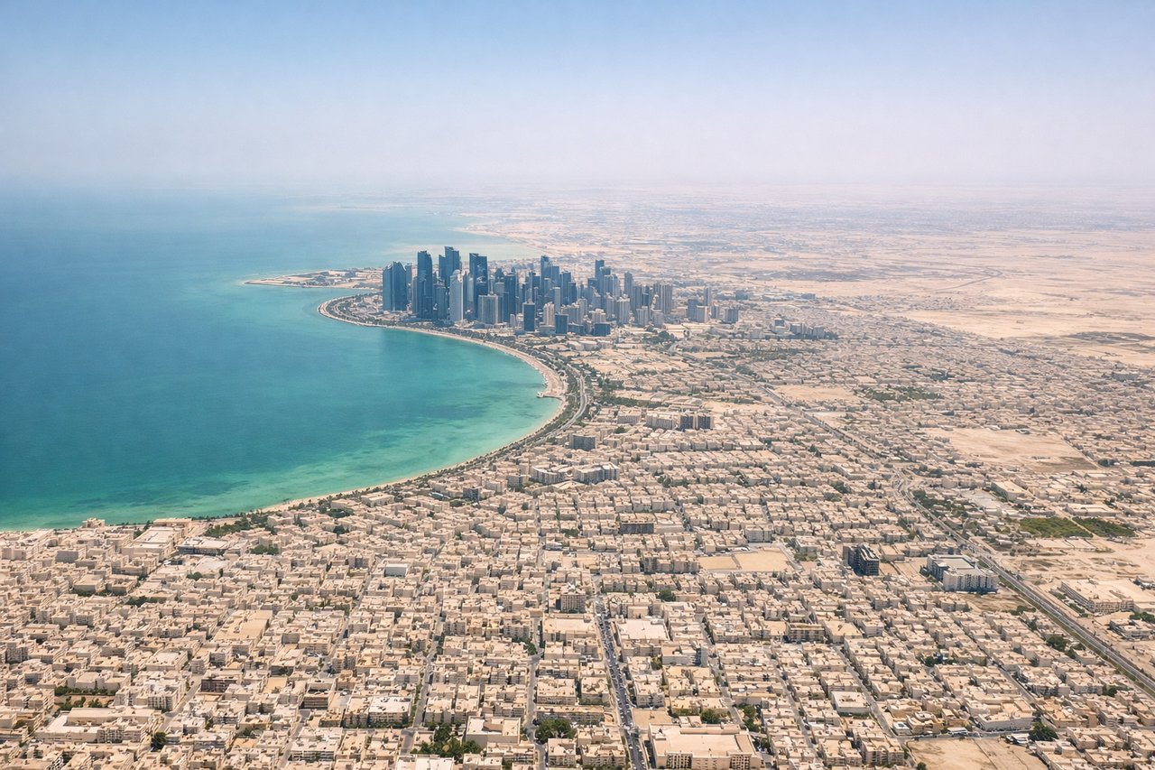
Takeoff from DOH
LEFTDoha's main runways (16L/34R and 16R/34L) mean departures heading southeast toward the Gulf put the city of Doha and its distinctive skyline on the left side. The West Bay skyscraper cluster and the Qatar National Convention Centre are clearly visible, along with the shallow turquoise waters of the Persian Gulf.
Landing at PNH
RIGHTPochentong Airport's primary runway is oriented roughly east-west (05/23). Approaches from the west on runway 05 bring aircraft over the Tonle Sap and Mekong river confluence on the right side, with Phnom Penh city center and the Royal Palace visible on the right bank of the Mekong. This is the more visually rewarding side.
Landmarks on this routeAll landmarks →
Will your flight be in sunlight?
Pick a date and time in the Sun Map to watch the sun move across your whole flight.
About This Route
Which side of the plane should I sit on flying from Hamad International Airport (DOH) to Pochentong International (PNH)?
Sit on the Left side of the plane for the best views on flights from Doha to Phnom Penh. The left side captures the dramatic Doha skyline and Persian Gulf on departure, and through the cruise phase offers views of the Indian subcontinent coastline including parts of the Bay of Bengal approach. The right side wins at landing but the departure spectacle on the left is the highlight of the route.
What can I see during takeoff from Hamad International Airport in Doha?
During takeoff from Hamad International Airport (DOH), sit on the Left side for the best views. Doha's main runways (16L/34R and 16R/34L) mean departures heading southeast toward the Gulf put the city of Doha and its distinctive skyline on the left side. The West Bay skyscraper cluster and the Qatar National Convention Centre are clearly visible, along with the shallow turquoise waters of the Persian Gulf. Notable sights include: West Bay skyline of Doha, Pearl-Qatar artificial island, shallow Persian Gulf waters, Doha Corniche waterfront arc.
What can I see when landing at Pochentong International in Phnom Penh?
When landing at Pochentong International (PNH), sit on the Right side for the best views. Pochentong Airport's primary runway is oriented roughly east-west (05/23). Approaches from the west on runway 05 bring aircraft over the Tonle Sap and Mekong river confluence on the right side, with Phnom Penh city center and the Royal Palace visible on the right bank of the Mekong. This is the more visually rewarding side. Notable sights include: Mekong and Tonle Sap river confluence (Chaktomuk), Phnom Penh city center and Royal Palace, Bassac River splitting south, flat Cambodian floodplain patchwork of rice paddies.
How long is the flight from Doha to Phnom Penh?
The flight from Hamad International Airport (DOH) to Pochentong International (PNH) takes about 6 hours 30 minutes. The shortest flight path between them is 3,593 miles (5,782 km); winds and air traffic control usually add a few percent.
What does the Doha to Phnom Penh flight path pass over?
The route tracks east-northeast across the Arabian Sea, crossing the Indian subcontinent over Gujarat and central India, passing south of the Himalayas, then crossing the Bay of Bengal before descending over the Gulf of Thailand and into Cambodia. Notable features include the Ganges-Brahmaputra delta visible on the left, the Bay of Bengal below, and the flat Irrawaddy delta of Myanmar before the Cambodian floodplain.