The left side wins for both bookend city views (Doha's skyline at takeoff, Ho Chi Minh City's skyline at landing) and for facing the more varied terrain during cruise — the Zagros foothills of Iran and the Ganges plain — compared to the largely featureless ocean and desert visible on the right.
Flown DOH to SGN? Did we get it right?
Flight Path
Doha to Ho Chi Minh City is 3,725 miles (5,995 km), a flight of about 6 hours 40 minutes.
The route crosses southern Iran, the Arabian Sea near Pakistan's coast, central India, the Bay of Bengal, and southern Myanmar before entering Thailand and Cambodia en route to Vietnam.
Great circle distance and headings ›


Phase by phase
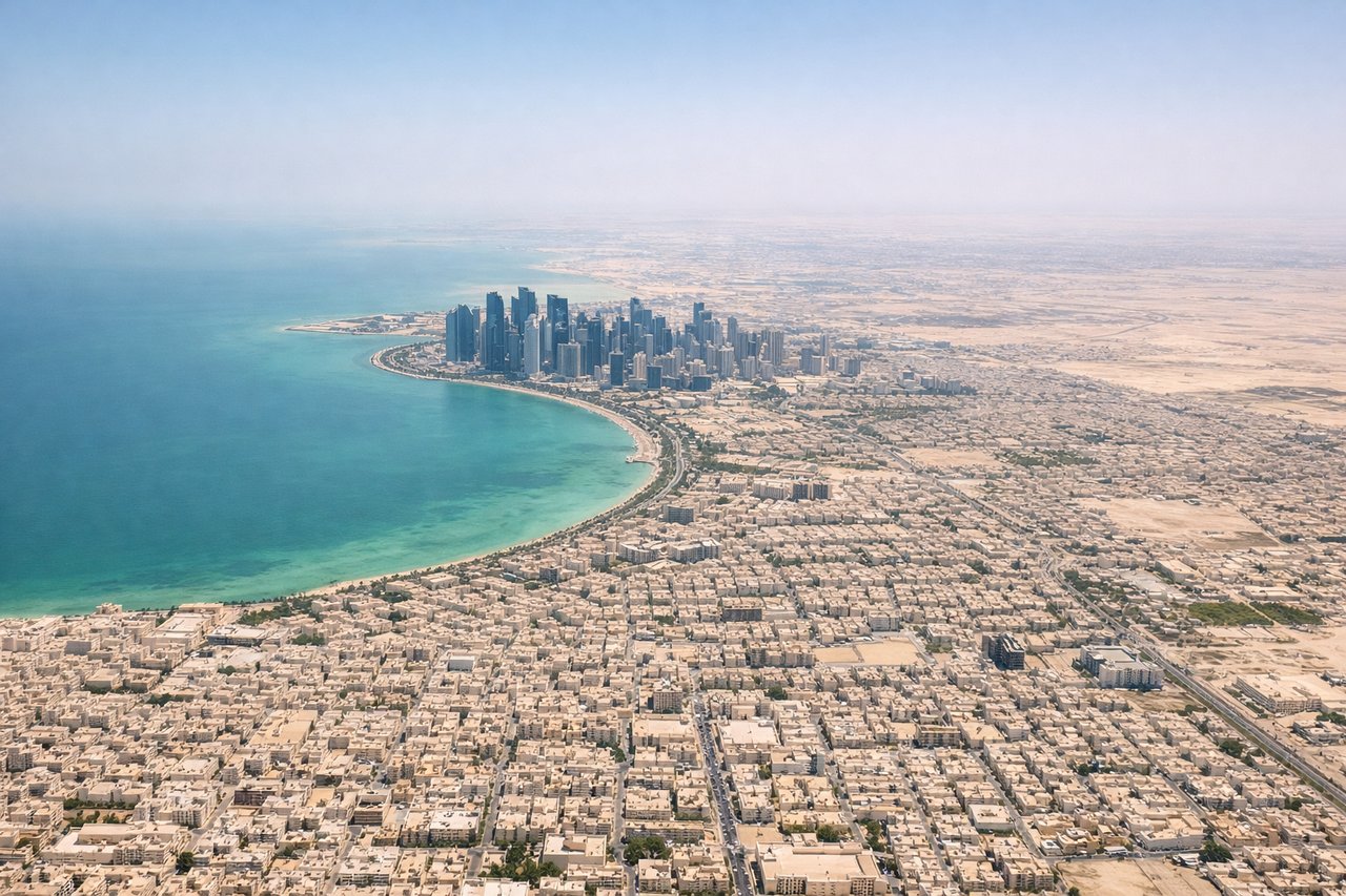
Takeoff from DOH
LEFTDeparting DOH to the southeast, the aircraft's climb-out and initial turn put Doha's West Bay skyline and the Corniche on the northern (left) side, followed by views of the Persian Gulf coastline as the jet turns east toward Iran. The right side only shows featureless desert.

Landing at SGN
LEFTOn approach to SGN during the northeast monsoon season (runway 07), the final approach track passes north of the city, giving left-side passengers a good look at Ho Chi Minh City's dense downtown skyline and the winding Saigon River before touchdown. The right side mostly shows flat, repetitive Mekong Delta rice paddies.
Will your flight be in sunlight?
Pick a date and time in the Sun Map to watch the sun move across your whole flight.
About This Route
Which side of the plane should I sit on flying from Hamad International Airport (DOH) to Tansonnhat International (SGN)?
Sit on the Left side of the plane for the best views on flights from Doha to Ho Chi Minh City. The left side wins for both bookend city views (Doha's skyline at takeoff, Ho Chi Minh City's skyline at landing) and for facing the more varied terrain during cruise — the Zagros foothills of Iran and the Ganges plain — compared to the largely featureless ocean and desert visible on the right.
What can I see during takeoff from Hamad International Airport in Doha?
During takeoff from Hamad International Airport (DOH), sit on the Left side for the best views. Departing DOH to the southeast, the aircraft's climb-out and initial turn put Doha's West Bay skyline and the Corniche on the northern (left) side, followed by views of the Persian Gulf coastline as the jet turns east toward Iran. The right side only shows featureless desert. Notable sights include: Doha West Bay skyline, The Pearl-Qatar, Persian Gulf coastline, Qatari desert interior.
What can I see when landing at Tansonnhat International in Ho Chi Minh City?
When landing at Tansonnhat International (SGN), sit on the Left side for the best views. On approach to SGN during the northeast monsoon season (runway 07), the final approach track passes north of the city, giving left-side passengers a good look at Ho Chi Minh City's dense downtown skyline and the winding Saigon River before touchdown. The right side mostly shows flat, repetitive Mekong Delta rice paddies. Notable sights include: Saigon River, Ho Chi Minh City downtown skyline, Bitexco Financial Tower, Mekong Delta rice paddies.
How long is the flight from Doha to Ho Chi Minh City?
The flight from Hamad International Airport (DOH) to Tansonnhat International (SGN) takes about 6 hours 40 minutes. The shortest flight path between them is 3,725 miles (5,995 km); winds and air traffic control usually add a few percent.
What does the Doha to Ho Chi Minh City flight path pass over?
The route crosses southern Iran, the Arabian Sea near Pakistan's coast, central India, the Bay of Bengal, and southern Myanmar before entering Thailand and Cambodia en route to Vietnam.