Doha to Tashkent is 1,498 miles (2,411 km), a flight of about 3 hours 15 minutes.
While left offers good takeoff views of the Persian Gulf, right dominates the flight with the dramatic Tian Shan Mountains visible for much of the northbound cruise and descent. The mountain scenery is more visually striking than the gulf and desert.
Flight Path
Karakum Desert (central Turkmenistan), Amu Darya River (Afghanistan-Uzbekistan border visible from altitude), Ustyurt Plateau, Aral Sea region (diminished but still visible as salt flats and water remnants), Kyzylkum Desert, Zeravshan River valley, foothills of the Tian Shan range
Great circle distance and headings ›


Phase by phase
Takeoff from DOH
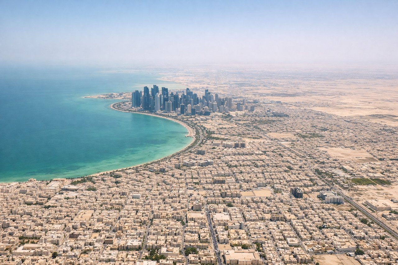
LEFTLeft side captures the Persian Gulf coastline and the initial northwestward climb path. You'll see Doha's waterfront receding, the shallow gulf waters, and the Qatar peninsula's eastern edge as the aircraft banks north toward Uzbekistan.
Landing at TAS
RIGHTRight side offers the best views during the southeastward descent into Tashkent. You'll see the Tian Shan mountain range's northern foothills rising dramatically, the Chirchik River valley, and the urban sprawl of Tashkent itself as you approach from the northwest.
Landmarks on this routeAll landmarks →
Will your flight be in sunlight?
Pick a date and time in the Sun Map to watch the sun move across your whole flight.
About This Route
Which side of the plane should I sit on flying from Hamad International Airport (DOH) to Tashkent International Airport (TAS)?
Sit on the Right side of the plane for the best views on flights from Doha to Tashkent. While left offers good takeoff views of the Persian Gulf, right dominates the flight with the dramatic Tian Shan Mountains visible for much of the northbound cruise and descent. The mountain scenery is more visually striking than the gulf and desert.
What can I see during takeoff from Hamad International Airport in Doha?
During takeoff from Hamad International Airport (DOH), sit on the Left side for the best views. Left side captures the Persian Gulf coastline and the initial northwestward climb path. You'll see Doha's waterfront receding, the shallow gulf waters, and the Qatar peninsula's eastern edge as the aircraft banks north toward Uzbekistan. Notable sights include: Persian Gulf (shallow turquoise waters), Doha city grid and harbor, Qatar's northeastern coastline, Al Wakrah town to the south.
What can I see when landing at Tashkent International Airport in Tashkent?
When landing at Tashkent International Airport (TAS), sit on the Right side for the best views. Right side offers the best views during the southeastward descent into Tashkent. You'll see the Tian Shan mountain range's northern foothills rising dramatically, the Chirchik River valley, and the urban sprawl of Tashkent itself as you approach from the northwest. Notable sights include: Tian Shan Mountains (western foothills), Chirchik River valley, Tashkent city sprawl, Yuzhny airport and surrounding steppe.
How long is the flight from Doha to Tashkent?
The flight from Hamad International Airport (DOH) to Tashkent International Airport (TAS) takes about 3 hours 15 minutes. The shortest flight path between them is 1,498 miles (2,411 km); winds and air traffic control usually add a few percent.
What does the Doha to Tashkent flight path pass over?
Karakum Desert (central Turkmenistan), Amu Darya River (Afghanistan-Uzbekistan border visible from altitude), Ustyurt Plateau, Aral Sea region (diminished but still visible as salt flats and water remnants), Kyzylkum Desert, Zeravshan River valley, foothills of the Tian Shan range