Dominica to Toronto is 2,222 miles (3,576 km), a flight of about 4 hours 45 minutes.
While takeoff offers Dominica's dramatic volcanic scenery on the right, the landing approach into Toronto provides more extensive and visually striking views of Lake Ontario and the city skyline on the left. The landing experience is more rewarding for most passengers.
Flight Path
The flight path crosses the Atlantic Ocean northwestward, passing east of the Bahamas and over the southeastern United States. Notable features include the Turks and Caicos Islands (visible early in flight), the Bahama Banks (shallow turquoise waters), the Florida peninsula and coastline, and the Appalachian Mountains as you approach the Great Lakes region. The flight primarily follows ocean and coastal routes with limited overland visibility in the mid-Atlantic portion.
Great circle distance and headings ›.jpeg?width=600)

Phase by phase
Takeoff from DOM
RIGHTRight side offers immediate views of Dominica's volcanic terrain and the Caribbean coastline as you climb out northwestward from Melville Hall. You'll see the island's interior ridges and the Atlantic coast dropping away beneath you.
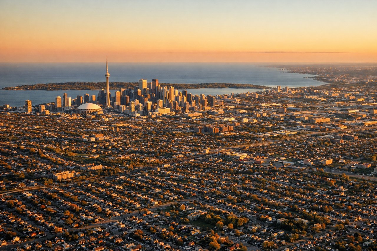
Landing at YYZ
LEFTLeft side provides excellent views during the descent into Toronto as you approach from the southeast. You'll see Lake Ontario, the Greater Toronto Area sprawl, and the city's downtown core along the lakeshore before touchdown at Pearson.
Landmarks on this routeAll landmarks →
Will your flight be in sunlight?
Pick a date and time in the Sun Map to watch the sun move across your whole flight.
About This Route
Which side of the plane should I sit on flying from Melville Hall (DOM) to Lester B Pearson International (YYZ)?
Sit on the Left side of the plane for the best views on flights from Dominica to Toronto. While takeoff offers Dominica's dramatic volcanic scenery on the right, the landing approach into Toronto provides more extensive and visually striking views of Lake Ontario and the city skyline on the left. The landing experience is more rewarding for most passengers.
What can I see during takeoff from Melville Hall in Dominica?
During takeoff from Melville Hall (DOM), sit on the Right side for the best views. Right side offers immediate views of Dominica's volcanic terrain and the Caribbean coastline as you climb out northwestward from Melville Hall. You'll see the island's interior ridges and the Atlantic coast dropping away beneath you. Notable sights include: Morne Diablotins (4,747 ft, northernmost peak), Dominica's central mountain spine, Atlantic coastline to the east.
What can I see when landing at Lester B Pearson International in Toronto?
When landing at Lester B Pearson International (YYZ), sit on the Left side for the best views. Left side provides excellent views during the descent into Toronto as you approach from the southeast. You'll see Lake Ontario, the Greater Toronto Area sprawl, and the city's downtown core along the lakeshore before touchdown at Pearson. Notable sights include: Lake Ontario (massive freshwater body), Toronto downtown skyline along the north shore, Scarborough Bluffs (eastern lakeshore cliffs), Greater Toronto Area urban grid.
How long is the flight from Dominica to Toronto?
The flight from Melville Hall (DOM) to Lester B Pearson International (YYZ) takes about 4 hours 45 minutes. The shortest flight path between them is 2,222 miles (3,576 km); winds and air traffic control usually add a few percent.
What does the Dominica to Toronto flight path pass over?
The flight path crosses the Atlantic Ocean northwestward, passing east of the Bahamas and over the southeastern United States. Notable features include the Turks and Caicos Islands (visible early in flight), the Bahama Banks (shallow turquoise waters), the Florida peninsula and coastline, and the Appalachian Mountains as you approach the Great Lakes region. The flight primarily follows ocean and coastal routes with limited overland visibility in the mid-Atlantic portion.