Toronto to Dominica is 2,222 miles (3,576 km), a flight of about 4 hours 45 minutes.
Left side wins at both ends — Toronto's skyline and Lake Ontario on departure, and Dominica's spectacular volcanic interior on approach. The left seat is the clear choice for the full journey.
Flight Path
The flight tracks southeast over upstate New York and Pennsylvania, then over the US Mid-Atlantic coast near the Carolinas, crossing into the Atlantic roughly over Cape Hatteras. The remainder is open ocean over the western Atlantic, passing east of the Bahamas and Puerto Rico before reaching the Lesser Antilles chain. The Leeward Islands including Antigua and Guadeloupe may be visible on the left side as the aircraft descends toward Dominica.
Great circle distance and headings ›
.jpeg?width=600)
Phase by phase
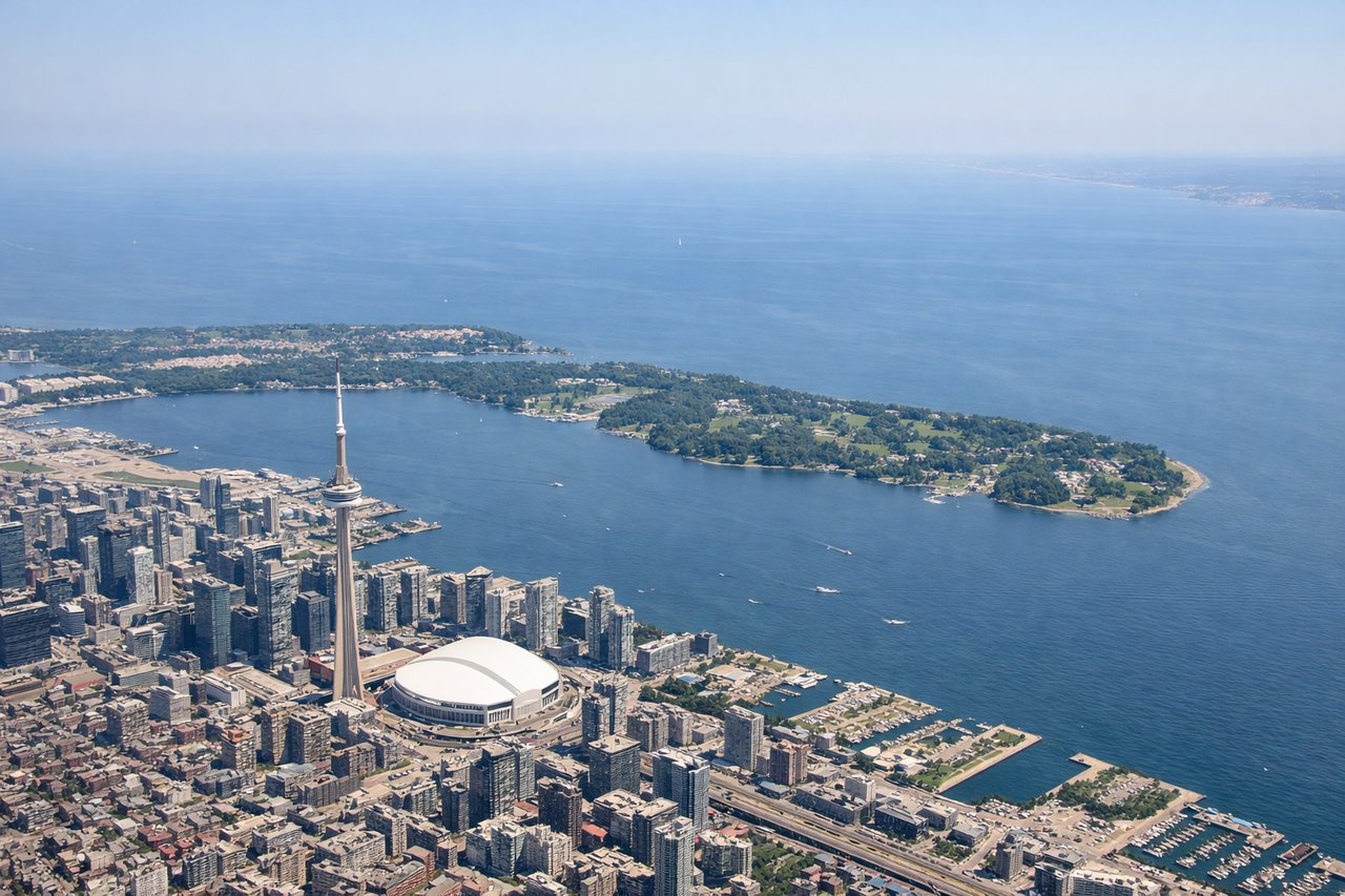
Takeoff from YYZ
LEFTYYZ's most common departure is runway 23 heading southwest, then aircraft typically turn southeast. A left seat gives you the city of Toronto, Lake Ontario, and the downtown skyline as you climb out and bank. Right side faces suburban sprawl with little of interest.
Landing at DOM
LEFTMelville Hall airport sits on Dominica's northeastern coast. Aircraft typically approach from the northeast over the Atlantic, landing heading southwest. The left side faces the dramatic volcanic interior of Dominica — Morne Diablotin and the central mountain spine — while the right side looks out over open Atlantic.
Landmarks on this routeAll landmarks →
Will your flight be in sunlight?
Pick a date and time in the Sun Map to watch the sun move across your whole flight.
About This Route
Which side of the plane should I sit on flying from Lester B Pearson International (YYZ) to Melville Hall (DOM)?
Sit on the Left side of the plane for the best views on flights from Toronto to Dominica. Left side wins at both ends — Toronto's skyline and Lake Ontario on departure, and Dominica's spectacular volcanic interior on approach. The left seat is the clear choice for the full journey.
What can I see during takeoff from Lester B Pearson International in Toronto?
During takeoff from Lester B Pearson International (YYZ), sit on the Left side for the best views. YYZ's most common departure is runway 23 heading southwest, then aircraft typically turn southeast. A left seat gives you the city of Toronto, Lake Ontario, and the downtown skyline as you climb out and bank. Right side faces suburban sprawl with little of interest. Notable sights include: Toronto downtown skyline and CN Tower, Lake Ontario shoreline, Hamilton and Burlington at the western end of the lake, Niagara Peninsula in the distance.
What can I see when landing at Melville Hall in Dominica?
When landing at Melville Hall (DOM), sit on the Left side for the best views. Melville Hall airport sits on Dominica's northeastern coast. Aircraft typically approach from the northeast over the Atlantic, landing heading southwest. The left side faces the dramatic volcanic interior of Dominica — Morne Diablotin and the central mountain spine — while the right side looks out over open Atlantic. Notable sights include: Morne Diablotin (Dominica's highest peak at 4,747 ft), the rugged central mountain spine of Dominica, the northeastern Atlantic coastline and Marigot Bay area, dense rainforest canopy covering the volcanic slopes.
How long is the flight from Toronto to Dominica?
The flight from Lester B Pearson International (YYZ) to Melville Hall (DOM) takes about 4 hours 45 minutes. The shortest flight path between them is 2,222 miles (3,576 km); winds and air traffic control usually add a few percent.
What does the Toronto to Dominica flight path pass over?
The flight tracks southeast over upstate New York and Pennsylvania, then over the US Mid-Atlantic coast near the Carolinas, crossing into the Atlantic roughly over Cape Hatteras. The remainder is open ocean over the western Atlantic, passing east of the Bahamas and Puerto Rico before reaching the Lesser Antilles chain. The Leeward Islands including Antigua and Guadeloupe may be visible on the left side as the aircraft descends toward Dominica.