This short coastal hop keeps the aircraft near the Indian Ocean shoreline for nearly the entire flight, so the left side consistently offers views of the rugged Wild Coast, river mouths, and Algoa Bay, while the right side mostly shows inland hills with no comparable landmarks.
Flown DUR to PLZ? Did we get it right?
Flight Path
Durban to Port Elizabeth is 442 miles (712 km), a flight of about 1 hour 20 minutes.
The flight path roughly follows the Wild Coast of the Eastern Cape, passing near the Kei River mouth and the rolling green hills of the former Transkei region before curving toward Algoa Bay.
Great circle distance and headings ›Phase by phase
Takeoff from DUR
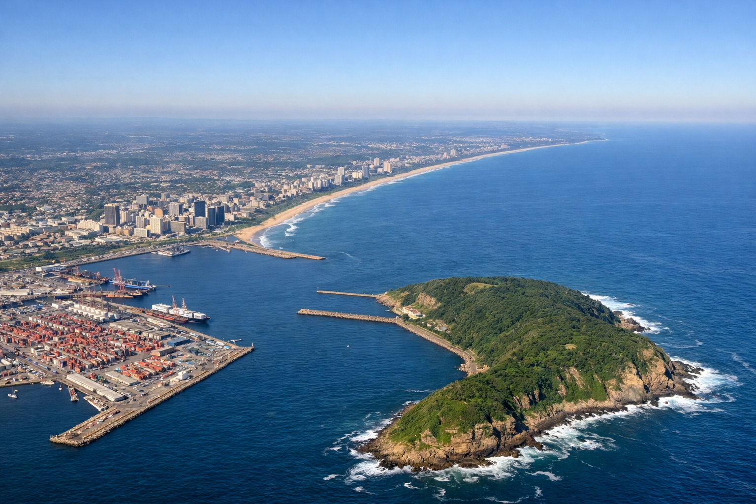
LEFTDeparting Durban toward the southwest, the initial climb passes directly over the city's beachfront, harbor entrance, and the Bluff headland, all visible on the ocean side of the aircraft. The Indian Ocean coastline curves away to the south, setting up the scenic coastal routing that follows for the rest of the flight.
Landing at PLZ
LEFTOn approach into Port Elizabeth from the northeast, the aircraft descends along the coastline, giving passengers on the ocean side a clear view of Algoa Bay, the sweeping beaches near Cape Recife, and the city's harbor as the runway 26 approach turns the plane parallel to the shore.
Will your flight be in sunlight?
Pick a date and time in the Sun Map to watch the sun move across your whole flight.
About This Route
Which side of the plane should I sit on flying from King Shaka International Airport (DUR) to Port Elizabeth (PLZ)?
Sit on the Left side of the plane for the best views on flights from Durban to Port Elizabeth. This short coastal hop keeps the aircraft near the Indian Ocean shoreline for nearly the entire flight, so the left side consistently offers views of the rugged Wild Coast, river mouths, and Algoa Bay, while the right side mostly shows inland hills with no comparable landmarks.
What can I see during takeoff from King Shaka International Airport in Durban?
During takeoff from King Shaka International Airport (DUR), sit on the Left side for the best views. Departing Durban toward the southwest, the initial climb passes directly over the city's beachfront, harbor entrance, and the Bluff headland, all visible on the ocean side of the aircraft. The Indian Ocean coastline curves away to the south, setting up the scenic coastal routing that follows for the rest of the flight. Notable sights include: Durban Harbour and Bluff headland, Golden Mile beachfront, Umgeni River mouth, Indian Ocean coastline.
What can I see when landing at Port Elizabeth in Port Elizabeth?
When landing at Port Elizabeth (PLZ), sit on the Left side for the best views. On approach into Port Elizabeth from the northeast, the aircraft descends along the coastline, giving passengers on the ocean side a clear view of Algoa Bay, the sweeping beaches near Cape Recife, and the city's harbor as the runway 26 approach turns the plane parallel to the shore. Notable sights include: Algoa Bay, Cape Recife lighthouse area, Port Elizabeth harbor, sandy beaches near Humewood.
How long is the flight from Durban to Port Elizabeth?
The flight from King Shaka International Airport (DUR) to Port Elizabeth (PLZ) takes about 1 hour 20 minutes. The shortest flight path between them is 442 miles (712 km); winds and air traffic control usually add a few percent.
What does the Durban to Port Elizabeth flight path pass over?
The flight path roughly follows the Wild Coast of the Eastern Cape, passing near the Kei River mouth and the rolling green hills of the former Transkei region before curving toward Algoa Bay.