Right side scores higher due to the Vienna approach sequence. While the Ankara departure offers modest urban and plateau scenery (2.5), the Vienna landing provides distinctive geographical features—the Danube's dramatic meanders, the Vienna Basin's agricultural geometry, and the river's approach to the city (3.0). The Danube's visual prominence and the contrast between river, floodplain, and urban development create more varied and recognizable scenery than the Ankara plateau departure.
Flown ESB to VIE? Did we get it right?
Flight Path
Ankara to Vienna is 981 miles (1,578 km), a flight of about 2 hours 15 minutes.
The flight crosses the Carpathian foothills and the Hungarian Plain. Notable features include the transition from Anatolian plateau through the Balkans, the Danube's course through Hungary, and the approach to the Alpine foothills near Vienna. The route typically passes east of Budapest, offering views of the Hungarian Plain's agricultural landscape and the Danube's major bends.
Great circle distance and headings ›Phase by phase
Takeoff from ESB
LEFTLeft side captures Ankara's urban sprawl and the transition from the Anatolian plateau toward the northwest. Departing northward (runway 03), the left wing shows the city's eastern districts and the gradual terrain rise toward the Black Sea foothills.
Landing at VIE
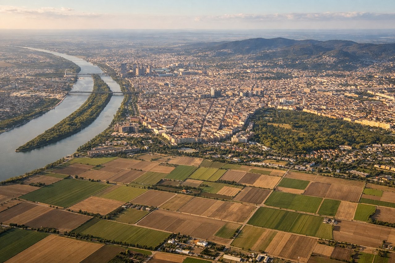
RIGHTRight side offers superior approach scenery into Vienna. Descending toward runway 16 (the typical preference for southeast flow), the right wing reveals the Danube River's distinctive meanders, the Vienna Basin's agricultural patchwork, and the city's eastern approach with the Danube's characteristic loops clearly visible.
Will your flight be in sunlight?
Pick a date and time in the Sun Map to watch the sun move across your whole flight.
About This Route
Which side of the plane should I sit on flying from Esenboga (ESB) to Schwechat (VIE)?
Sit on the Right side of the plane for the best views on flights from Ankara to Vienna. Right side scores higher due to the Vienna approach sequence. While the Ankara departure offers modest urban and plateau scenery (2.5), the Vienna landing provides distinctive geographical features—the Danube's dramatic meanders, the Vienna Basin's agricultural geometry, and the river's approach to the city (3.0). The Danube's visual prominence and the contrast between river, floodplain, and urban development create more varied and recognizable scenery than the Ankara plateau departure.
What can I see during takeoff from Esenboga in Ankara?
During takeoff from Esenboga (ESB), sit on the Left side for the best views. Left side captures Ankara's urban sprawl and the transition from the Anatolian plateau toward the northwest. Departing northward (runway 03), the left wing shows the city's eastern districts and the gradual terrain rise toward the Black Sea foothills. Notable sights include: Ankara city center and suburbs, Ankara Citadel (visible as a fortified ridge), transition zone between urban development and Anatolian steppe.
What can I see when landing at Schwechat in Vienna?
When landing at Schwechat (VIE), sit on the Right side for the best views. Right side offers superior approach scenery into Vienna. Descending toward runway 16 (the typical preference for southeast flow), the right wing reveals the Danube River's distinctive meanders, the Vienna Basin's agricultural patchwork, and the city's eastern approach with the Danube's characteristic loops clearly visible. Notable sights include: Danube River with its characteristic meanders, Vienna Basin agricultural fields, Danube floodplain forests, Vienna's eastern suburbs and the Danube's approach to the city center.
How long is the flight from Ankara to Vienna?
The flight from Esenboga (ESB) to Schwechat (VIE) takes about 2 hours 15 minutes. The shortest flight path between them is 981 miles (1,578 km); winds and air traffic control usually add a few percent.
What does the Ankara to Vienna flight path pass over?
The flight crosses the Carpathian foothills and the Hungarian Plain. Notable features include the transition from Anatolian plateau through the Balkans, the Danube's course through Hungary, and the approach to the Alpine foothills near Vienna. The route typically passes east of Budapest, offering views of the Hungarian Plain's agricultural landscape and the Danube's major bends.