While left offers excellent takeoff scenery over the Hudson and Manhattan, right provides the more rewarding landing experience over Barbados's distinctive Caribbean coastline and turquoise waters. The landing views are more visually striking and geographically unique to this route.
Flight Path
The flight path crosses the Atlantic Ocean at roughly 30,000-35,000 feet. Notable geographic waypoints include: the Outer Banks of North Carolina (visible during initial climb if on a more northerly routing), then open Atlantic with occasional views of the Gulf Stream's darker water color. As you approach the Caribbean, the Bahamas archipelago may be visible on the southern approach—the shallow turquoise banks and island chains are distinctive from altitude. The final approach to Barbados brings views of the Lesser Antilles chain; nearby islands like St. Lucia and Dominica may be visible to the north and west depending on exact flight path. The Atlantic swell patterns and trade wind cloud formations are often visible throughout the oceanic portion.
Great circle distance and headings ›Phase by phase
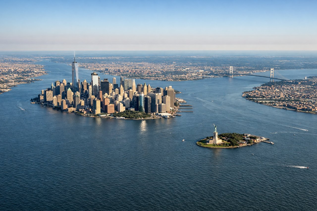
Takeoff from EWR
LEFTLeft side offers views of the Hudson River estuary, Manhattan's skyline, and the New Jersey Palisades as you climb out over the Northeast Corridor. Right side faces inland toward New Jersey suburbs with less distinctive scenery.
Landing at BGI
RIGHTRight side provides views of Barbados's windward (Atlantic) coast, the island's interior terrain, and the approach over the Caribbean Sea. Left side faces away from the island during standard southwesterly approaches to Grantley Adams.
Landmarks on this routeAll landmarks →
Will your flight be in sunlight?
See exactly which side of the plane gets sun and shade at your departure time.
About This Route
Which side of the plane should I sit on flying from Newark Liberty International (EWR) to Grantley Adams International (BGI)?
Sit on the Right side of the plane for the best views on flights from Newark to Bridgetown. While left offers excellent takeoff scenery over the Hudson and Manhattan, right provides the more rewarding landing experience over Barbados's distinctive Caribbean coastline and turquoise waters. The landing views are more visually striking and geographically unique to this route.
What can I see during takeoff from Newark Liberty International in Newark?
During takeoff from Newark Liberty International (EWR), sit on the Left side for the best views. Left side offers views of the Hudson River estuary, Manhattan's skyline, and the New Jersey Palisades as you climb out over the Northeast Corridor. Right side faces inland toward New Jersey suburbs with less distinctive scenery. Notable sights include: Hudson River estuary, Manhattan skyline, New Jersey Palisades, Newark Bay.
What can I see when landing at Grantley Adams International in Bridgetown?
When landing at Grantley Adams International (BGI), sit on the Right side for the best views. Right side provides views of Barbados's windward (Atlantic) coast, the island's interior terrain, and the approach over the Caribbean Sea. Left side faces away from the island during standard southwesterly approaches to Grantley Adams. Notable sights include: Barbados windward coast, Caribbean Sea, interior ridge terrain, Bridgetown harbor area.
How long is the flight from Newark to Bridgetown?
The flight from Newark Liberty International (EWR) to Grantley Adams International (BGI) takes Approximately 4 hours 45 minutes to 5 hours 15 minutes.
What does the Newark to Bridgetown flight path pass over?
The flight path crosses the Atlantic Ocean at roughly 30,000-35,000 feet. Notable geographic waypoints include: the Outer Banks of North Carolina (visible during initial climb if on a more northerly routing), then open Atlantic with occasional views of the Gulf Stream's darker water color. As you approach the Caribbean, the Bahamas archipelago may be visible on the southern approach—the shallow turquoise banks and island chains are distinctive from altitude. The final approach to Barbados brings views of the Lesser Antilles chain; nearby islands like St. Lucia and Dominica may be visible to the north and west depending on exact flight path. The Atlantic swell patterns and trade wind cloud formations are often visible throughout the oceanic portion.