While takeoff offers iconic New York views, the landing approach into Belize provides more sustained scenic value with the Caribbean Sea, barrier reef system, and tropical coastline—features that dominate the final 30 minutes of descent and create a more memorable visual experience.
Flown EWR to BZE? Did we get it right?
Flight Path
Newark to Belize City is 1,807 miles (2,908 km), a flight of about 4 hours 15 minutes.
The flight path crosses the Appalachian Mountains (visible during climb-out over Pennsylvania and West Virginia), the Mississippi River valley, the Gulf of Mexico's open waters, and the Yucatan Peninsula's low-lying terrain and cenote-dotted landscape before reaching the Belize coast.
Great circle distance and headings ›


Phase by phase
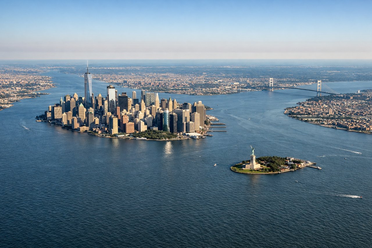
Takeoff from EWR
LEFTLeft side offers views of the Hudson River, Manhattan skyline, and the New Jersey Palisades as the aircraft climbs southwestward out of Newark. Right side faces inland toward New Jersey suburbs with minimal scenic value.
Landing at BZE
RIGHTRight side provides views of the Belize Barrier Reef, Caribbean Sea, and the Yucatan Peninsula's coastal features during descent into Belize City. Left side faces inland toward dense jungle with limited visual interest.
Will your flight be in sunlight?
Pick a date and time in the Sun Map to watch the sun move across your whole flight.
About This Route
Which side of the plane should I sit on flying from Newark Liberty International (EWR) to Philip S W Goldson International (BZE)?
Sit on the Right side of the plane for the best views on flights from Newark to Belize City. While takeoff offers iconic New York views, the landing approach into Belize provides more sustained scenic value with the Caribbean Sea, barrier reef system, and tropical coastline—features that dominate the final 30 minutes of descent and create a more memorable visual experience.
What can I see during takeoff from Newark Liberty International in Newark?
During takeoff from Newark Liberty International (EWR), sit on the Left side for the best views. Left side offers views of the Hudson River, Manhattan skyline, and the New Jersey Palisades as the aircraft climbs southwestward out of Newark. Right side faces inland toward New Jersey suburbs with minimal scenic value. Notable sights include: Hudson River, Manhattan skyline, New Jersey Palisades, Upper New York Bay.
What can I see when landing at Philip S W Goldson International in Belize City?
When landing at Philip S W Goldson International (BZE), sit on the Right side for the best views. Right side provides views of the Belize Barrier Reef, Caribbean Sea, and the Yucatan Peninsula's coastal features during descent into Belize City. Left side faces inland toward dense jungle with limited visual interest. Notable sights include: Belize Barrier Reef, Caribbean Sea, Yucatan Peninsula coastline, Belize City waterfront.
How long is the flight from Newark to Belize City?
The flight from Newark Liberty International (EWR) to Philip S W Goldson International (BZE) takes about 4 hours 15 minutes. The shortest flight path between them is 1,807 miles (2,908 km); winds and air traffic control usually add a few percent.
What does the Newark to Belize City flight path pass over?
The flight path crosses the Appalachian Mountains (visible during climb-out over Pennsylvania and West Virginia), the Mississippi River valley, the Gulf of Mexico's open waters, and the Yucatan Peninsula's low-lying terrain and cenote-dotted landscape before reaching the Belize coast.