Left side wins both ends of the flight. The Manhattan and New York Harbor departure view is exceptional, and the Lake Michigan lakefront arrival into Milwaukee is the best visual on approach. During cruise the left side also faces generally south, keeping Lake Michigan in view as you parallel the southern shore of Lake Erie and cross northern Indiana.
Flown EWR to MKE? Did we get it right?
Flight Path
Newark to Milwaukee is 723 miles (1,163 km), a flight of about 2 hours 10 minutes.
The flight tracks northwest across northern New Jersey, crosses the Delaware River briefly, then passes over northeastern Pennsylvania's Pocono plateau. Over central Pennsylvania the terrain flattens into Ohio farmland. The southern shore of Lake Erie may be visible to the left in northern Ohio. The flight then crosses northern Indiana's flat agricultural grid before descending over the Illinois-Wisconsin border toward Milwaukee.
Great circle distance and headings ›


Phase by phase
Takeoff from EWR
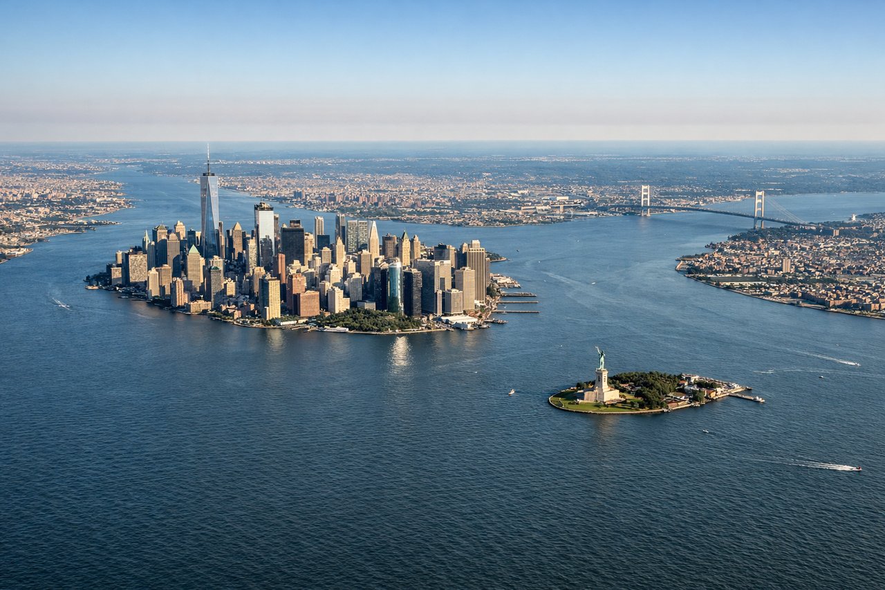
LEFTEWR's primary departure runways (22L/22R) head southwest, then aircraft turn northwest toward Milwaukee. A left seat gives you the Manhattan skyline, Upper New York Bay, and the Hudson River as you climb out. The view of Lower Manhattan and the Statue of Liberty in the harbor is genuinely one of the best urban departure views in the US.
Landing at MKE
LEFTMKE's primary arrival runways (19L/19R) bring aircraft in from the north heading south, or runway 1L/1R from the south heading north. On the common southward approach, the left side faces east over Lake Michigan, giving a clear view of the lake's western shoreline and Milwaukee's lakefront. The contrast between the deep blue lake and the urban grid is striking on approach.
Will your flight be in sunlight?
Pick a date and time in the Sun Map to watch the sun move across your whole flight.
About This Route
Which side of the plane should I sit on flying from Newark Liberty International (EWR) to General Mitchell International (MKE)?
Sit on the Left side of the plane for the best views on flights from Newark to Milwaukee. Left side wins both ends of the flight. The Manhattan and New York Harbor departure view is exceptional, and the Lake Michigan lakefront arrival into Milwaukee is the best visual on approach. During cruise the left side also faces generally south, keeping Lake Michigan in view as you parallel the southern shore of Lake Erie and cross northern Indiana.
What can I see during takeoff from Newark Liberty International in Newark?
During takeoff from Newark Liberty International (EWR), sit on the Left side for the best views. EWR's primary departure runways (22L/22R) head southwest, then aircraft turn northwest toward Milwaukee. A left seat gives you the Manhattan skyline, Upper New York Bay, and the Hudson River as you climb out. The view of Lower Manhattan and the Statue of Liberty in the harbor is genuinely one of the best urban departure views in the US. Notable sights include: Manhattan skyline, Upper New York Bay, Statue of Liberty on Liberty Island, Hudson River.
What can I see when landing at General Mitchell International in Milwaukee?
When landing at General Mitchell International (MKE), sit on the Left side for the best views. MKE's primary arrival runways (19L/19R) bring aircraft in from the north heading south, or runway 1L/1R from the south heading north. On the common southward approach, the left side faces east over Lake Michigan, giving a clear view of the lake's western shoreline and Milwaukee's lakefront. The contrast between the deep blue lake and the urban grid is striking on approach. Notable sights include: Lake Michigan western shoreline, Milwaukee downtown lakefront, Milwaukee Harbor, Menomonee River valley.
How long is the flight from Newark to Milwaukee?
The flight from Newark Liberty International (EWR) to General Mitchell International (MKE) takes about 2 hours 10 minutes. The shortest flight path between them is 723 miles (1,163 km); winds and air traffic control usually add a few percent.
What does the Newark to Milwaukee flight path pass over?
The flight tracks northwest across northern New Jersey, crosses the Delaware River briefly, then passes over northeastern Pennsylvania's Pocono plateau. Over central Pennsylvania the terrain flattens into Ohio farmland. The southern shore of Lake Erie may be visible to the left in northern Ohio. The flight then crosses northern Indiana's flat agricultural grid before descending over the Illinois-Wisconsin border toward Milwaukee.