Newark to Shannon is 3,087 miles (4,968 km), a flight of about 6 hours 50 minutes.
The left side wins primarily due to the dramatic Manhattan skyline view during departure, which outweighs the more modest estuary view on landing since most of the flight is spent over featureless open Atlantic Ocean regardless of side.
Flight Path
Open North Atlantic Ocean, with the flight path passing south of Newfoundland's Grand Banks region before approaching the Irish coast
Great circle distance and headings ›.jpeg?width=600)
.jpg?width=600)
.jpg?width=600)
Phase by phase
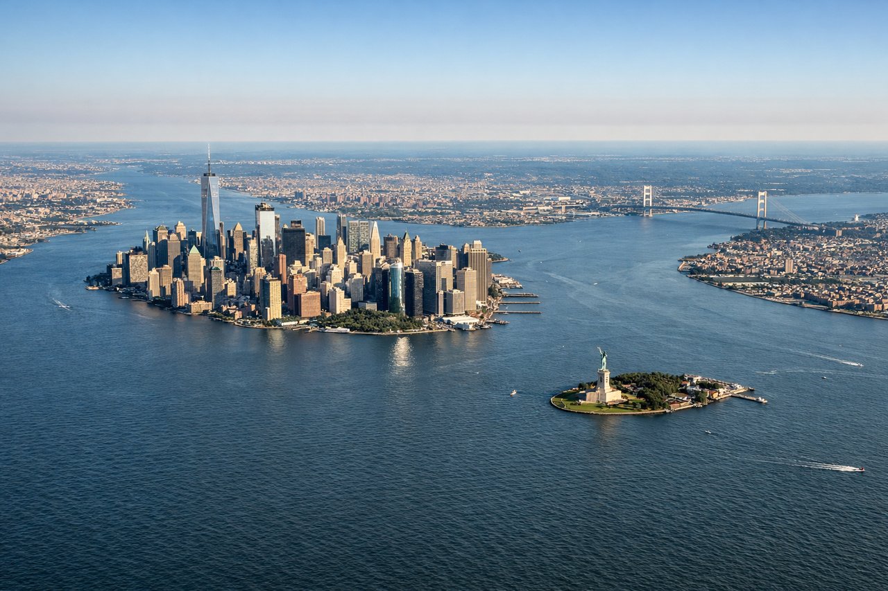
Takeoff from EWR
LEFTDeparting EWR to the northeast, the climb-out typically banks north of Manhattan before turning east over Long Island Sound, giving passengers on the left a sweeping view of the Manhattan skyline, the Hudson River, and Upper New York Bay. The right side mostly shows the flatter New Jersey suburbs and Raritan Bay.
Landing at SNN
RIGHTOn approach to SNN's runway 24 from the northeast, the descent path crosses the Shannon Estuary and the rolling green hills of County Clare, with the estuary's wide tidal channel visible off the right side before the final turn onto the runway. The left side during this leg shows mostly inland farmland with fewer distinctive features.
Landmarks on this routeAll landmarks →
Will your flight be in sunlight?
Pick a date and time in the Sun Map to watch the sun move across your whole flight.
About This Route
Which side of the plane should I sit on flying from Newark Liberty International (EWR) to Shannon (SNN)?
Sit on the Left side of the plane for the best views on flights from Newark to Shannon. The left side wins primarily due to the dramatic Manhattan skyline view during departure, which outweighs the more modest estuary view on landing since most of the flight is spent over featureless open Atlantic Ocean regardless of side.
What can I see during takeoff from Newark Liberty International in Newark?
During takeoff from Newark Liberty International (EWR), sit on the Left side for the best views. Departing EWR to the northeast, the climb-out typically banks north of Manhattan before turning east over Long Island Sound, giving passengers on the left a sweeping view of the Manhattan skyline, the Hudson River, and Upper New York Bay. The right side mostly shows the flatter New Jersey suburbs and Raritan Bay. Notable sights include: Manhattan skyline, Hudson River, Upper New York Bay, Verrazzano-Narrows Bridge.
What can I see when landing at Shannon in Shannon?
When landing at Shannon (SNN), sit on the Right side for the best views. On approach to SNN's runway 24 from the northeast, the descent path crosses the Shannon Estuary and the rolling green hills of County Clare, with the estuary's wide tidal channel visible off the right side before the final turn onto the runway. The left side during this leg shows mostly inland farmland with fewer distinctive features. Notable sights include: Shannon Estuary, County Clare countryside, River Fergus, Limerick city outline.
How long is the flight from Newark to Shannon?
The flight from Newark Liberty International (EWR) to Shannon (SNN) takes about 6 hours 50 minutes. The shortest flight path between them is 3,087 miles (4,968 km); winds and air traffic control usually add a few percent.
What does the Newark to Shannon flight path pass over?
Open North Atlantic Ocean, with the flight path passing south of Newfoundland's Grand Banks region before approaching the Irish coast