Buenos Aires to San Carlos De Bariloch is 813 miles (1,309 km), a flight of about 2 hours 30 minutes.
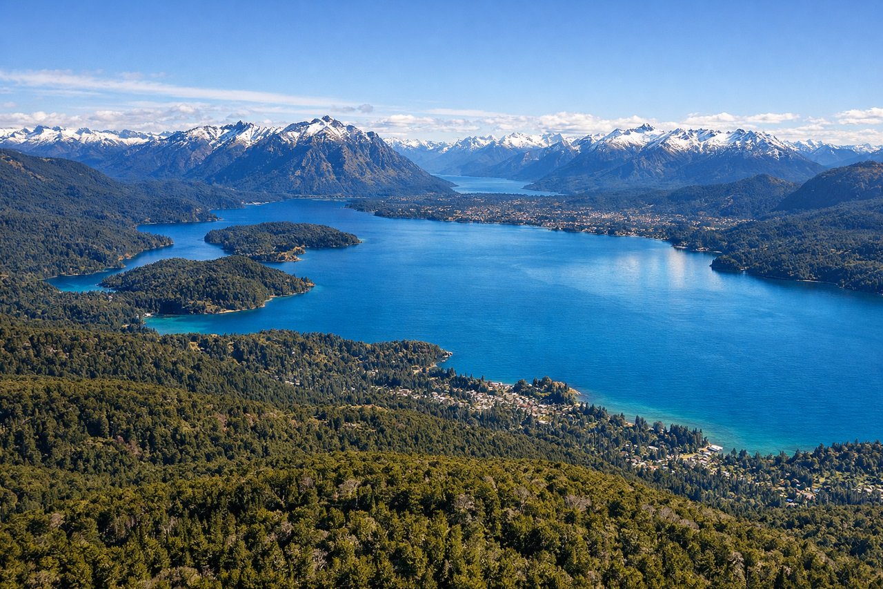
While takeoff favors left for Buenos Aires views, the landing approach over Lago Nahuel Huapi and the Andes is far more visually dramatic and memorable. Right seats capture the iconic Patagonian landscape that defines this route.
Flight Path
The flight path crosses the flat pampas of Buenos Aires Province, then transitions into the rolling pre-cordillera terrain of Río Negro Province. Notable features include the Salado del Sur river valley (visible as a linear depression in the landscape around 1 hour into flight), scattered estancias (ranch settlements) across the grasslands, and the gradual rise of the Andes foothills appearing on the western horizon after approximately 1.5 hours. The landscape transitions from agricultural flatland to increasingly forested, mountainous terrain as you approach Bariloche. Several smaller lakes become visible in the final 30 minutes of descent, signaling proximity to the Nahuel Huapi region.
Great circle distance and headings ›Phase by phase

Takeoff from EZE
LEFTEZE typically departs runway 09 (westbound). Left seats face north across the Río de la Plata estuary and the sprawling Buenos Aires metropolitan area, offering clear views of the city's grid pattern and waterfront. Right seats look south over industrial zones and suburban sprawl with less distinctive features.
Landing at BRC
RIGHTApproaching BRC typically uses runway 24 (southbound descent). Right seats face west toward the Andes foothills and Lago Nahuel Huapi, the dramatic centerpiece of the region. Left seats face east over less visually distinctive pre-cordillera terrain and smaller lakes.
Landmarks on this routeAll landmarks →
Will your flight be in sunlight?
Pick a date and time in the Sun Map to watch the sun move across your whole flight.
About This Route
Which side of the plane should I sit on flying from Ezeiza Ministro Pistarini (EZE) to San Carlos De Bariloche (BRC)?
Sit on the Right side of the plane for the best views on flights from Buenos Aires to San Carlos De Bariloch. While takeoff favors left for Buenos Aires views, the landing approach over Lago Nahuel Huapi and the Andes is far more visually dramatic and memorable. Right seats capture the iconic Patagonian landscape that defines this route.
What can I see during takeoff from Ezeiza Ministro Pistarini in Buenos Aires?
During takeoff from Ezeiza Ministro Pistarini (EZE), sit on the Left side for the best views. EZE typically departs runway 09 (westbound). Left seats face north across the Río de la Plata estuary and the sprawling Buenos Aires metropolitan area, offering clear views of the city's grid pattern and waterfront. Right seats look south over industrial zones and suburban sprawl with less distinctive features. Notable sights include: Río de la Plata (broad estuary to the north), Buenos Aires city grid and high-rises in the distance, Tigre Delta waterways (northeast), suburban Buenos Aires extending westward.
What can I see when landing at San Carlos De Bariloche in San Carlos De Bariloch?
When landing at San Carlos De Bariloche (BRC), sit on the Right side for the best views. Approaching BRC typically uses runway 24 (southbound descent). Right seats face west toward the Andes foothills and Lago Nahuel Huapi, the dramatic centerpiece of the region. Left seats face east over less visually distinctive pre-cordillera terrain and smaller lakes. Notable sights include: Lago Nahuel Huapi (large glacial lake, turquoise-blue water), Andes mountain range (Cerro Campanario and surrounding peaks), Circuito Chico valley and forested terrain, smaller lakes (Lago Moreno, Lago Mascardi) scattered across the landscape.
How long is the flight from Buenos Aires to San Carlos De Bariloch?
The flight from Ezeiza Ministro Pistarini (EZE) to San Carlos De Bariloche (BRC) takes about 2 hours 30 minutes. The shortest flight path between them is 813 miles (1,309 km); winds and air traffic control usually add a few percent.
What does the Buenos Aires to San Carlos De Bariloch flight path pass over?
The flight path crosses the flat pampas of Buenos Aires Province, then transitions into the rolling pre-cordillera terrain of Río Negro Province. Notable features include the Salado del Sur river valley (visible as a linear depression in the landscape around 1 hour into flight), scattered estancias (ranch settlements) across the grasslands, and the gradual rise of the Andes foothills appearing on the western horizon after approximately 1.5 hours. The landscape transitions from agricultural flatland to increasingly forested, mountainous terrain as you approach Bariloche. Several smaller lakes become visible in the final 30 minutes of descent, signaling proximity to the Nahuel Huapi region.