San Carlos De Bariloch to Buenos Aires is 813 miles (1,309 km), a flight of about 2 hours 15 minutes.
While takeoff favors the left for mountain scenery, the landing approach over the Río de la Plata and the approach corridor is more visually distinctive and dramatic. The estuary and the transition from pampas to the river system offer better sustained views than the steppe crossing during cruise.
Flight Path
The flight crosses the Patagonian steppe and then transitions into the flat pampas of Buenos Aires province. You'll pass over the Salado River system (visible as a meandering watercourse with gallery forest, ~1 hour into flight), and the landscape gradually transitions from rolling semi-arid terrain to completely flat agricultural land. The Río de la Plata becomes visible about 30 minutes before landing as a broad tan-colored waterway cutting through the landscape.
Great circle distance and headings ›Phase by phase
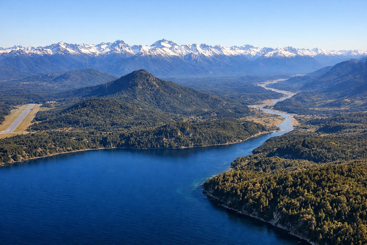
Takeoff from BRC
LEFTBariloche typically departs to the west or northwest. Left seats face the Andes spine and the dramatic peaks surrounding the airport, while right seats look toward the steppe. The western departure gives you the best view of the immediate mountain terrain.
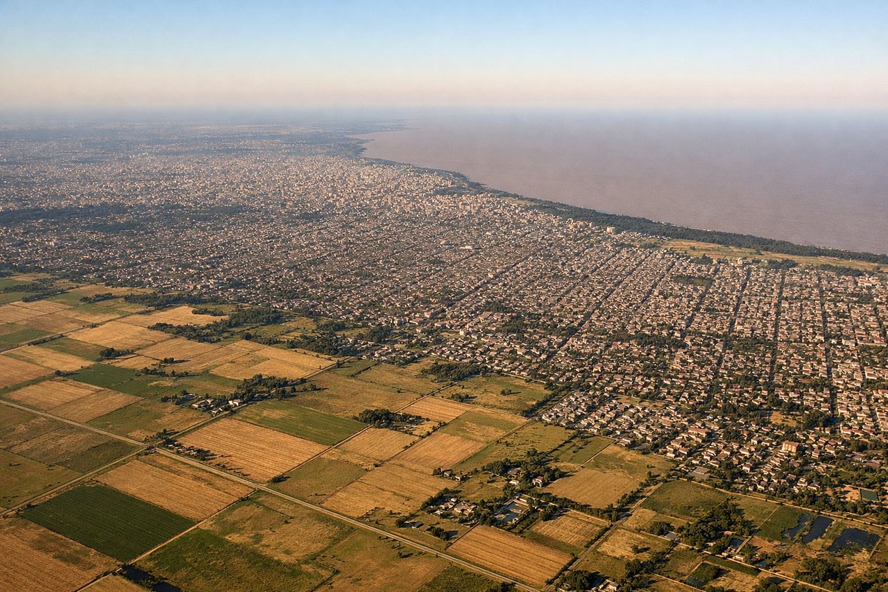
Landing at EZE
RIGHTApproach to Ezeiza typically comes from the northeast or north. Right seats face the Río de la Plata estuary and the approach corridor over the flat Buenos Aires province. You'll see the massive river system and the city's sprawl developing as you descend.
Landmarks on this routeAll landmarks →
Will your flight be in sunlight?
Pick a date and time in the Sun Map to watch the sun move across your whole flight.
About This Route
Which side of the plane should I sit on flying from San Carlos De Bariloche (BRC) to Ezeiza Ministro Pistarini (EZE)?
Sit on the Right side of the plane for the best views on flights from San Carlos De Bariloch to Buenos Aires. While takeoff favors the left for mountain scenery, the landing approach over the Río de la Plata and the approach corridor is more visually distinctive and dramatic. The estuary and the transition from pampas to the river system offer better sustained views than the steppe crossing during cruise.
What can I see during takeoff from San Carlos De Bariloche in San Carlos De Bariloch?
During takeoff from San Carlos De Bariloche (BRC), sit on the Left side for the best views. Bariloche typically departs to the west or northwest. Left seats face the Andes spine and the dramatic peaks surrounding the airport, while right seats look toward the steppe. The western departure gives you the best view of the immediate mountain terrain. Notable sights include: Cerro Campanario (directly west, ~1,000 m above airport elevation), Lago Nahuel Huapi (visible below as you climb, stretching north-south), the Andes cordillera ridgeline receding westward, Cerro Otto (northeast of airport, distinctive cone shape).
What can I see when landing at Ezeiza Ministro Pistarini in Buenos Aires?
When landing at Ezeiza Ministro Pistarini (EZE), sit on the Right side for the best views. Approach to Ezeiza typically comes from the northeast or north. Right seats face the Río de la Plata estuary and the approach corridor over the flat Buenos Aires province. You'll see the massive river system and the city's sprawl developing as you descend. Notable sights include: Río de la Plata (wide muddy estuary, visible from 15,000+ feet as a broad tan-colored waterway), the flat pampas of Buenos Aires province (grid-pattern agricultural fields and roads), Ezeiza airport itself (visible at ~5,000 feet as parallel runways and taxiways), the distant skyline of Buenos Aires city (visible as a low haze on the horizon from 10,000+ feet).
How long is the flight from San Carlos De Bariloch to Buenos Aires?
The flight from San Carlos De Bariloche (BRC) to Ezeiza Ministro Pistarini (EZE) takes about 2 hours 15 minutes. The shortest flight path between them is 813 miles (1,309 km); winds and air traffic control usually add a few percent.
What does the San Carlos De Bariloch to Buenos Aires flight path pass over?
The flight crosses the Patagonian steppe and then transitions into the flat pampas of Buenos Aires province. You'll pass over the Salado River system (visible as a meandering watercourse with gallery forest, ~1 hour into flight), and the landscape gradually transitions from rolling semi-arid terrain to completely flat agricultural land. The Río de la Plata becomes visible about 30 minutes before landing as a broad tan-colored waterway cutting through the landscape.