San Carlos De Bariloch to Buenos Aires is 830 miles (1,335 km), a flight of about 1 hour 50 minutes.
The left side wins because the Bariloche departure delivers a genuinely spectacular mountain-and-lake sequence, while the cruise phase over the flat Patagonian steppe and pampas offers little on either side. The right side's river approach into Buenos Aires is pleasant but shorter and less dramatic than the Andean takeoff.
Flight Path
Flat Patagonian steppe, the Rio Negro valley, and the vast agricultural plains of La Pampa province, with no major mountains or coastlines along the mid-route.
Great circle distance and headings ›Phase by phase
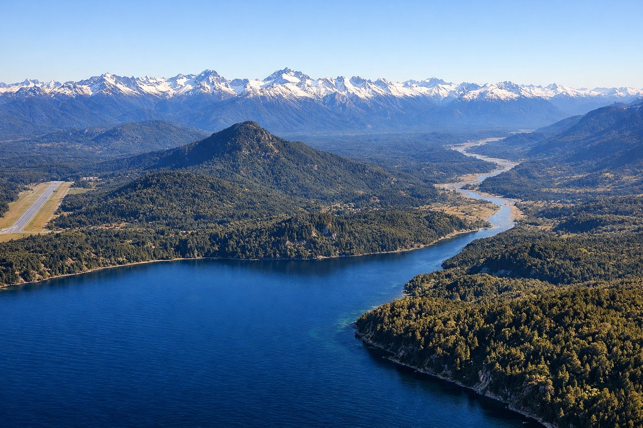
Takeoff from BRC
LEFTDeparting Bariloche, the initial climb offers sweeping views of Nahuel Huapi Lake and the snow-capped Andean foothills to the west, visible from the left side as the aircraft turns northeast toward Buenos Aires. This is one of the most dramatic departure sequences in Argentina.

Landing at AEP
RIGHTOn approach to Aeroparque via runway 31, the aircraft crosses over the Río de la Plata before turning to land, giving passengers on the right side a view of the wide brown river and the Buenos Aires waterfront skyline. This urban and river panorama is the only strong scenic element of the eastern side.
Landmarks on this routeAll landmarks →
Will your flight be in sunlight?
Pick a date and time in the Sun Map to watch the sun move across your whole flight.
About This Route
Which side of the plane should I sit on flying from San Carlos De Bariloche (BRC) to Aeroparque Jorge Newbery (AEP)?
Sit on the Left side of the plane for the best views on flights from San Carlos De Bariloch to Buenos Aires. The left side wins because the Bariloche departure delivers a genuinely spectacular mountain-and-lake sequence, while the cruise phase over the flat Patagonian steppe and pampas offers little on either side. The right side's river approach into Buenos Aires is pleasant but shorter and less dramatic than the Andean takeoff.
What can I see during takeoff from San Carlos De Bariloche in San Carlos De Bariloch?
During takeoff from San Carlos De Bariloche (BRC), sit on the Left side for the best views. Departing Bariloche, the initial climb offers sweeping views of Nahuel Huapi Lake and the snow-capped Andean foothills to the west, visible from the left side as the aircraft turns northeast toward Buenos Aires. This is one of the most dramatic departure sequences in Argentina. Notable sights include: Nahuel Huapi Lake, Andean foothills, Cerro Otto, Cerro Catedral.
What can I see when landing at Aeroparque Jorge Newbery in Buenos Aires?
When landing at Aeroparque Jorge Newbery (AEP), sit on the Right side for the best views. On approach to Aeroparque via runway 31, the aircraft crosses over the Río de la Plata before turning to land, giving passengers on the right side a view of the wide brown river and the Buenos Aires waterfront skyline. This urban and river panorama is the only strong scenic element of the eastern side. Notable sights include: Río de la Plata, Puerto Madero towers, Buenos Aires coastline, Aeroparque runway jutting into the river.
How long is the flight from San Carlos De Bariloch to Buenos Aires?
The flight from San Carlos De Bariloche (BRC) to Aeroparque Jorge Newbery (AEP) takes about 1 hour 50 minutes. The shortest flight path between them is 830 miles (1,335 km); winds and air traffic control usually add a few percent.
What does the San Carlos De Bariloch to Buenos Aires flight path pass over?
Flat Patagonian steppe, the Rio Negro valley, and the vast agricultural plains of La Pampa province, with no major mountains or coastlines along the mid-route.