San Carlos De Bariloch to Mendoza is 589 miles (948 km), a flight of about 2 hours 15 minutes.
The takeoff view from Bariloche's right side is superior—the immediate proximity of Lago Nahuel Huapi and Andes peaks creates a more dramatic and memorable experience than the landing approach. The flight path itself crosses the Andes spine, but the departure offers the most concentrated scenic value.
Flight Path
The flight crosses the spine of the Patagonian Andes, passing over high-altitude lakes and valleys including Lago Traful and Lago Meliquina regions. The terrain transitions from the wet, forested western slopes to the drier, higher-altitude eastern plateau. Multiple snow-capped peaks are visible throughout the crossing, with the landscape becoming progressively more arid as the aircraft moves eastward toward Mendoza's semi-desert environment.
Great circle distance and headings ›Phase by phase
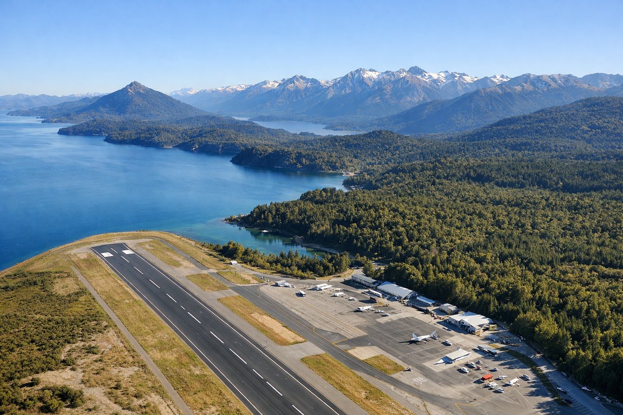
Takeoff from BRC
RIGHTBariloche typically departs runway 11/29 depending on wind. Right-side seats offer views of Lago Nahuel Huapi immediately west of the airport and the northern Andes peaks. Left side faces the city and eastern lowlands with less dramatic terrain.
Landing at MDZ
LEFTApproaching Mendoza typically uses runway 04/22. Left-side seats during descent offer views of the Andes eastern slopes, the Aconcagua massif region to the south, and the high-altitude desert terrain. Right side faces the flat Cuyo plain with less visual interest.
Landmarks on this routeAll landmarks →
Will your flight be in sunlight?
Pick a date and time in the Sun Map to watch the sun move across your whole flight.
About This Route
Which side of the plane should I sit on flying from San Carlos De Bariloche (BRC) to El Plumerillo (MDZ)?
Sit on the Right side of the plane for the best views on flights from San Carlos De Bariloch to Mendoza. The takeoff view from Bariloche's right side is superior—the immediate proximity of Lago Nahuel Huapi and Andes peaks creates a more dramatic and memorable experience than the landing approach. The flight path itself crosses the Andes spine, but the departure offers the most concentrated scenic value.
What can I see during takeoff from San Carlos De Bariloche in San Carlos De Bariloch?
During takeoff from San Carlos De Bariloche (BRC), sit on the Right side for the best views. Bariloche typically departs runway 11/29 depending on wind. Right-side seats offer views of Lago Nahuel Huapi immediately west of the airport and the northern Andes peaks. Left side faces the city and eastern lowlands with less dramatic terrain. Notable sights include: Lago Nahuel Huapi (large glacial lake directly adjacent to airport), Cerro Campanario (distinctive peak southwest of airport), Andes foothills rising westward, Circuito Chico peninsula formations.
What can I see when landing at El Plumerillo in Mendoza?
When landing at El Plumerillo (MDZ), sit on the Left side for the best views. Approaching Mendoza typically uses runway 04/22. Left-side seats during descent offer views of the Andes eastern slopes, the Aconcagua massif region to the south, and the high-altitude desert terrain. Right side faces the flat Cuyo plain with less visual interest. Notable sights include: Andes cordillera (snow-capped peaks), Aconcagua region (highest peak in Americas, visible as distant summit), high-altitude desert plateau, Río Mendoza valley cutting through foothills.
How long is the flight from San Carlos De Bariloch to Mendoza?
The flight from San Carlos De Bariloche (BRC) to El Plumerillo (MDZ) takes about 2 hours 15 minutes. The shortest flight path between them is 589 miles (948 km); winds and air traffic control usually add a few percent.
What does the San Carlos De Bariloch to Mendoza flight path pass over?
The flight crosses the spine of the Patagonian Andes, passing over high-altitude lakes and valleys including Lago Traful and Lago Meliquina regions. The terrain transitions from the wet, forested western slopes to the drier, higher-altitude eastern plateau. Multiple snow-capped peaks are visible throughout the crossing, with the landscape becoming progressively more arid as the aircraft moves eastward toward Mendoza's semi-desert environment.