San Carlos De Bariloch to Santiago is 536 miles (863 km), a flight of about 2 hours 15 minutes.
While takeoff favors the left, the landing approach provides more sustained and dramatic views of the Andes' main crest, which is the flight's most visually distinctive feature. The right side captures the cordillera's snow-capped peaks throughout descent.
Flight Path
The flight path crosses the Andes' main divide roughly midway. Notable features include the Puyehue-Cordón Caulle volcanic complex (visible as a darker, lower ridge section), multiple glaciated peaks of the southern Andes (Volcán Villarrica region to the north), and the transition from Patagonian temperate rainforest to the drier central Chilean valley. The Biobío River valley becomes visible during the descent phase as the aircraft approaches the central valley.
Great circle distance and headings ›


Phase by phase
Takeoff from BRC
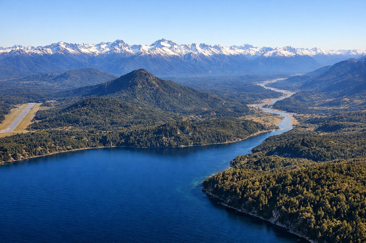
LEFTBRC typically departs to the west or northwest. Left-side seats capture the dramatic eastern face of the Andes immediately after takeoff, with Cerro Campanario and the Circuito Chico peaks rising sharply from the valley floor.
Landing at SCL
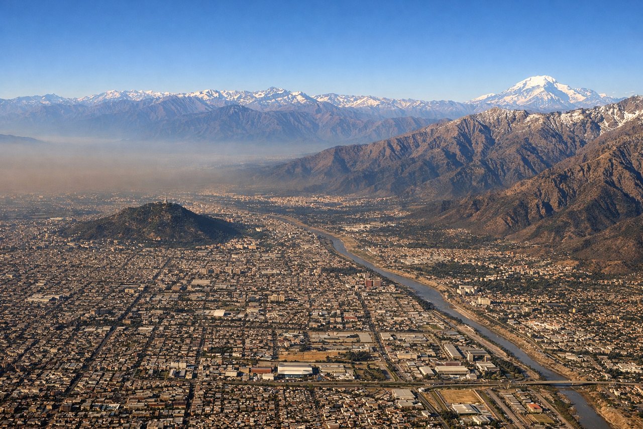
RIGHTSCL approaches from the north or northeast, typically landing on runways 07L/07R. Right-side seats offer views of the Andes cordillera as the aircraft descends through the central valley, with the snow-capped peaks of the main range visible across the right wing.
Landmarks on this routeAll landmarks →
Will your flight be in sunlight?
Pick a date and time in the Sun Map to watch the sun move across your whole flight.
About This Route
Which side of the plane should I sit on flying from San Carlos De Bariloche (BRC) to Arturo Merino Benitez International (SCL)?
Sit on the Right side of the plane for the best views on flights from San Carlos De Bariloch to Santiago. While takeoff favors the left, the landing approach provides more sustained and dramatic views of the Andes' main crest, which is the flight's most visually distinctive feature. The right side captures the cordillera's snow-capped peaks throughout descent.
What can I see during takeoff from San Carlos De Bariloche in San Carlos De Bariloch?
During takeoff from San Carlos De Bariloche (BRC), sit on the Left side for the best views. BRC typically departs to the west or northwest. Left-side seats capture the dramatic eastern face of the Andes immediately after takeoff, with Cerro Campanario and the Circuito Chico peaks rising sharply from the valley floor. Notable sights include: Cerro Campanario (2,050m), Lago Nahuel Huapi (the large glacial lake directly below), Circuito Chico mountain chain, Río Limay valley.
What can I see when landing at Arturo Merino Benitez International in Santiago?
When landing at Arturo Merino Benitez International (SCL), sit on the Right side for the best views. SCL approaches from the north or northeast, typically landing on runways 07L/07R. Right-side seats offer views of the Andes cordillera as the aircraft descends through the central valley, with the snow-capped peaks of the main range visible across the right wing. Notable sights include: Andes cordillera (main crest with multiple 4,000m+ peaks), Maipo River valley, Santiago metropolitan sprawl, Cerro San Cristóbal.
How long is the flight from San Carlos De Bariloch to Santiago?
The flight from San Carlos De Bariloche (BRC) to Arturo Merino Benitez International (SCL) takes about 2 hours 15 minutes. The shortest flight path between them is 536 miles (863 km); winds and air traffic control usually add a few percent.
What does the San Carlos De Bariloch to Santiago flight path pass over?
The flight path crosses the Andes' main divide roughly midway. Notable features include the Puyehue-Cordón Caulle volcanic complex (visible as a darker, lower ridge section), multiple glaciated peaks of the southern Andes (Volcán Villarrica region to the north), and the transition from Patagonian temperate rainforest to the drier central Chilean valley. The Biobío River valley becomes visible during the descent phase as the aircraft approaches the central valley.