Fort-de-France to Paris is 4,269 miles (6,870 km), a flight of about 9 hours.
Right-side seats capture the most dramatic scenery: Martinique's volcanic landscape during departure is far more visually striking than the relatively flat approach to Paris. While the landing view is geographically interesting, the takeoff experience over Caribbean island terrain offers superior scenic value.
Flight Path
The flight path crosses the Atlantic Ocean at high altitude (typically 35,000-37,000 feet). Notable features include: the Azores archipelago (if visible during daylight, roughly 4-5 hours into flight at approximately 38°N 28°W), the Bay of Biscay (off the coast of southwestern France), and the transition from open ocean to European continental airspace. At cruise altitude, the ocean itself offers limited visual interest except for occasional cloud formations and weather systems. The most significant midpoint landmark is the Iberian Peninsula and western France coastline as the aircraft approaches European airspace, typically visible 1-2 hours before descent into Paris.
Great circle distance and headings ›Phase by phase
Takeoff from FDF
RIGHTRight-side seats offer views of Martinique's dramatic volcanic peaks and the island's northern coastline as the aircraft climbs northwestward. The left side faces open Atlantic Ocean with minimal visual interest during initial climb.
Landing at CDG
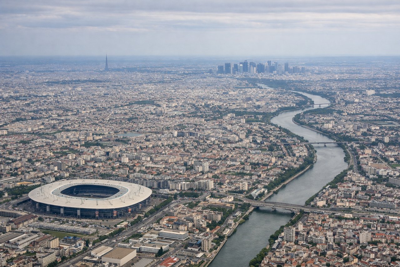
LEFTLeft-side seats provide views of the European continent during descent into Paris. Passengers see the Seine River valley, suburban sprawl of the Île-de-France region, and the approach to Charles de Gaulle Airport from the northeast.
Landmarks on this routeAll landmarks →
Will your flight be in sunlight?
Pick a date and time in the Sun Map to watch the sun move across your whole flight.
About This Route
Which side of the plane should I sit on flying from Le Lamentin (FDF) to Charles De Gaulle (CDG)?
Sit on the Right side of the plane for the best views on flights from Fort-de-France to Paris. Right-side seats capture the most dramatic scenery: Martinique's volcanic landscape during departure is far more visually striking than the relatively flat approach to Paris. While the landing view is geographically interesting, the takeoff experience over Caribbean island terrain offers superior scenic value.
What can I see during takeoff from Le Lamentin in Fort-de-France?
During takeoff from Le Lamentin (FDF), sit on the Right side for the best views. Right-side seats offer views of Martinique's dramatic volcanic peaks and the island's northern coastline as the aircraft climbs northwestward. The left side faces open Atlantic Ocean with minimal visual interest during initial climb. Notable sights include: Mount Pelée (1,397 m, visible as a prominent cone on Martinique's northern tip), Pitons du Carbet mountain range (central spine of the island), Fort-de-France Bay and harbor, Caribbean Sea coastline.
What can I see when landing at Charles De Gaulle in Paris?
When landing at Charles De Gaulle (CDG), sit on the Left side for the best views. Left-side seats provide views of the European continent during descent into Paris. Passengers see the Seine River valley, suburban sprawl of the Île-de-France region, and the approach to Charles de Gaulle Airport from the northeast. Notable sights include: Seine River and its meandering course through the Paris basin, Île-de-France suburban grid pattern, Roissy-Charles de Gaulle Airport runways and taxiways, forested areas of the Parisian hinterland.
How long is the flight from Fort-de-France to Paris?
The flight from Le Lamentin (FDF) to Charles De Gaulle (CDG) takes about 9 hours. The shortest flight path between them is 4,269 miles (6,870 km); winds and air traffic control usually add a few percent.
What does the Fort-de-France to Paris flight path pass over?
The flight path crosses the Atlantic Ocean at high altitude (typically 35,000-37,000 feet). Notable features include: the Azores archipelago (if visible during daylight, roughly 4-5 hours into flight at approximately 38°N 28°W), the Bay of Biscay (off the coast of southwestern France), and the transition from open ocean to European continental airspace. At cruise altitude, the ocean itself offers limited visual interest except for occasional cloud formations and weather systems. The most significant midpoint landmark is the Iberian Peninsula and western France coastline as the aircraft approaches European airspace, typically visible 1-2 hours before descent into Paris.