Fuzhou to Osaka is 1,098 miles (1,767 km), a flight of about 2 hours 15 minutes.
While takeoff favors the right, the landing view from the left is more dramatic and sustained—Osaka Bay and the Kii Peninsula's forested terrain provide superior visual interest during the critical final approach phase. The left side also captures the approach corridor's geography more completely.
Flight Path
The flight path crosses the Taiwan Strait (open water, 50-80 nm wide), then passes over the Seto Inland Sea's eastern approaches. The Seto Inland Sea itself—a narrow, island-dotted waterway between Honshu and Shikoku—becomes visible around the midpoint. Numerous small islands, fishing villages, and narrow straits characterize this region. The Chugoku Mountains (low, forested ridges) form the northern boundary of the Seto Inland Sea and remain visible on the left (north) throughout the crossing. As the flight approaches Kansai, the Kii Peninsula's mountainous terrain rises on the right (south), and Osaka Bay opens ahead.
Great circle distance and headings ›Phase by phase
Takeoff from FOC
RIGHTChangle typically departs to the northeast (Runway 06/24 system, favoring 06 for northbound traffic). Right-side seats capture the Min River estuary and Fuzhou's urban sprawl immediately after rotation, with clear views of the coastal plain transitioning to open water.
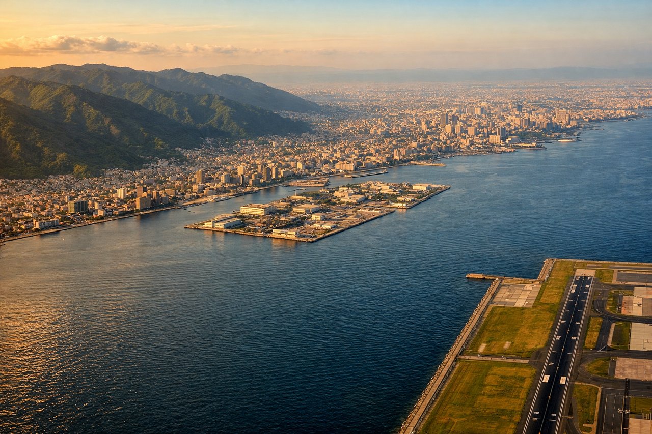
Landing at KIX
LEFTKansai International typically lands from the southwest (Runway 06L/24R system, favoring 06 for arrivals from China). Left-side seats offer extended views of Osaka Bay's eastern shoreline, the Kii Peninsula's forested ridges, and the approach over water with Wakayama visible to the south.
Will your flight be in sunlight?
Pick a date and time in the Sun Map to watch the sun move across your whole flight.
About This Route
Which side of the plane should I sit on flying from Changle (FOC) to Kansai International (KIX)?
Sit on the Left side of the plane for the best views on flights from Fuzhou to Osaka. While takeoff favors the right, the landing view from the left is more dramatic and sustained—Osaka Bay and the Kii Peninsula's forested terrain provide superior visual interest during the critical final approach phase. The left side also captures the approach corridor's geography more completely.
What can I see during takeoff from Changle in Fuzhou?
During takeoff from Changle (FOC), sit on the Right side for the best views. Changle typically departs to the northeast (Runway 06/24 system, favoring 06 for northbound traffic). Right-side seats capture the Min River estuary and Fuzhou's urban sprawl immediately after rotation, with clear views of the coastal plain transitioning to open water. Notable sights include: Min River estuary (wide, braided channels visible below), Fuzhou city grid (southwest of airport), Taiwan Strait opening to the east, Wuyi Mountains (distant southwestern horizon).
What can I see when landing at Kansai International in Osaka?
When landing at Kansai International (KIX), sit on the Left side for the best views. Kansai International typically lands from the southwest (Runway 06L/24R system, favoring 06 for arrivals from China). Left-side seats offer extended views of Osaka Bay's eastern shoreline, the Kii Peninsula's forested ridges, and the approach over water with Wakayama visible to the south. Notable sights include: Osaka Bay (wide, shallow water body with visible shipping lanes), Kii Peninsula (forested, mountainous terrain to the south and southeast), Wakayama city (visible on southern shore), Izumi Mountains (low ridges on eastern horizon).
How long is the flight from Fuzhou to Osaka?
The flight from Changle (FOC) to Kansai International (KIX) takes about 2 hours 15 minutes. The shortest flight path between them is 1,098 miles (1,767 km); winds and air traffic control usually add a few percent.
What does the Fuzhou to Osaka flight path pass over?
The flight path crosses the Taiwan Strait (open water, 50-80 nm wide), then passes over the Seto Inland Sea's eastern approaches. The Seto Inland Sea itself—a narrow, island-dotted waterway between Honshu and Shikoku—becomes visible around the midpoint. Numerous small islands, fishing villages, and narrow straits characterize this region. The Chugoku Mountains (low, forested ridges) form the northern boundary of the Seto Inland Sea and remain visible on the left (north) throughout the crossing. As the flight approaches Kansai, the Kii Peninsula's mountainous terrain rises on the right (south), and Osaka Bay opens ahead.