Left side captures Frankfurt's urban departure with the Main River and skyline, plus the Taunus hills, while the cruise phase over central Europe and the Pyrenees offers more varied terrain than the right side's ocean-dominated descent. Although Lanzarote's volcanic landscape is dramatic, the right side's 5+ hours of Atlantic crossing limits its overall score. Left side benefits from a scenic takeoff and more diverse mid-flight geography, scoring 3.5 vs 2.5.
Flown FRA to ACE? Did we get it right?
Flight Path
Frankfurt to Lanzerote is 1,861 miles (2,995 km), a flight of about 4 hours 50 minutes.
Rhine Valley and Rhineland wine region, Vosges Mountains (eastern France), Jura Mountains (France-Switzerland border), Pyrenees Mountains (Spain-France border), Spanish Meseta plateau, Portuguese Atlantic coast, Canary Islands archipelago approach over open Atlantic with trade-wind cloud patterns
Great circle distance and headings ›Phase by phase
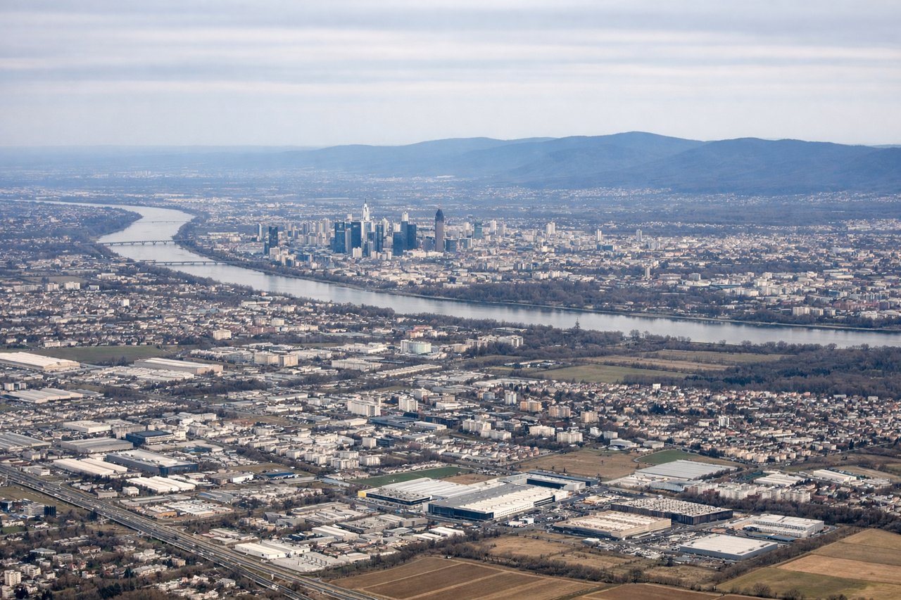
Takeoff from FRA
LEFTWesterly departure (70% probability) from runway 25C climbs over the Main River valley and Frankfurt's urban sprawl, offering views of the city's skyline and the Rhine-Main confluence. Right side departs over flat, featureless terrain toward the Taunus hills in the distance.
Landing at ACE
RIGHTApproach to Lanzarote typically uses runway 03 (northeast heading) with descent over the Atlantic. Right-side passengers see the volcanic island's dramatic terrain, including Timanfaya National Park's dark lava fields and the island's rugged interior, plus the approach over the Atlantic coastline. Left side faces open ocean for most of the descent.
Will your flight be in sunlight?
Pick a date and time in the Sun Map to watch the sun move across your whole flight.
About This Route
Which side of the plane should I sit on flying from Frankfurt Main (FRA) to Lanzarote (ACE)?
Sit on the Left side of the plane for the best views on flights from Frankfurt to Lanzerote. Left side captures Frankfurt's urban departure with the Main River and skyline, plus the Taunus hills, while the cruise phase over central Europe and the Pyrenees offers more varied terrain than the right side's ocean-dominated descent. Although Lanzarote's volcanic landscape is dramatic, the right side's 5+ hours of Atlantic crossing limits its overall score. Left side benefits from a scenic takeoff and more diverse mid-flight geography, scoring 3.5 vs 2.5.
What can I see during takeoff from Frankfurt Main in Frankfurt?
During takeoff from Frankfurt Main (FRA), sit on the Left side for the best views. Westerly departure (70% probability) from runway 25C climbs over the Main River valley and Frankfurt's urban sprawl, offering views of the city's skyline and the Rhine-Main confluence. Right side departs over flat, featureless terrain toward the Taunus hills in the distance. Notable sights include: Frankfurt skyline and Main Tower, Main River and its confluence with the Rhine, Taunus mountain range (distant), Frankfurt airport infrastructure and surrounding industrial zones.
What can I see when landing at Lanzarote in Lanzerote?
When landing at Lanzarote (ACE), sit on the Right side for the best views. Approach to Lanzarote typically uses runway 03 (northeast heading) with descent over the Atlantic. Right-side passengers see the volcanic island's dramatic terrain, including Timanfaya National Park's dark lava fields and the island's rugged interior, plus the approach over the Atlantic coastline. Left side faces open ocean for most of the descent. Notable sights include: Timanfaya National Park lava fields (dark volcanic terrain), Lanzarote's northern coastline and cliffs, Atlantic Ocean with trade-wind wave patterns, Arrecife harbor and coastal development.
How long is the flight from Frankfurt to Lanzerote?
The flight from Frankfurt Main (FRA) to Lanzarote (ACE) takes about 4 hours 50 minutes. The shortest flight path between them is 1,861 miles (2,995 km); winds and air traffic control usually add a few percent.
What does the Frankfurt to Lanzerote flight path pass over?
Rhine Valley and Rhineland wine region, Vosges Mountains (eastern France), Jura Mountains (France-Switzerland border), Pyrenees Mountains (Spain-France border), Spanish Meseta plateau, Portuguese Atlantic coast, Canary Islands archipelago approach over open Atlantic with trade-wind cloud patterns