The left side delivers the more dramatic departure view over Frankfurt's skyline and the Rhine-Main region. Over the Atlantic the views are similar on both sides, but the left side also picks up the southern coast of Ireland and Cornwall during the crossing. On balance, left wins for the departure experience which is the most visually rich part of this route.
Flown FRA to CLT? Did we get it right?
Flight Path
Frankfurt to Charlotte is 4,386 miles (7,059 km), a flight of about 9 hours 15 minutes.
The route tracks northwest over the Benelux region, crosses the southern tip of Ireland near Cork, then flies a great circle arc over the North Atlantic. Mid-ocean the flight passes south of Greenland's tip. Approaching North America, the route crosses Newfoundland or Nova Scotia, then tracks southwest down the US East Coast over the Appalachian Mountains of Virginia and the Carolinas before descending into Charlotte.
Great circle distance and headings ›


Phase by phase
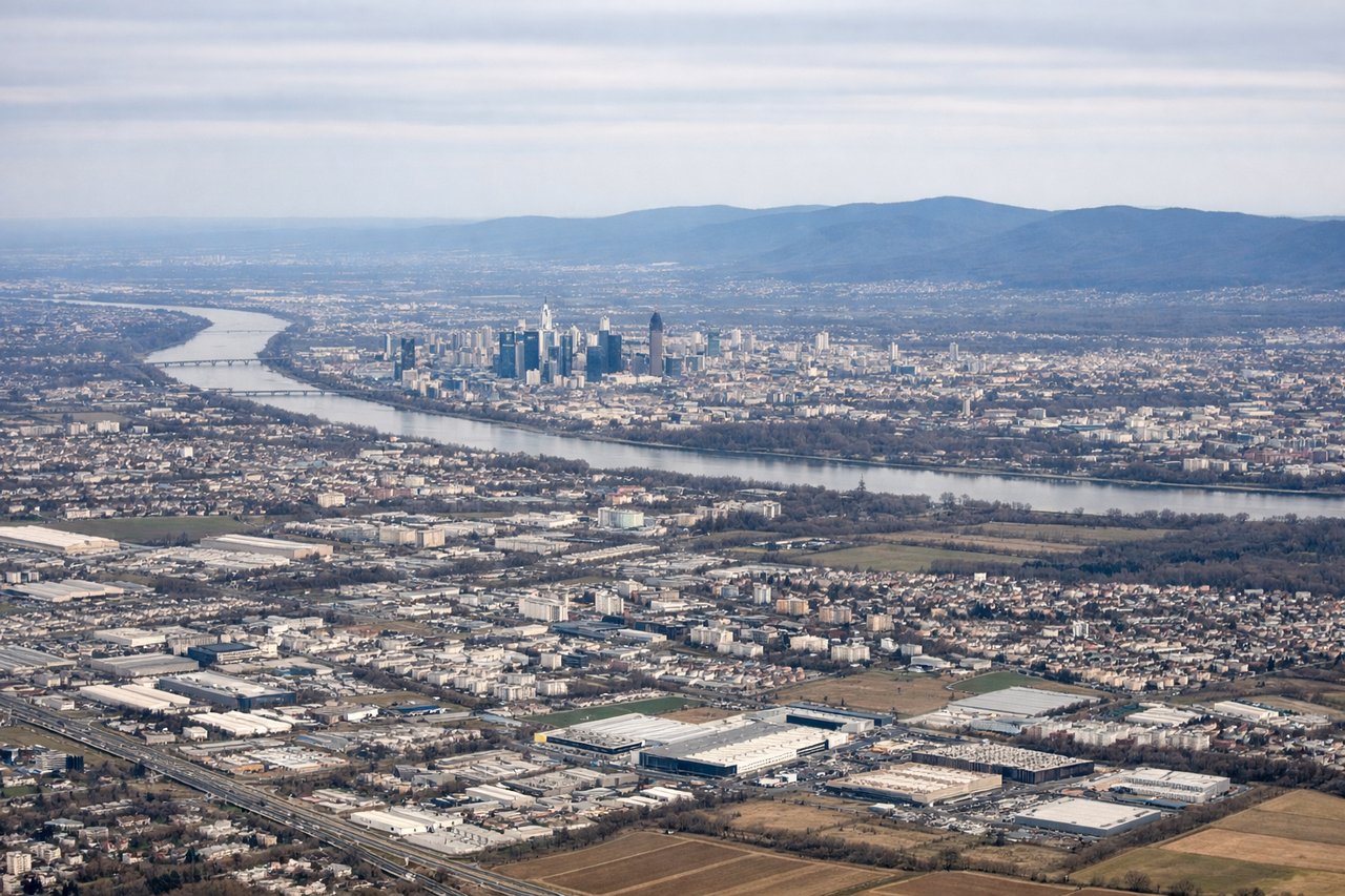
Takeoff from FRA
LEFTFrankfurt departures heading west on runway 25L/25C put the Main River, Frankfurt city center, and the Taunus hills on the left side. You get a clear view of the Frankfurt skyline and the river bends as the aircraft climbs out westward.

Landing at CLT
RIGHTCharlotte Douglas typically uses runways 18C/18L for southbound arrivals or 36 for northbound, but the dominant approach from the northeast on runway 23 puts Lake Norman and the Charlotte uptown skyline on the right side during the descent. The Catawba River chain of lakes is clearly visible to the right on approach.
Will your flight be in sunlight?
Pick a date and time in the Sun Map to watch the sun move across your whole flight.
About This Route
Which side of the plane should I sit on flying from Frankfurt Main (FRA) to Charlotte Douglas International (CLT)?
Sit on the Left side of the plane for the best views on flights from Frankfurt to Charlotte. The left side delivers the more dramatic departure view over Frankfurt's skyline and the Rhine-Main region. Over the Atlantic the views are similar on both sides, but the left side also picks up the southern coast of Ireland and Cornwall during the crossing. On balance, left wins for the departure experience which is the most visually rich part of this route.
What can I see during takeoff from Frankfurt Main in Frankfurt?
During takeoff from Frankfurt Main (FRA), sit on the Left side for the best views. Frankfurt departures heading west on runway 25L/25C put the Main River, Frankfurt city center, and the Taunus hills on the left side. You get a clear view of the Frankfurt skyline and the river bends as the aircraft climbs out westward. Notable sights include: Frankfurt city skyline (Bankenviertel), Main River bends, Taunus hills to the north, Wiesbaden and Rhine River confluence area.
What can I see when landing at Charlotte Douglas International in Charlotte?
When landing at Charlotte Douglas International (CLT), sit on the Right side for the best views. Charlotte Douglas typically uses runways 18C/18L for southbound arrivals or 36 for northbound, but the dominant approach from the northeast on runway 23 puts Lake Norman and the Charlotte uptown skyline on the right side during the descent. The Catawba River chain of lakes is clearly visible to the right on approach. Notable sights include: Lake Norman (large reservoir north of Charlotte), Charlotte uptown skyline, Catawba River reservoir chain, Piedmont farmland patchwork.
How long is the flight from Frankfurt to Charlotte?
The flight from Frankfurt Main (FRA) to Charlotte Douglas International (CLT) takes about 9 hours 15 minutes. The shortest flight path between them is 4,386 miles (7,059 km); winds and air traffic control usually add a few percent.
What does the Frankfurt to Charlotte flight path pass over?
The route tracks northwest over the Benelux region, crosses the southern tip of Ireland near Cork, then flies a great circle arc over the North Atlantic. Mid-ocean the flight passes south of Greenland's tip. Approaching North America, the route crosses Newfoundland or Nova Scotia, then tracks southwest down the US East Coast over the Appalachian Mountains of Virginia and the Carolinas before descending into Charlotte.