While the Frankfurt departure offers local interest, the landing approach to La Paz on the right side provides the flight's most spectacular scenery—the Andes Mountains and high-altitude plateau are far more visually dramatic than the Rhine-Main region.
Flown FRA to LPB? Did we get it right?
Flight Path
Frankfurt to La Paz is 6,522 miles (10,496 km), a flight of about 12 hours 15 minutes.
The flight path crosses the Atlantic Ocean (minimal visual interest), then enters South American airspace over the Amazon Basin and Andes foothills. Notable midpoint features include the transition from lowland rainforest to high-altitude terrain, the eastern slopes of the Andes, and the approach to the Altiplano plateau. The descent into La Paz reveals the dramatic topography of the Bolivian highlands with deep canyon valleys and snow-capped peaks of the Cordillera Real.
Great circle distance and headings ›

Phase by phase
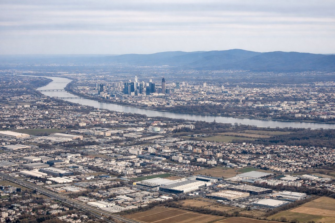
Takeoff from FRA
LEFTLeft side offers views of the Main River valley and the Rhine-Main region's industrial and urban sprawl as the aircraft climbs northwestward. Right side faces inland toward the flat Hessian plateau with minimal visual interest during initial climb.
Landing at LPB
RIGHTRight side provides dramatic views of the Andes Mountains as the aircraft descends toward El Alto. The approach from the east brings the snow-capped peaks and high-altitude plateau into clear view on the right side of the fuselage during final descent.
Will your flight be in sunlight?
Pick a date and time in the Sun Map to watch the sun move across your whole flight.
About This Route
Which side of the plane should I sit on flying from Frankfurt Main (FRA) to El Alto International (LPB)?
Sit on the Right side of the plane for the best views on flights from Frankfurt to La Paz. While the Frankfurt departure offers local interest, the landing approach to La Paz on the right side provides the flight's most spectacular scenery—the Andes Mountains and high-altitude plateau are far more visually dramatic than the Rhine-Main region.
What can I see during takeoff from Frankfurt Main in Frankfurt?
During takeoff from Frankfurt Main (FRA), sit on the Left side for the best views. Left side offers views of the Main River valley and the Rhine-Main region's industrial and urban sprawl as the aircraft climbs northwestward. Right side faces inland toward the flat Hessian plateau with minimal visual interest during initial climb. Notable sights include: Main River (winding through Frankfurt), Rhine-Main industrial zone, Taunus Mountains (distant northern horizon), Frankfurt city center and Main Tower.
What can I see when landing at El Alto International in La Paz?
When landing at El Alto International (LPB), sit on the Right side for the best views. Right side provides dramatic views of the Andes Mountains as the aircraft descends toward El Alto. The approach from the east brings the snow-capped peaks and high-altitude plateau into clear view on the right side of the fuselage during final descent. Notable sights include: Cordillera Real (snow-capped peaks), Lake Titicaca (visible on clear days to the north), Altiplano plateau, La Paz city nestled in canyon valleys.
How long is the flight from Frankfurt to La Paz?
The flight from Frankfurt Main (FRA) to El Alto International (LPB) takes about 12 hours 15 minutes. The shortest flight path between them is 6,522 miles (10,496 km); winds and air traffic control usually add a few percent.
What does the Frankfurt to La Paz flight path pass over?
The flight path crosses the Atlantic Ocean (minimal visual interest), then enters South American airspace over the Amazon Basin and Andes foothills. Notable midpoint features include the transition from lowland rainforest to high-altitude terrain, the eastern slopes of the Andes, and the approach to the Altiplano plateau. The descent into La Paz reveals the dramatic topography of the Bolivian highlands with deep canyon valleys and snow-capped peaks of the Cordillera Real.