Frankfurt to Bucharest is 902 miles (1,451 km), a flight of about 2 hours 15 minutes.
Left side wins both ends of the flight. During the cruise over central Europe, the left side also tracks closer to the Carpathian arc as the route curves southeast over Slovakia and Hungary, offering distant views of the Western Carpathians and later the Transylvanian Alps on the horizon.
Flight Path
The route passes over the Czech Republic and Austria border region, then tracks southeast over Hungary's flat Pannonian Plain, crosses into Romania over the Transylvanian plateau, and descends across the Southern Carpathians (Transylvanian Alps) before reaching the flat Wallachian plain toward Bucharest. The Carpathian arc is the dominant geographic feature of the mid-to-late flight.
Great circle distance and headings ›Phase by phase
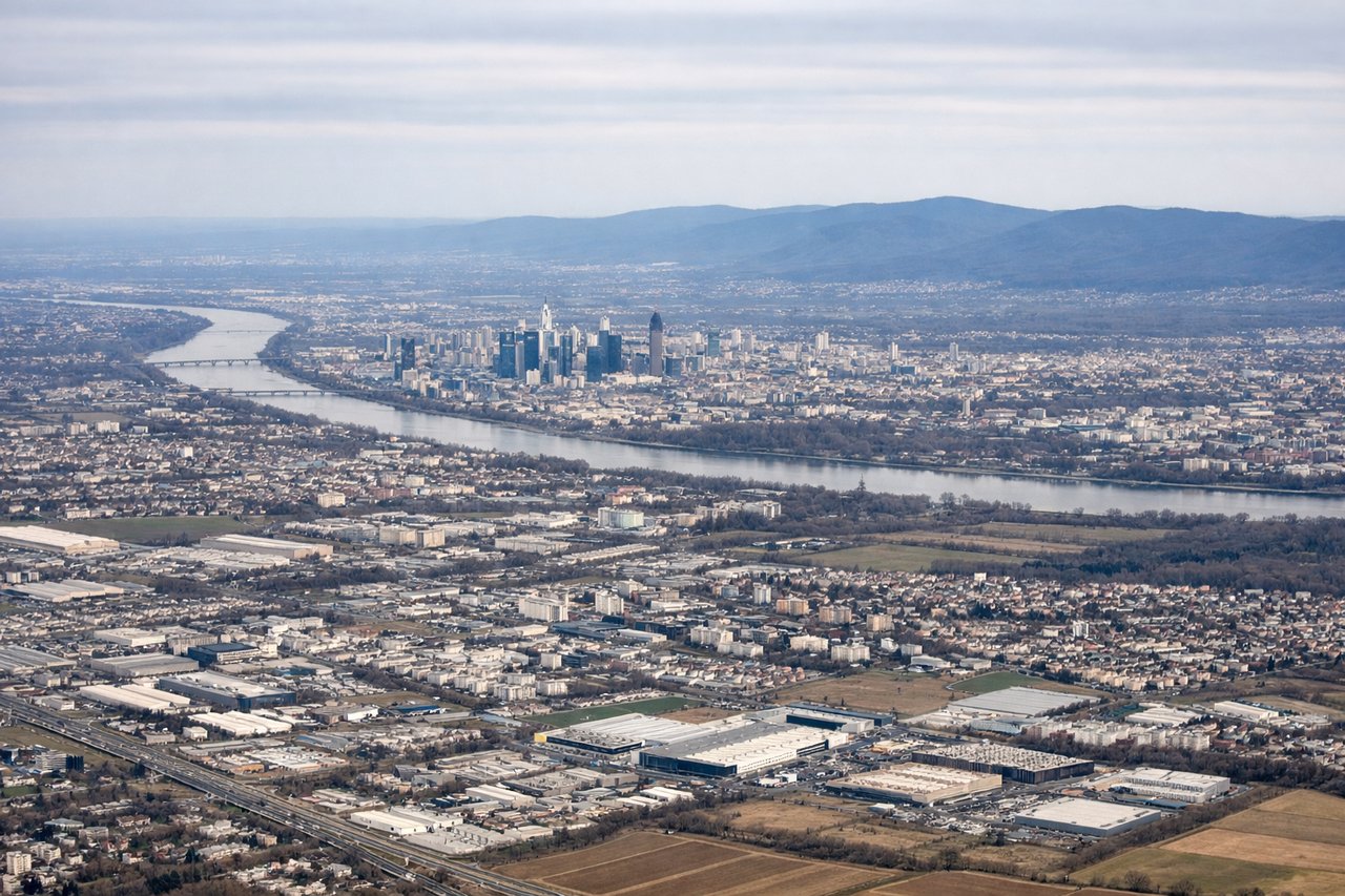
Takeoff from FRA
LEFTFrankfurt typically departs eastbound on runway 07L/07R, meaning the left side faces north. You get a clear view over Frankfurt city center, the Main River bends, and the dense Taunus hills to the northwest. The right side faces south toward flat Rhine-Main plain with less visual interest.
Landing at OTP
LEFTBucharest Otopeni typically lands on runway 08R from the west, with the approach tracking eastward. The left side faces north, giving views over the Snagov Lake area and forested Ilfov plain. The right side faces south toward Bucharest city center, but the city is partially obscured by the aircraft's nose angle on final approach.
Landmarks on this routeAll landmarks →
Will your flight be in sunlight?
Pick a date and time in the Sun Map to watch the sun move across your whole flight.
About This Route
Which side of the plane should I sit on flying from Frankfurt Main (FRA) to Otopeni (OTP)?
Sit on the Left side of the plane for the best views on flights from Frankfurt to Bucharest. Left side wins both ends of the flight. During the cruise over central Europe, the left side also tracks closer to the Carpathian arc as the route curves southeast over Slovakia and Hungary, offering distant views of the Western Carpathians and later the Transylvanian Alps on the horizon.
What can I see during takeoff from Frankfurt Main in Frankfurt?
During takeoff from Frankfurt Main (FRA), sit on the Left side for the best views. Frankfurt typically departs eastbound on runway 07L/07R, meaning the left side faces north. You get a clear view over Frankfurt city center, the Main River bends, and the dense Taunus hills to the northwest. The right side faces south toward flat Rhine-Main plain with less visual interest. Notable sights include: Frankfurt skyline and Main River bend, Taunus hills to the northwest, Rhine River valley to the west, Sachsenhausen district rooftops.
What can I see when landing at Otopeni in Bucharest?
When landing at Otopeni (OTP), sit on the Left side for the best views. Bucharest Otopeni typically lands on runway 08R from the west, with the approach tracking eastward. The left side faces north, giving views over the Snagov Lake area and forested Ilfov plain. The right side faces south toward Bucharest city center, but the city is partially obscured by the aircraft's nose angle on final approach. Notable sights include: Snagov Lake and forest to the north, Bucharest city sprawl to the south, Colentina lake chain northeast of the city, flat Wallachian plain stretching to the horizon.
How long is the flight from Frankfurt to Bucharest?
The flight from Frankfurt Main (FRA) to Otopeni (OTP) takes about 2 hours 15 minutes. The shortest flight path between them is 902 miles (1,451 km); winds and air traffic control usually add a few percent.
What does the Frankfurt to Bucharest flight path pass over?
The route passes over the Czech Republic and Austria border region, then tracks southeast over Hungary's flat Pannonian Plain, crosses into Romania over the Transylvanian plateau, and descends across the Southern Carpathians (Transylvanian Alps) before reaching the flat Wallachian plain toward Bucharest. The Carpathian arc is the dominant geographic feature of the mid-to-late flight.