The right side scores higher due to the Mekong Delta's dramatic visual complexity during approach—the intricate waterway patterns, rice paddies, and river confluence create far more scenic variety than Frankfurt's relatively modest Main River valley departure. While Frankfurt's urban takeoff is pleasant, the landing approach into Ho Chi Minh City offers richer terrain drama and landmark density across the full flight.
Flown FRA to SGN? Did we get it right?
Flight Path
Frankfurt to Ho Chi Minh City is 6,001 miles (9,657 km), a flight of about 11 hours 15 minutes.
The flight path crosses the Alps (visible from cruise altitude as a snow-capped ridge on the left side during early cruise), the Adriatic Sea, Greece, Turkey, the Taurus Mountains, Iraq's Mesopotamian plains, the Persian Gulf, Iran's interior plateaus, the Oman Sea, and the Arabian Sea before descending into Southeast Asia. The Balkans, eastern Mediterranean, and Middle Eastern deserts dominate the mid-flight cruise segment.
Great circle distance and headings ›


Phase by phase
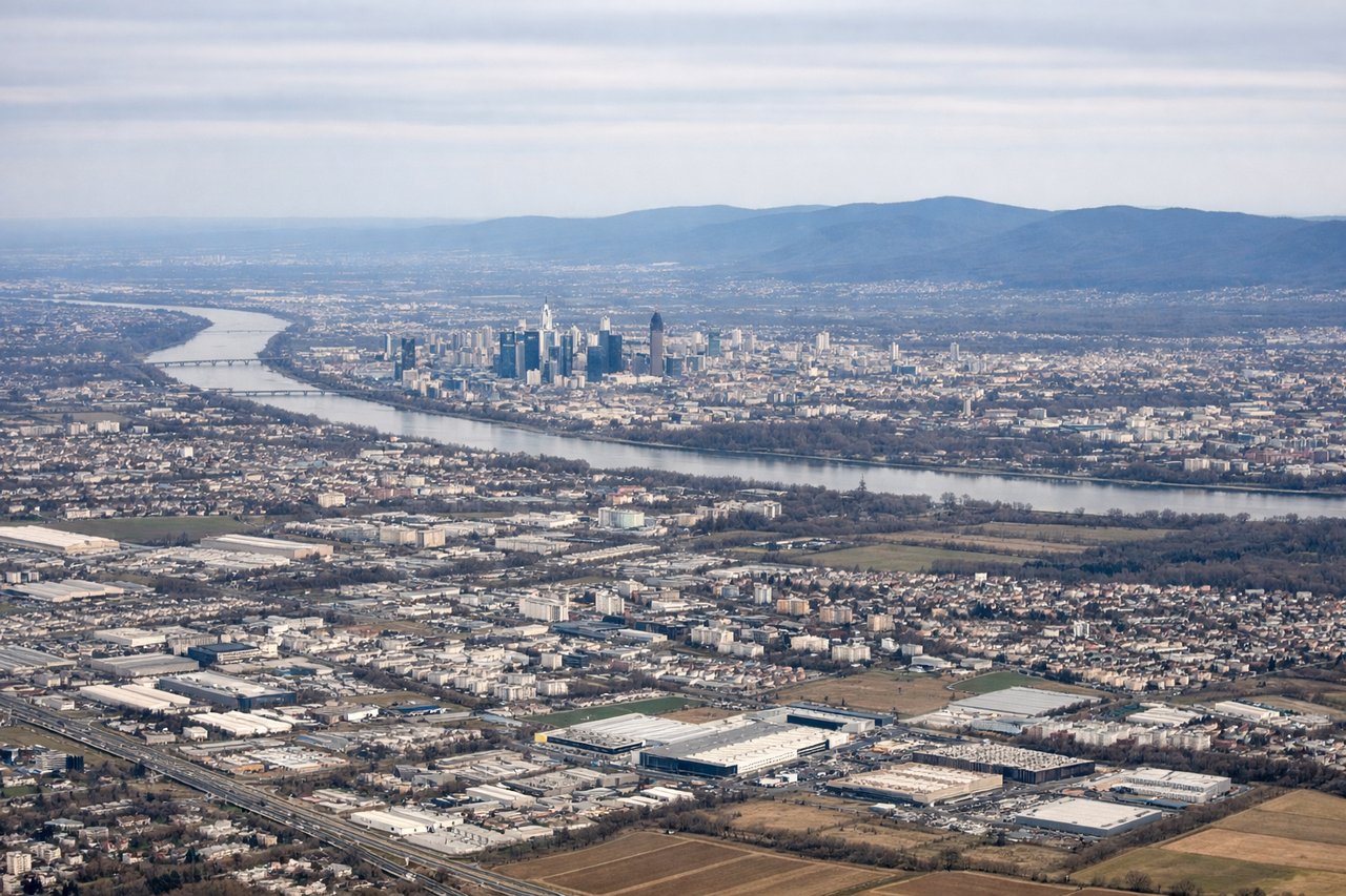
Takeoff from FRA
LEFTFrankfurt's Main River valley and surrounding Rhine-Main region provide urban and riverine scenery during climb-out. The left side captures the city's skyline and the Main River's distinctive curves as the aircraft departs westward before turning southeast.
Landing at SGN
RIGHTThe right side offers superior approach scenery into Ho Chi Minh City. The Mekong Delta's intricate waterways, rice paddies, and the Saigon River's confluence create distinctive visual patterns. The approach also reveals the city's harbor and urban sprawl along the river before touchdown at Tan Son Nhat.
Will your flight be in sunlight?
Pick a date and time in the Sun Map to watch the sun move across your whole flight.
About This Route
Which side of the plane should I sit on flying from Frankfurt Main (FRA) to Tansonnhat International (SGN)?
Sit on the Right side of the plane for the best views on flights from Frankfurt to Ho Chi Minh City. The right side scores higher due to the Mekong Delta's dramatic visual complexity during approach—the intricate waterway patterns, rice paddies, and river confluence create far more scenic variety than Frankfurt's relatively modest Main River valley departure. While Frankfurt's urban takeoff is pleasant, the landing approach into Ho Chi Minh City offers richer terrain drama and landmark density across the full flight.
What can I see during takeoff from Frankfurt Main in Frankfurt?
During takeoff from Frankfurt Main (FRA), sit on the Left side for the best views. Frankfurt's Main River valley and surrounding Rhine-Main region provide urban and riverine scenery during climb-out. The left side captures the city's skyline and the Main River's distinctive curves as the aircraft departs westward before turning southeast. Notable sights include: Frankfurt city center and Main River, Taunus Hills to the north, Rhine River valley to the west.
What can I see when landing at Tansonnhat International in Ho Chi Minh City?
When landing at Tansonnhat International (SGN), sit on the Right side for the best views. The right side offers superior approach scenery into Ho Chi Minh City. The Mekong Delta's intricate waterways, rice paddies, and the Saigon River's confluence create distinctive visual patterns. The approach also reveals the city's harbor and urban sprawl along the river before touchdown at Tan Son Nhat. Notable sights include: Mekong Delta waterways and rice paddies, Saigon River, Ho Chi Minh City urban area and harbor.
How long is the flight from Frankfurt to Ho Chi Minh City?
The flight from Frankfurt Main (FRA) to Tansonnhat International (SGN) takes about 11 hours 15 minutes. The shortest flight path between them is 6,001 miles (9,657 km); winds and air traffic control usually add a few percent.
What does the Frankfurt to Ho Chi Minh City flight path pass over?
The flight path crosses the Alps (visible from cruise altitude as a snow-capped ridge on the left side during early cruise), the Adriatic Sea, Greece, Turkey, the Taurus Mountains, Iraq's Mesopotamian plains, the Persian Gulf, Iran's interior plateaus, the Oman Sea, and the Arabian Sea before descending into Southeast Asia. The Balkans, eastern Mediterranean, and Middle Eastern deserts dominate the mid-flight cruise segment.